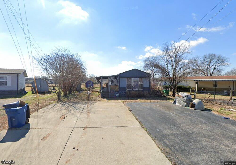
205 Hurricane Cir La Vergne, TN 37086
Estimated Value: $106,159 - $234,000
--
Bed
--
Bath
--
Sq Ft
8,625
Sq Ft Lot
About This Home
This home is located at 205 Hurricane Cir, La Vergne, TN 37086 and is currently estimated at $152,386. 205 Hurricane Cir is a home with nearby schools including Roy L. Waldron Elementary School, Lavergne Primary School, and La Vergne Middle School.
Ownership History
Date
Name
Owned For
Owner Type
Purchase Details
Closed on
Aug 30, 2022
Sold by
Kelly Simpson
Bought by
Kamel Gamil K and Abdalla Samia M
Current Estimated Value
Purchase Details
Closed on
Aug 28, 2009
Sold by
Smith Naomi Emery
Bought by
Simpson Kelly
Purchase Details
Closed on
Feb 5, 1999
Sold by
Nelms Jewell Estate
Bought by
Emery and Naomi
Purchase Details
Closed on
Feb 21, 1997
Bought by
Jewell Nelms
Purchase Details
Closed on
Dec 18, 1995
Bought by
Calhoun Revocable Living T
Purchase Details
Closed on
Jul 18, 1994
Sold by
Vester Waldron
Bought by
Pennington Kenneth K
Create a Home Valuation Report for This Property
The Home Valuation Report is an in-depth analysis detailing your home's value as well as a comparison with similar homes in the area
Home Values in the Area
Average Home Value in this Area
Purchase History
| Date | Buyer | Sale Price | Title Company |
|---|---|---|---|
| Kamel Gamil K | $80,000 | None Listed On Document | |
| Simpson Kelly | $49,000 | -- | |
| Emery | -- | -- | |
| Jewell Nelms | $56,500 | -- | |
| Calhoun Revocable Living T | $45,000 | -- | |
| Pennington Kenneth K | -- | -- |
Source: Public Records
Tax History Compared to Growth
Tax History
| Year | Tax Paid | Tax Assessment Tax Assessment Total Assessment is a certain percentage of the fair market value that is determined by local assessors to be the total taxable value of land and additions on the property. | Land | Improvement |
|---|---|---|---|---|
| 2025 | $496 | $20,575 | $9,375 | $11,200 |
| 2024 | $496 | $20,575 | $9,375 | $11,200 |
| 2023 | $386 | $20,575 | $9,375 | $11,200 |
| 2022 | $333 | $20,575 | $9,375 | $11,200 |
| 2021 | $264 | $11,875 | $7,000 | $4,875 |
| 2020 | $264 | $11,875 | $7,000 | $4,875 |
| 2019 | $264 | $11,875 | $7,000 | $4,875 |
| 2018 | $333 | $11,875 | $0 | $0 |
| 2017 | $427 | $11,750 | $0 | $0 |
| 2016 | $427 | $11,750 | $0 | $0 |
| 2015 | $430 | $11,750 | $0 | $0 |
| 2014 | $292 | $11,750 | $0 | $0 |
| 2013 | -- | $12,000 | $0 | $0 |
Source: Public Records
Map
Nearby Homes
- 1119 Moss Trail
- 613 Sycamore Ln
- 2015 Keaton Dr
- 4237 Miranda Place
- 148 Bluegill Ln
- 150 Bluegill Ln
- 143 Bluegill Ln
- 149 Bluegill Ln
- ELSTON Plan at Percy Cove
- CALHOUN Plan at Percy Cove
- IRWIN Plan at Percy Cove
- EDMON Plan at Percy Cove
- BOWEN Plan at Percy Cove
- HARBOR Plan at Percy Cove
- ALAMOSA Plan at Percy Cove
- 307 Carp Ct
- 4414 Maxwell Rd
- 305 Carp Ct
- 4441 Maxwell Rd
- 327 Delta Way
- 207 Hurricane Cir
- 111 Plantation Dr
- 209 Redbud Ct
- 109 Plantation Dr
- 113 Plantation Dr
- 210 Hurricane Cir
- 211 Redbud Ct
- 213 Redbud Ct
- 115 Plantation Dr
- 214 Hurricane Cir
- 215 Redbud Ct
- 218 Hurricane Cir
- 117 Plantation Dr
- 112 Plantation Dr
- 114 Plantation Dr
- 110 Plantation Dr
- 119 Plantation Dr
- 219 Hurricane Cir
- 106 Plantation Dr
- 220 Hurricane Cir