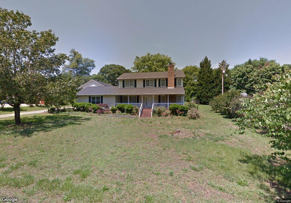
205 Keithwood Dr Anderson, SC 29621
Estimated Value: $255,000 - $328,000
3
Beds
3
Baths
1,800
Sq Ft
$162/Sq Ft
Est. Value
About This Home
This home is located at 205 Keithwood Dr, Anderson, SC 29621 and is currently estimated at $290,803, approximately $161 per square foot. 205 Keithwood Dr is a home located in Anderson County with nearby schools including North Pointe Elementary School, McCants Middle School, and T.L. Hanna High School.
Ownership History
Date
Name
Owned For
Owner Type
Purchase Details
Closed on
Aug 24, 2007
Sold by
Hardy Renee
Bought by
Ngo Tien N and Nguyen Lieu Thi
Current Estimated Value
Home Financials for this Owner
Home Financials are based on the most recent Mortgage that was taken out on this home.
Original Mortgage
$125,000
Outstanding Balance
$79,103
Interest Rate
6.65%
Mortgage Type
Purchase Money Mortgage
Estimated Equity
$211,700
Purchase Details
Closed on
Mar 4, 2007
Sold by
Lowe Jimmy Larry and Lowe Joyce C
Bought by
Hardy Renee
Create a Home Valuation Report for This Property
The Home Valuation Report is an in-depth analysis detailing your home's value as well as a comparison with similar homes in the area
Home Values in the Area
Average Home Value in this Area
Purchase History
| Date | Buyer | Sale Price | Title Company |
|---|---|---|---|
| Ngo Tien N | $175,000 | Attorney | |
| Hardy Renee | -- | None Available |
Source: Public Records
Mortgage History
| Date | Status | Borrower | Loan Amount |
|---|---|---|---|
| Open | Ngo Tien N | $125,000 |
Source: Public Records
Tax History Compared to Growth
Tax History
| Year | Tax Paid | Tax Assessment Tax Assessment Total Assessment is a certain percentage of the fair market value that is determined by local assessors to be the total taxable value of land and additions on the property. | Land | Improvement |
|---|---|---|---|---|
| 2024 | $932 | $7,830 | $1,000 | $6,830 |
| 2023 | $932 | $7,830 | $1,000 | $6,830 |
| 2022 | $901 | $7,830 | $1,000 | $6,830 |
| 2021 | $805 | $6,430 | $720 | $5,710 |
| 2020 | $797 | $6,430 | $720 | $5,710 |
| 2019 | $797 | $6,430 | $720 | $5,710 |
| 2018 | $810 | $6,430 | $720 | $5,710 |
| 2017 | -- | $6,430 | $720 | $5,710 |
| 2016 | $865 | $6,890 | $720 | $6,170 |
| 2015 | $884 | $6,890 | $720 | $6,170 |
| 2014 | $879 | $6,890 | $720 | $6,170 |
Source: Public Records
Map
Nearby Homes
- 301 Woodlake Rd
- 4115 Liberty Hwy
- 802 Yates Cir
- 706 Woodlake Rd
- 403 Brown Rd
- 105-107 Independence Path
- 210 Giles St
- 212 Giles St
- 214 Giles St
- 216 Giles St
- 216 Maplewood Rd
- 304 Arcadia Dr
- 505 Brookgreen Ct
- 103 Amanda Dr
- 211 Elizabeth Ln
- 103 Sunrise View
- 211 Phil Watson Rd
- 212 Middleton Shores Dr
- 340 Green Hill Dr
- 401 Phil Watson Rd
- 207 Keithwood Dr
- 201 Keithwood Dr
- 206 Keithwood Dr
- 204 Keithwood Dr
- 106 Geneva Cir Unit Anderson
- 208 Keithwood Dr
- 202 Keithwood Dr
- 209 Keithwood Dr
- 4008 Liberty Hwy
- 108 Geneva Cir
- 108 C-9-354
- 110 C-9-354
- 202 Woodlake Rd
- 212 Keithwood Dr
- 200 Woodlake Rd
- 300 Woodlake Rd
- 211 Keithwood Dr
- Lot 69 C-9-354
- 00 C-9-354
- 400 Woodlake Rd