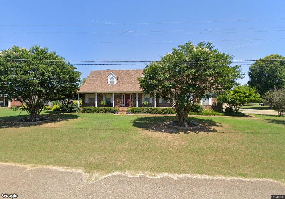
205 Magnolia Dr New Albany, MS 38652
Estimated Value: $267,000 - $363,000
3
Beds
3
Baths
3,185
Sq Ft
$105/Sq Ft
Est. Value
About This Home
This home is located at 205 Magnolia Dr, New Albany, MS 38652 and is currently estimated at $333,291, approximately $104 per square foot. 205 Magnolia Dr is a home located in Union County with nearby schools including New Albany Elementary School, New Albany/S.Tippah/Union County Alternative School, and New Albany Middle School.
Ownership History
Date
Name
Owned For
Owner Type
Purchase Details
Closed on
Mar 31, 2016
Sold by
Murphy Meah M and Bennett Meah M
Bought by
Andersen Russell M and Andersen Angela J
Current Estimated Value
Home Financials for this Owner
Home Financials are based on the most recent Mortgage that was taken out on this home.
Original Mortgage
$191,224
Outstanding Balance
$151,716
Interest Rate
3.64%
Mortgage Type
New Conventional
Estimated Equity
$181,575
Purchase Details
Closed on
Oct 16, 2008
Sold by
Crumpton Larry H and Crumpton Norma J
Bought by
Bennett Meah M and Bennett Morgan M
Create a Home Valuation Report for This Property
The Home Valuation Report is an in-depth analysis detailing your home's value as well as a comparison with similar homes in the area
Home Values in the Area
Average Home Value in this Area
Purchase History
| Date | Buyer | Sale Price | Title Company |
|---|---|---|---|
| Andersen Russell M | -- | -- | |
| Bennett Meah M | -- | -- |
Source: Public Records
Mortgage History
| Date | Status | Borrower | Loan Amount |
|---|---|---|---|
| Open | Andersen Russell M | $191,224 |
Source: Public Records
Tax History Compared to Growth
Tax History
| Year | Tax Paid | Tax Assessment Tax Assessment Total Assessment is a certain percentage of the fair market value that is determined by local assessors to be the total taxable value of land and additions on the property. | Land | Improvement |
|---|---|---|---|---|
| 2024 | $3,078 | $23,597 | $0 | $0 |
| 2023 | $3,088 | $23,597 | $0 | $0 |
| 2022 | $2,423 | $18,897 | $0 | $0 |
| 2021 | $2,294 | $18,517 | $0 | $0 |
| 2020 | $2,294 | $18,517 | $0 | $0 |
| 2019 | $2,286 | $18,464 | $0 | $0 |
| 2018 | $2,154 | $17,510 | $0 | $0 |
| 2017 | $2,085 | $17,510 | $0 | $0 |
| 2016 | $3,458 | $26,266 | $0 | $0 |
| 2015 | -- | $26,266 | $0 | $0 |
| 2014 | -- | $26,339 | $0 | $0 |
Source: Public Records
Map
Nearby Homes
- 0 Hwy 30 West - 2 Acres Unit 25-34
- Lot 909 W Longview Dr
- 1004 Lakewood Dr
- 403 Bristol Ave
- 714 W Shady Ln
- 0 Bratton Rd
- 0 Park Plaza Dr
- 0 Coulter Cove + - 52 Ac
- 621 Glendale Rd
- Lot 102 Greenhaven Dr
- Lot 92 Greenhaven Dr
- Lot 100 Greenhaven Dr
- Lot 84 Greenhaven Dr
- Lot 78 Greenhaven Dr
- Lot 80 Greenhaven Dr
- Lot 76 Greenhaven Dr
- Lot 75 Greenhaven Dr
- 0 Coulter Dr Denton Rd Unit 24-3689
- 816 W Bankhead St
- 1202 Martintown Rd
- 205 Magnolia Dr
- 300 Magnolia
- 203 Magnolia Dr
- 621 W Longview Dr
- 301 Magnolia
- 201 Magnolia Dr
- 201 Magnolia Dr
- 201 Magnolia Dr
- 206 Magnolia Dr
- 719 Monticello St
- 204 Magnolia Dr
- 300 Magnolia Dr
- 620 W Longview Dr
- 619 W Longview Dr
- 620 W Longview Dr
- 717 Monticello St
- 301 Magnolia Dr
- 110 Magnolia Dr
- 715 Monticello St
- 715 Monticello St