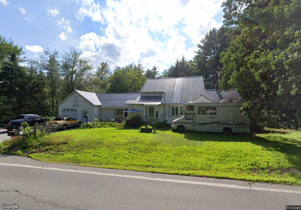
205 Meredith Center Rd Meredith, NH 03253
Estimated Value: $399,000 - $704,000
3
Beds
2
Baths
1,563
Sq Ft
$333/Sq Ft
Est. Value
About This Home
This home is located at 205 Meredith Center Rd, Meredith, NH 03253 and is currently estimated at $519,744, approximately $332 per square foot. 205 Meredith Center Rd is a home located in Belknap County with nearby schools including Inter-Lakes Elementary School, Sandwich Central School, and Inter-Lakes Middle High School.
Ownership History
Date
Name
Owned For
Owner Type
Purchase Details
Closed on
Mar 23, 2015
Sold by
Simons Guenlen C
Bought by
Ycas Lavinia A and Ycas John
Current Estimated Value
Purchase Details
Closed on
Mar 31, 1998
Sold by
Johnson Gerard J and Johnson Jeanette M
Bought by
Simpson Lester E and Simpson Susan M
Home Financials for this Owner
Home Financials are based on the most recent Mortgage that was taken out on this home.
Original Mortgage
$68,000
Interest Rate
6.96%
Create a Home Valuation Report for This Property
The Home Valuation Report is an in-depth analysis detailing your home's value as well as a comparison with similar homes in the area
Home Values in the Area
Average Home Value in this Area
Purchase History
| Date | Buyer | Sale Price | Title Company |
|---|---|---|---|
| Ycas Lavinia A | -- | -- | |
| Simpson Lester E | $85,000 | -- |
Source: Public Records
Mortgage History
| Date | Status | Borrower | Loan Amount |
|---|---|---|---|
| Previous Owner | Simpson Lester E | $68,000 |
Source: Public Records
Tax History
| Year | Tax Paid | Tax Assessment Tax Assessment Total Assessment is a certain percentage of the fair market value that is determined by local assessors to be the total taxable value of land and additions on the property. | Land | Improvement |
|---|---|---|---|---|
| 2024 | $2,938 | $286,400 | $121,400 | $165,000 |
| 2023 | $2,832 | $286,400 | $121,400 | $165,000 |
| 2022 | $2,720 | $194,700 | $70,900 | $123,800 |
| 2021 | $2,615 | $194,700 | $70,900 | $123,800 |
| 2020 | $2,730 | $194,700 | $70,900 | $123,800 |
| 2019 | $2,731 | $171,900 | $57,300 | $114,600 |
| 2018 | $2,685 | $171,900 | $57,300 | $114,600 |
| 2016 | $2,688 | $172,400 | $55,600 | $116,800 |
| 2015 | $2,620 | $172,400 | $55,600 | $116,800 |
| 2014 | $2,557 | $172,400 | $55,600 | $116,800 |
| 2013 | $2,484 | $172,400 | $55,600 | $116,800 |
Source: Public Records
Map
Nearby Homes
- 1 Sanctuary Ln
- 178 Meredith Center Rd
- 11 Chemung Rd
- 207 Pease Rd
- 18 Hickorywood Cir
- 00 Pease Rd Unit 3A
- 6 Loon Point Rd
- 70 Hatch Corner Rd
- 358 Roller Coaster Rd
- 00 Chemung Rd Unit 31
- 5 Clover Ridge Rd
- 47 Clover Ridge Rd
- 64 Granite Ridge
- 74 Granite Ridge
- 78 Granite Ridge
- 17 Granite Ridge
- 34-35-36 Commerce Ct
- 2 Namak Way
- UNIT 49 Stonewall Corners Way Unit 49
- 447 Nh Route 104
- 201 Meredith Center Rd
- 211 Meredith Center Rd
- 21 Solace Point
- 21 Solace Point
- 2 Solace Pointe Rd
- 15 Solace Point
- 15 Solace Point
- 15 Solace Point
- 6 Solace Pointe Rd
- 195 Meredith Center Rd
- 49 Solace Pointe Rd
- 0 Solace Pointe Rd
- 0 Solace Pointe Rd Unit 4159360
- 0 Solace Pointe Rd Unit 4147704
- 00 Solace Pointe Rd
- 0 Solace Pointe Rd Unit 4171420
- 0 Solace Pointe Rd Unit 4017401
- 0 Solace Pointe Rd Unit 4017368
- 9 Solace Pointe Rd
- Lot 3 Solace Point
Your Personal Tour Guide
Ask me questions while you tour the home.