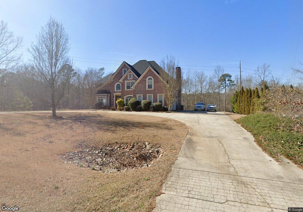
205 Thurman Rd Unit IV Stockbridge, GA 30281
Estimated Value: $473,000 - $542,000
5
Beds
5
Baths
3,416
Sq Ft
$148/Sq Ft
Est. Value
About This Home
This home is located at 205 Thurman Rd Unit IV, Stockbridge, GA 30281 and is currently estimated at $504,779, approximately $147 per square foot. 205 Thurman Rd Unit IV is a home located in Henry County with nearby schools including Cotton Indian Elementary School, Austin Road Middle School, and Stockbridge High School.
Ownership History
Date
Name
Owned For
Owner Type
Purchase Details
Closed on
Nov 6, 2002
Sold by
Larry Dan Bldrs Inc
Bought by
Mack Curtis C and Mack Belinda A
Current Estimated Value
Home Financials for this Owner
Home Financials are based on the most recent Mortgage that was taken out on this home.
Original Mortgage
$286,850
Outstanding Balance
$41,690
Interest Rate
5.98%
Mortgage Type
New Conventional
Estimated Equity
$463,089
Purchase Details
Closed on
Dec 14, 2001
Sold by
Thurmond Road Partners Llc
Bought by
Adams Larry D
Home Financials for this Owner
Home Financials are based on the most recent Mortgage that was taken out on this home.
Original Mortgage
$500,000
Interest Rate
6.42%
Mortgage Type
New Conventional
Create a Home Valuation Report for This Property
The Home Valuation Report is an in-depth analysis detailing your home's value as well as a comparison with similar homes in the area
Home Values in the Area
Average Home Value in this Area
Purchase History
| Date | Buyer | Sale Price | Title Company |
|---|---|---|---|
| Mack Curtis C | $39,500 | -- | |
| Adams Larry D | -- | -- |
Source: Public Records
Mortgage History
| Date | Status | Borrower | Loan Amount |
|---|---|---|---|
| Open | Mack Curtis C | $286,850 | |
| Previous Owner | Adams Larry D | $500,000 |
Source: Public Records
Tax History Compared to Growth
Tax History
| Year | Tax Paid | Tax Assessment Tax Assessment Total Assessment is a certain percentage of the fair market value that is determined by local assessors to be the total taxable value of land and additions on the property. | Land | Improvement |
|---|---|---|---|---|
| 2025 | $7,356 | $223,240 | $24,000 | $199,240 |
| 2024 | $7,356 | $208,640 | $24,000 | $184,640 |
| 2023 | $6,645 | $215,160 | $22,000 | $193,160 |
| 2022 | $5,834 | $159,480 | $16,000 | $143,480 |
| 2021 | $5,428 | $147,520 | $16,000 | $131,520 |
| 2020 | $5,408 | $147,000 | $12,000 | $135,000 |
| 2019 | $4,877 | $133,160 | $12,000 | $121,160 |
| 2018 | $4,366 | $119,840 | $12,000 | $107,840 |
| 2016 | $3,312 | $92,360 | $10,000 | $82,360 |
| 2015 | $2,857 | $92,360 | $10,000 | $82,360 |
| 2014 | $3,310 | $89,080 | $10,000 | $79,080 |
Source: Public Records
Map
Nearby Homes
- 20 Lamp Post Ct
- 230 Flintlock Trail
- 20 Carriage Trace
- 90 Country Roads Dr
- 219 Thorncrest
- 393 Young James Cir
- 389 Young James Cir
- 1773 E Atlanta Rd
- 453 Azalea Dr
- 0 E Atlanta Rd Unit @VALERIE CT 10464740
- 0 E Atlanta Rd Unit @KINSEY DR 10464743
- 145 Glenloch Pkwy
- 491 Thurman Rd Unit TRACT C
- 230 Carriage Cir
- 418 Honeysuckle Ln
- 565 Patillo Rd
- 7031 Coatsworth Dr Unit 2
- 562 Patillo Rd
- 7001 Coatsworth Dr Unit LOT 1
- 905 E Atlanta Rd
- 215 Thurman Rd Unit IV
- 208 James Forest Ct
- 208 James Forest Ct Unit 2
- 150 Dennis Dr
- 212 James Forest Ct Unit II
- 225 Thurman Rd
- 204 James Forest Ct Unit II
- 0 Dennis Dr Unit 7313852
- 0 Dennis Dr Unit 7607343
- 0 Dennis Dr Unit 3139785
- 100 James Ridge Dr Unit 2
- 140 Dennis Dr
- 160 Dennis Dr
- 235 Thurman Rd
- 213 James Forest Ct
- 130 Dennis Dr
- 110 James Ridge Dr Unit 2
- 209 James Forest Ct
- 209 James Forest Ct Unit 2
- 245 Thurman Rd