Estimated Value: $101,000 - $119,000
Studio
--
Bath
1,400
Sq Ft
$79/Sq Ft
Est. Value
About This Home
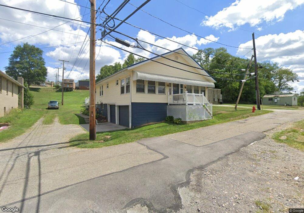
This home is located at 205 Utility St, Scio, OH 43988 and is currently estimated at $110,545, approximately $78 per square foot. 205 Utility St is a home with nearby schools including Harrison Central Elementary School and Harrison Central Junior/Senior High School.
Ownership History
Date
Name
Owned For
Owner Type
Purchase Details
Closed on
Dec 10, 2010
Sold by
Thompson Kelly J
Bought by
Thompson James H
Current Estimated Value
Purchase Details
Closed on
Mar 30, 1994
Purchase Details
Closed on
Jun 25, 1991
Purchase Details
Closed on
May 14, 1991
Create a Home Valuation Report for This Property
The Home Valuation Report is an in-depth analysis detailing your home's value as well as a comparison with similar homes in the area
Purchase History
| Date | Buyer | Sale Price | Title Company |
|---|---|---|---|
| Thompson James H | -- | -- | |
| -- | -- | -- | |
| -- | $22,000 | -- | |
| -- | $20,000 | -- |
Source: Public Records
Tax History
| Year | Tax Paid | Tax Assessment Tax Assessment Total Assessment is a certain percentage of the fair market value that is determined by local assessors to be the total taxable value of land and additions on the property. | Land | Improvement |
|---|---|---|---|---|
| 2025 | $1,126 | $26,840 | $4,460 | $22,380 |
| 2024 | $1,126 | $26,840 | $4,460 | $22,380 |
| 2023 | $1,125 | $26,840 | $4,460 | $22,380 |
| 2022 | $982 | $22,530 | $1,870 | $20,660 |
| 2021 | $972 | $22,530 | $1,870 | $20,660 |
| 2020 | $968 | $22,530 | $1,870 | $20,660 |
| 2019 | $997 | $21,450 | $1,780 | $19,670 |
| 2018 | $997 | $21,450 | $1,780 | $19,670 |
| 2017 | $1,006 | $21,450 | $1,780 | $19,670 |
| 2016 | $957 | $19,290 | $1,600 | $17,690 |
| 2015 | $951 | $19,290 | $1,600 | $17,690 |
| 2014 | $776 | $18,630 | $1,460 | $17,170 |
| 2013 | $776 | $18,630 | $1,460 | $17,170 |
Source: Public Records
Map
Nearby Homes
- 219 W College St
- 38500 Bower Rd
- 90480 Kilgore Ridge Rd
- 38150 Stagecoach Dr
- 91510 Amos Rd
- 91800 Irish Creek Rd
- 8125 Scio Rd SE Unit 35
- 0 Burrier Rd Unit 5195823
- 0 Burrier Rd Unit 5196831
- 0 Burrier Rd Unit 5195817
- 0 Burrier Rd Unit 5195694
- 0 Burrier Rd Unit 5195785
- 0 Eckley Rd
- 91100 Eckley Rd
- 205 Rumley St
- 85200 Merryman Rd
- 3188 Amsterdam Rd SE Unit 17
- 103 Lake St
- 89501 Arbaugh Rd
- 9100 Post Rd SE
- 102 N Carrollton St
- 223 E Main St
- 205 E Main St
- 102 Hilltop Dr
- 233 E Main St
- 207 E Main St
- 207 209 W Main St
- 0 Hilltop Dr Unit 3971808
- 0 Hilltop Dr Unit 1029384
- 106 Hilltop Dr
- 303 W Main St
- 144 Hilltop Dr
- 222 E Main St
- 38699 Ohio 151
- 214 E Main St
- 212 E Main St
- 105 N Carrollton St
- 206 E Main St
- 101 Hilltop Dr
- 103 Masonic Ave
Your Personal Tour Guide
Ask me questions while you tour the home.