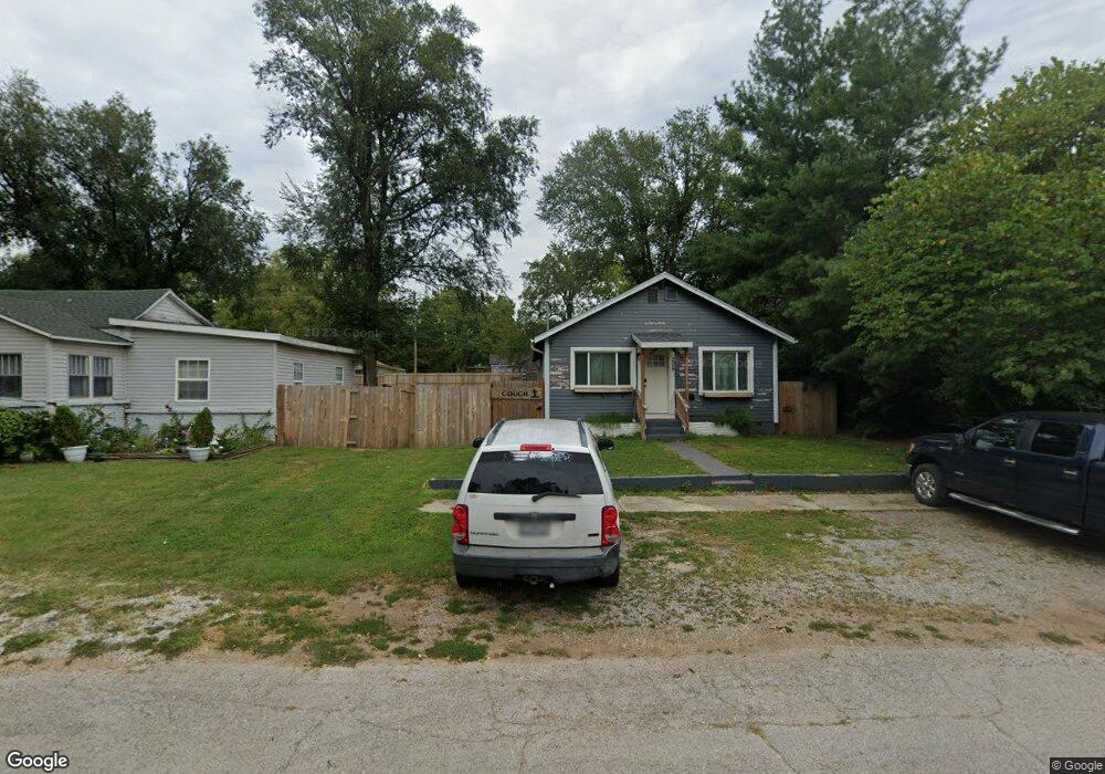
205 W Tyndal St Aurora, MO 65605
Estimated Value: $68,000 - $105,000
--
Bed
--
Bath
912
Sq Ft
$100/Sq Ft
Est. Value
About This Home
This home is located at 205 W Tyndal St, Aurora, MO 65605 and is currently estimated at $91,298, approximately $100 per square foot. 205 W Tyndal St is a home located in Lawrence County with nearby schools including Pate Early Childhood Center, Robinson Intermediate School, and Robinson Elementary School.
Ownership History
Date
Name
Owned For
Owner Type
Purchase Details
Closed on
Apr 16, 2020
Sold by
Smedley Robert and Smedley Rhonda
Bought by
Bdw Llc
Current Estimated Value
Home Financials for this Owner
Home Financials are based on the most recent Mortgage that was taken out on this home.
Original Mortgage
$43,300
Outstanding Balance
$38,212
Interest Rate
3.2%
Mortgage Type
Future Advance Clause Open End Mortgage
Estimated Equity
$53,086
Purchase Details
Closed on
Dec 21, 2015
Sold by
Williams Cynthia
Bought by
Smedley Robert
Purchase Details
Closed on
Jul 20, 2007
Sold by
Brothers Properties Investments Llc
Bought by
Sevy Daniel R
Home Financials for this Owner
Home Financials are based on the most recent Mortgage that was taken out on this home.
Original Mortgage
$53,000
Interest Rate
6.73%
Create a Home Valuation Report for This Property
The Home Valuation Report is an in-depth analysis detailing your home's value as well as a comparison with similar homes in the area
Home Values in the Area
Average Home Value in this Area
Purchase History
| Date | Buyer | Sale Price | Title Company |
|---|---|---|---|
| Bdw Llc | -- | None Available | |
| Smedley Robert | -- | Great American Title | |
| Sevy Daniel R | -- | None Available |
Source: Public Records
Mortgage History
| Date | Status | Borrower | Loan Amount |
|---|---|---|---|
| Open | Bdw Llc | $43,300 | |
| Previous Owner | Sevy Daniel R | $53,000 |
Source: Public Records
Tax History Compared to Growth
Tax History
| Year | Tax Paid | Tax Assessment Tax Assessment Total Assessment is a certain percentage of the fair market value that is determined by local assessors to be the total taxable value of land and additions on the property. | Land | Improvement |
|---|---|---|---|---|
| 2025 | $363 | $7,260 | $570 | $6,690 |
| 2024 | $332 | $6,590 | $570 | $6,020 |
| 2023 | $331 | $6,590 | $570 | $6,020 |
| 2022 | $309 | $6,160 | $570 | $5,590 |
| 2021 | $309 | $6,160 | $570 | $5,590 |
| 2020 | $302 | $5,950 | $360 | $5,590 |
| 2019 | $296 | $5,950 | $360 | $5,590 |
| 2018 | $296 | $5,950 | $360 | $5,590 |
| 2017 | $294 | $5,950 | $360 | $5,590 |
| 2016 | -- | $5,400 | $360 | $5,040 |
| 2015 | -- | $5,400 | $360 | $5,040 |
| 2014 | -- | $5,400 | $360 | $5,040 |
Source: Public Records
Map
Nearby Homes
- 225 Morgan Ave
- 503 Mcnatt Ave
- 15 E Cofield St
- 111 W Cofield St
- 112 N Madison Ave
- 406 W Cline St
- 109 W Cline St
- 141 W Pleasant St
- 311 W Pleasant St
- 304 E Cofield St
- 238 E Delta St
- 328 W Summit St
- Lot 2 Summit Grove Estates
- 000 Crescent St
- 421 W College St
- 216 S Elliott Ave
- 30 W College St
- 220 S Park Ave
- 114 E College St
- 308 W Church St
- 205 W Tyndal St
- 205 W Tyndall St Unit 1208485
- 205 W Tyndall St
- 213 W Tyndall St Unit 1301383
- 213 W Tyndall St
- 147 W Tyndal St
- 325 Morgan Ave
- 206 W Myrtle St
- 326 Morgan Ave
- 326 Morgan Ave
- 218 W Myrtle St
- 224 W Tyndal St
- 141 W Tyndall St
- 225 W Tyndal St
- 313 W Myrtle St
- 140 W Tyndal St
- 226 W Tyndal St
- 309 Morgan Ave
- 135 W Tyndal St
- 228 W Myrtle St