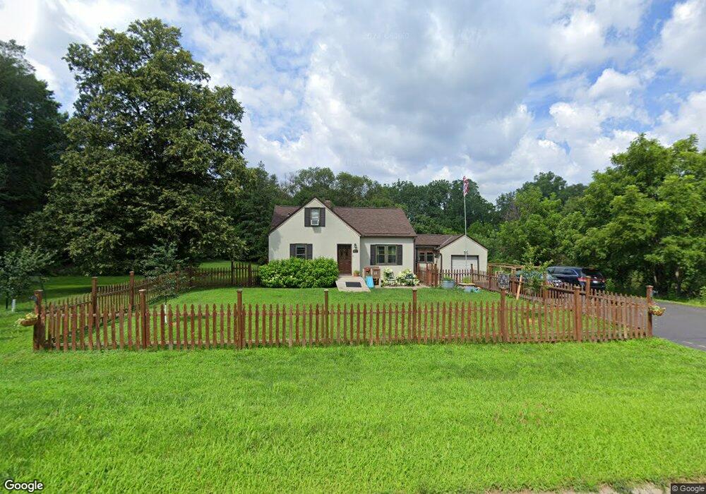
2051 Hazelwood St Saint Paul, MN 55109
Sherwood Glen NeighborhoodEstimated Value: $364,000 - $388,000
4
Beds
2
Baths
1,157
Sq Ft
$325/Sq Ft
Est. Value
About This Home
This home is located at 2051 Hazelwood St, Saint Paul, MN 55109 and is currently estimated at $376,412, approximately $325 per square foot. 2051 Hazelwood St is a home located in Ramsey County with nearby schools including Weaver Elementary School, John Glenn Middle School, and Mounds Park Academy.
Ownership History
Date
Name
Owned For
Owner Type
Purchase Details
Closed on
May 26, 2017
Sold by
Sauro Janet A
Bought by
Renze Joseph
Current Estimated Value
Home Financials for this Owner
Home Financials are based on the most recent Mortgage that was taken out on this home.
Original Mortgage
$225,250
Outstanding Balance
$187,515
Interest Rate
4.05%
Mortgage Type
New Conventional
Estimated Equity
$188,897
Purchase Details
Closed on
Aug 31, 1971
Sold by
Sauro Janet A and Sauro Joseph W
Bought by
Sauro Janet A
Create a Home Valuation Report for This Property
The Home Valuation Report is an in-depth analysis detailing your home's value as well as a comparison with similar homes in the area
Home Values in the Area
Average Home Value in this Area
Purchase History
| Date | Buyer | Sale Price | Title Company |
|---|---|---|---|
| Renze Joseph | $291,212 | Burnet Title | |
| Sauro Janet A | -- | None Available |
Source: Public Records
Mortgage History
| Date | Status | Borrower | Loan Amount |
|---|---|---|---|
| Open | Renze Joseph | $225,250 |
Source: Public Records
Tax History Compared to Growth
Tax History
| Year | Tax Paid | Tax Assessment Tax Assessment Total Assessment is a certain percentage of the fair market value that is determined by local assessors to be the total taxable value of land and additions on the property. | Land | Improvement |
|---|---|---|---|---|
| 2025 | $4,840 | $353,800 | $128,300 | $225,500 |
| 2023 | $4,840 | $344,500 | $128,300 | $216,200 |
| 2022 | $3,554 | $279,400 | $128,300 | $151,100 |
| 2021 | $3,254 | $249,400 | $128,300 | $121,100 |
| 2020 | $3,488 | $235,300 | $128,300 | $107,000 |
| 2019 | $3,436 | $234,700 | $128,300 | $106,400 |
| 2018 | $3,292 | $234,700 | $128,300 | $106,400 |
| 2017 | $3,202 | $205,300 | $102,700 | $102,600 |
| 2016 | $2,962 | $0 | $0 | $0 |
| 2015 | $2,842 | $193,700 | $94,200 | $99,500 |
| 2014 | $2,262 | $0 | $0 | $0 |
Source: Public Records
Map
Nearby Homes
- 1984 Prosperity Rd
- 1940 Barclay St
- 1467 County Road B E
- 1509 Sandhurst Ave E
- 1496 Laurie Rd E
- 1854 Barclay St
- 1666 Laurie Rd E
- 1937 Flandrau St
- 1869 Birmingham St
- 1694 Laurie Rd E
- 1849 Kennard St
- 1870 Clarence St
- 1856 Flandrau St
- 1247 Lealand Rd E
- 1435 Price Ave
- 1751 Clarence St
- 1201 Frost Ave
- 2420 Hazelwood St
- 1740 English St
- 1672 Manton St
- 2071 Hazelwood St
- 2034 Hazelwood St
- 2026 Dieter St
- 2081 Hazelwood St
- 2026 Hazelwood St
- 2021 Hazelwood St
- 2018 Dieter St
- 2091 Hazelwood St
- 2052 Barclay St
- 2018 Hazelwood St
- 2013 Hazelwood St
- 2046 Barclay St
- 2012 Dieter St
- 2012 Dieter St N
- 2044 Hazelwood St
- 2019 Dieter St
- 2060 Barclay St
- 2068 Barclay St
- 2080 Barclay St
- 2006 Dieter St