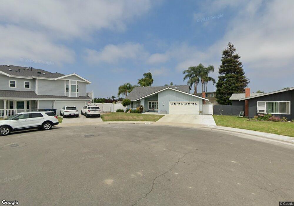
20512 Bearsden Cir Huntington Beach, CA 92646
Southeast NeighborhoodEstimated Value: $1,632,000 - $1,736,000
6
Beds
3
Baths
2,383
Sq Ft
$707/Sq Ft
Est. Value
About This Home
This home is located at 20512 Bearsden Cir, Huntington Beach, CA 92646 and is currently estimated at $1,685,936, approximately $707 per square foot. 20512 Bearsden Cir is a home located in Orange County with nearby schools including S.A. Moffett Elementary School, Isaac L. Sowers Middle School, and Edison High School.
Ownership History
Date
Name
Owned For
Owner Type
Purchase Details
Closed on
Apr 14, 2012
Sold by
Denardo Barth Dale and Denardo Nancy
Bought by
Denardo Barth Dale and The Barth Dale Denardo & Nancy Emiko Den
Current Estimated Value
Purchase Details
Closed on
Aug 5, 1999
Sold by
Dunbar Patricia A
Bought by
Denardo Barth Dale and Denardo Nancy
Home Financials for this Owner
Home Financials are based on the most recent Mortgage that was taken out on this home.
Original Mortgage
$305,600
Outstanding Balance
$87,202
Interest Rate
7.56%
Estimated Equity
$1,598,734
Create a Home Valuation Report for This Property
The Home Valuation Report is an in-depth analysis detailing your home's value as well as a comparison with similar homes in the area
Home Values in the Area
Average Home Value in this Area
Purchase History
| Date | Buyer | Sale Price | Title Company |
|---|---|---|---|
| Denardo Barth Dale | -- | None Available | |
| Denardo Barth Dale | $382,000 | Commonwealth Land Title |
Source: Public Records
Mortgage History
| Date | Status | Borrower | Loan Amount |
|---|---|---|---|
| Open | Denardo Barth Dale | $305,600 | |
| Closed | Denardo Barth Dale | $20,000 |
Source: Public Records
Tax History Compared to Growth
Tax History
| Year | Tax Paid | Tax Assessment Tax Assessment Total Assessment is a certain percentage of the fair market value that is determined by local assessors to be the total taxable value of land and additions on the property. | Land | Improvement |
|---|---|---|---|---|
| 2025 | $6,661 | $587,115 | $444,551 | $142,564 |
| 2024 | $6,661 | $575,603 | $435,834 | $139,769 |
| 2023 | $6,510 | $564,317 | $427,288 | $137,029 |
| 2022 | $6,338 | $553,252 | $418,909 | $134,343 |
| 2021 | $6,220 | $542,404 | $410,695 | $131,709 |
| 2020 | $6,178 | $536,843 | $406,484 | $130,359 |
| 2019 | $6,104 | $526,317 | $398,514 | $127,803 |
| 2018 | $6,009 | $515,998 | $390,700 | $125,298 |
| 2017 | $5,928 | $505,881 | $383,039 | $122,842 |
| 2016 | $5,666 | $495,962 | $375,528 | $120,434 |
| 2015 | $5,611 | $488,513 | $369,888 | $118,625 |
| 2014 | $5,493 | $478,944 | $362,642 | $116,302 |
Source: Public Records
Map
Nearby Homes
- 20380 Flora Ln
- 8932 Amador Cir Unit 1309B
- 20258 Lantana Dr
- 8856 526C Sutter
- 9001 Oceanwood Dr
- 20862 Lancelot Ln
- 8646 Butte Cir Unit 607E
- 20111 Marina Ln
- 9522 Yellowstone Dr
- 9221 Belcaro Dr
- 8656 Fresno Cir Unit 507C
- 8777 Coral Springs Ct Unit 7H
- 20071 Moontide Cir
- 8565 Trinity Cir
- 20131 Crown Reef Ln
- 8565 Larkhall Cir Unit 804A
- 8565 Larkhall Cir Unit 802C
- 8566 Larkhall Cir Unit 808A
- 8566 Larkhall Cir Unit 809D
- 8565 Colusa Cir Unit 906C
- 20502 Bearsden Cir
- 20511 Tobermory Cir
- 20522 Bearsden Cir
- 20521 Tobermory Cir
- 20502 Tobermory Cir
- 20542 Bearsden Cir
- 20511 Bearsden Cir
- 20541 Tobermory Cir
- 20521 Bearsden Cir
- 20531 Bearsden Cir
- 20552 Bearsden Cir
- 20551 Tobermory Cir
- 20512 Tobermory Cir
- 20522 Callieburn Cir
- 9051 Colbreggan Dr
- 20522 Tobermory Cir
- 20542 Tobermory Cir
- 20502 Callieburn Cir
- 20532 Callieburn Cir
- 9041 Colbreggan Dr