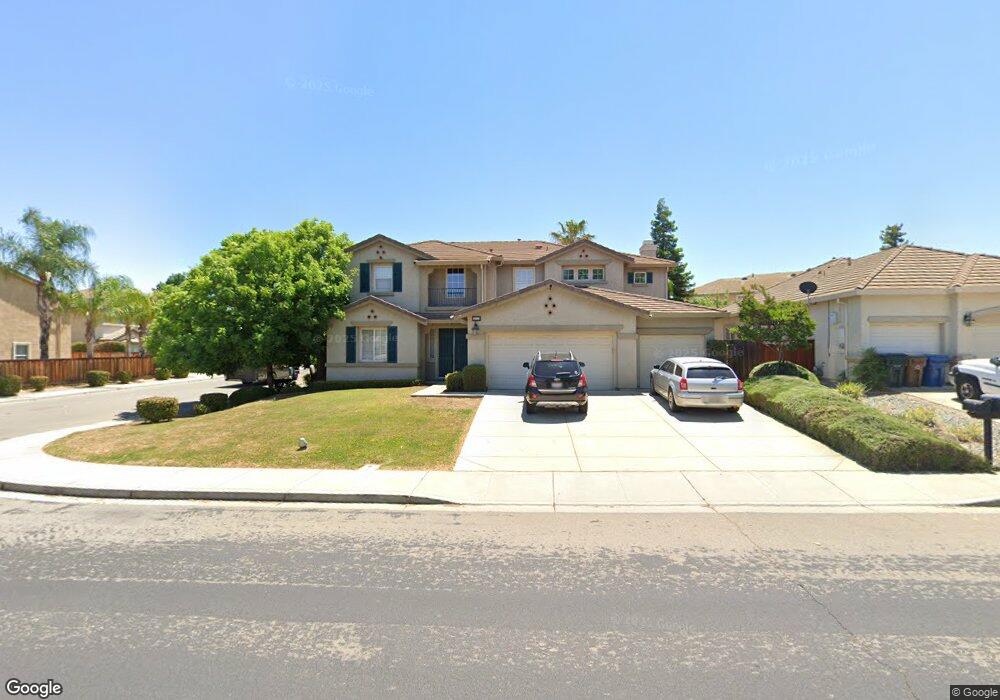
2052 Mokelumne Dr Antioch, CA 94531
Lone Tree Valley NeighborhoodEstimated Value: $735,176 - $804,000
4
Beds
4
Baths
3,117
Sq Ft
$248/Sq Ft
Est. Value
About This Home
This home is located at 2052 Mokelumne Dr, Antioch, CA 94531 and is currently estimated at $774,294, approximately $248 per square foot. 2052 Mokelumne Dr is a home located in Contra Costa County with nearby schools including Lone Tree Elementary School, Dallas Ranch Middle School, and Deer Valley High School.
Ownership History
Date
Name
Owned For
Owner Type
Purchase Details
Closed on
Jan 21, 2011
Sold by
Guzman Marty
Bought by
Yee Wilma Xu and Yee Lichi Leland
Current Estimated Value
Home Financials for this Owner
Home Financials are based on the most recent Mortgage that was taken out on this home.
Original Mortgage
$206,000
Outstanding Balance
$140,712
Interest Rate
4.82%
Mortgage Type
New Conventional
Estimated Equity
$633,582
Create a Home Valuation Report for This Property
The Home Valuation Report is an in-depth analysis detailing your home's value as well as a comparison with similar homes in the area
Home Values in the Area
Average Home Value in this Area
Purchase History
| Date | Buyer | Sale Price | Title Company |
|---|---|---|---|
| Yee Wilma Xu | $290,000 | Chicago Title Company |
Source: Public Records
Mortgage History
| Date | Status | Borrower | Loan Amount |
|---|---|---|---|
| Open | Yee Wilma Xu | $206,000 |
Source: Public Records
Tax History Compared to Growth
Tax History
| Year | Tax Paid | Tax Assessment Tax Assessment Total Assessment is a certain percentage of the fair market value that is determined by local assessors to be the total taxable value of land and additions on the property. | Land | Improvement |
|---|---|---|---|---|
| 2025 | $4,580 | $371,530 | $25,617 | $345,913 |
| 2024 | $4,420 | $364,246 | $25,115 | $339,131 |
| 2023 | $4,420 | $357,105 | $24,623 | $332,482 |
| 2022 | $4,356 | $350,104 | $24,141 | $325,963 |
| 2021 | $4,230 | $343,240 | $23,668 | $319,572 |
| 2019 | $4,134 | $333,062 | $22,967 | $310,095 |
| 2018 | $3,984 | $326,532 | $22,517 | $304,015 |
| 2017 | $3,903 | $320,130 | $22,076 | $298,054 |
| 2016 | $3,810 | $313,854 | $21,644 | $292,210 |
| 2015 | $4,111 | $309,140 | $21,319 | $287,821 |
| 2014 | $4,868 | $303,085 | $20,902 | $282,183 |
Source: Public Records
Map
Nearby Homes
- 2401 Silveria Way
- 4604 Coal Hill Place
- 1964 Finger Peak Way
- 2344 Forty Niner Ct
- 2498 Taylor Way
- 2510 Vallecito Way
- 1879 Mount Conness Way
- 2721 Vallejo Ct
- 1928 Badger Pass Way
- 5488 Southwood Ct
- 1333 Mokelumne Dr
- 2201 Mark Twain Dr
- 5243 Delta View Way
- 5448 Southwood Way
- Residence 2 Plan at Deer Valley
- Residence 6 Plan at Deer Valley
- Residence 4 Plan at Deer Valley
- Residence 1 Plan at Deer Valley
- Residence 3 Plan at Deer Valley
- Residence 5 Plan at Deer Valley
- 2048 Mokelumne Dr
- 1812 Sanger Peak Ct
- 2056 Mokelumne Dr
- 1816 Sanger Peak Ct
- 1818 Sanger Peak Way
- 2044 Mokelumne Dr
- 1823 Sanger Peak Way
- 2055 Mokelumne Dr
- 1822 Sanger Peak Way
- 2060 Mokelumne Dr
- 1827 Sanger Peak Way
- 1819 Sanger Peak Way
- 2040 Mokelumne Dr
- 2051 Mokelumne Dr
- 1808 Sanger Peak Ct
- 1831 Sanger Peak Way
- 1815 Sanger Peak Way
- 1826 Sanger Peak Way
- 2047 Mokelumne Dr
- 2064 Mokelumne Dr