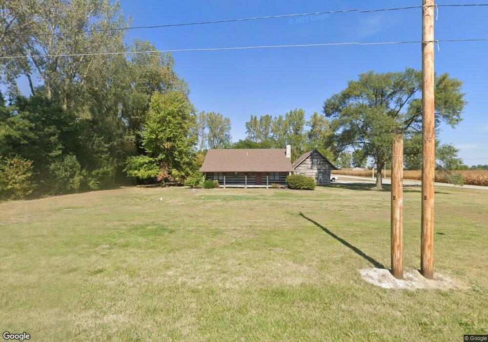
20532 US Route 6 Weston, OH 43569
Estimated Value: $268,000 - $326,000
3
Beds
2
Baths
2,000
Sq Ft
$148/Sq Ft
Est. Value
About This Home
This home is located at 20532 US Route 6, Weston, OH 43569 and is currently estimated at $296,577, approximately $148 per square foot. 20532 US Route 6 is a home located in Wood County with nearby schools including Otsego Elementary School, Otsego Junior High School, and Otsego High School.
Ownership History
Date
Name
Owned For
Owner Type
Purchase Details
Closed on
Apr 17, 1986
Bought by
Dewitt Ralph E
Current Estimated Value
Create a Home Valuation Report for This Property
The Home Valuation Report is an in-depth analysis detailing your home's value as well as a comparison with similar homes in the area
Home Values in the Area
Average Home Value in this Area
Purchase History
| Date | Buyer | Sale Price | Title Company |
|---|---|---|---|
| Dewitt Ralph E | $10,500 | -- |
Source: Public Records
Tax History Compared to Growth
Tax History
| Year | Tax Paid | Tax Assessment Tax Assessment Total Assessment is a certain percentage of the fair market value that is determined by local assessors to be the total taxable value of land and additions on the property. | Land | Improvement |
|---|---|---|---|---|
| 2024 | $3,101 | $86,590 | $12,530 | $74,060 |
| 2023 | $3,101 | $86,590 | $12,530 | $74,060 |
| 2021 | $2,768 | $72,000 | $10,780 | $61,220 |
| 2020 | $2,784 | $72,000 | $10,780 | $61,220 |
| 2019 | $2,488 | $63,390 | $10,610 | $52,780 |
| 2018 | $2,410 | $63,390 | $10,610 | $52,780 |
| 2017 | $2,308 | $63,390 | $10,610 | $52,780 |
| 2016 | $2,140 | $59,500 | $10,290 | $49,210 |
| 2015 | $2,140 | $59,500 | $10,290 | $49,210 |
| 2014 | $2,235 | $59,500 | $10,290 | $49,210 |
| 2013 | $2,446 | $59,500 | $10,290 | $49,210 |
Source: Public Records
Map
Nearby Homes
- 15255 Van Tassel Rd
- 0 Otsego Pike Unit 6136991
- 20553 Euler Rd
- 19393 U S 6
- 20391 Brown Ln
- 15722 Range Line Rd
- 22327 U S 6
- 20410 Oak St
- 20750 Sycamore St
- 20525 Locust St
- 22888 Wintergreen Rd
- 19330 Tuller Rd
- 17884 Euler Rd
- 16710 Potter Rd
- 0 Kellogg Rd Unit 6125521
- 17630 Woodburn Ave
- 16920 Long Judson Rd
- 0 Manore Lot A Rd Unit 6130402
- 0 Manore Lot B Rd Unit 6130403
- 18735 Main St
- 20532 Us Highway 6
- 20560 Bowling Green Rd W
- 15071 Van Tassel Rd
- 15051 Van Tassel Rd
- 20617 Us Route 6
- 20585 U S 6
- 15080 Van Tassel Rd
- 20585 US Route 6
- 20585 Us Highway 6
- 20596 Bowling Green Rd W
- 14939 Van Tassel Rd
- 15149 Van Tassel Rd
- 20617 State Route 6
- 20660 Bowling Green Rd
- 20670 Us Highway 6
- 15201 Van Tassel Rd
- 20706 Bowling Green Rd
- 20685 Us Highway 6
- 20738 U S 6
- 20316 U S 6