Estimated Value: $105,000 - $157,000
3
Beds
2
Baths
1,212
Sq Ft
$111/Sq Ft
Est. Value
About This Home
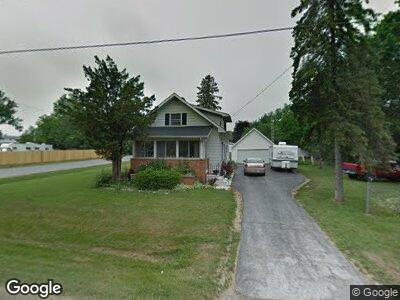
This home is located at 2054 Anoka St, Flint, MI 48532 and is currently estimated at $134,382, approximately $110 per square foot. 2054 Anoka St is a home located in Genesee County with nearby schools including Carman-Ainsworth High School, Genesee STEM Academy, and St. Paul Lutheran School.
Ownership History
Date
Name
Owned For
Owner Type
Purchase Details
Closed on
Jul 25, 2022
Sold by
Spaulding John K
Bought by
Mcdaniel Jo Ann
Current Estimated Value
Purchase Details
Closed on
Dec 4, 2017
Sold by
Mcdaniel Jo Ann
Bought by
Spaudling John Keith
Purchase Details
Closed on
Mar 25, 2011
Sold by
Maier Ron and Maier Cheryl
Bought by
Mcdaniel Jo Ann
Home Financials for this Owner
Home Financials are based on the most recent Mortgage that was taken out on this home.
Original Mortgage
$47,824
Interest Rate
4.99%
Mortgage Type
New Conventional
Purchase Details
Closed on
Jun 23, 2009
Sold by
Maier Ronald and Estate Of Frank S Maier
Bought by
Maier Ronald and Evans Carol
Create a Home Valuation Report for This Property
The Home Valuation Report is an in-depth analysis detailing your home's value as well as a comparison with similar homes in the area
Home Values in the Area
Average Home Value in this Area
Purchase History
| Date | Buyer | Sale Price | Title Company |
|---|---|---|---|
| Mcdaniel Jo Ann | -- | None Listed On Document | |
| Spaudling John Keith | -- | None Available | |
| Mcdaniel Jo Ann | $49,069 | Lighthouse Title Inc | |
| Maier Ronald | -- | None Available |
Source: Public Records
Mortgage History
| Date | Status | Borrower | Loan Amount |
|---|---|---|---|
| Previous Owner | Mcdaniel Jo Ann | $47,824 |
Source: Public Records
Tax History Compared to Growth
Tax History
| Year | Tax Paid | Tax Assessment Tax Assessment Total Assessment is a certain percentage of the fair market value that is determined by local assessors to be the total taxable value of land and additions on the property. | Land | Improvement |
|---|---|---|---|---|
| 2024 | $1,594 | $45,700 | $0 | $0 |
| 2023 | $1,506 | $37,400 | $0 | $0 |
| 2022 | $1,356 | $34,100 | $0 | $0 |
| 2021 | $665 | $31,700 | $0 | $0 |
| 2020 | $954 | $27,300 | $0 | $0 |
| 2019 | $942 | $23,400 | $0 | $0 |
| 2018 | $1,886 | $27,900 | $0 | $0 |
| 2017 | $1,185 | $27,900 | $0 | $0 |
| 2016 | $1,222 | $25,800 | $0 | $0 |
| 2015 | $969 | $25,100 | $0 | $0 |
| 2014 | $575 | $24,100 | $0 | $0 |
| 2012 | -- | $27,600 | $27,600 | $0 |
Source: Public Records
Map
Nearby Homes
- 18.41 Taft Rd
- 1551 Eberly Rd
- 4020 Red Wing Dr
- 1540 Pound Dr
- 10 Acres T A Mansour Blvd
- 3451 Brown St
- 4474 Corunna Rd
- 2245 Lodge Rd
- 4480 Corunna Rd
- 1455 S Linden Rd
- 0 Charter Dr Unit 50153638
- VL Utley Rd
- 00 W Court St
- 3277 Whitney Ave
- 1091 Normandy Terrace Dr
- 1543 Ryan St
- VL Clairmont St
- 2448 Valley Oaks Cir Unit 32
- 1023 Normandy Terrace Dr
- 3320 Timberview St