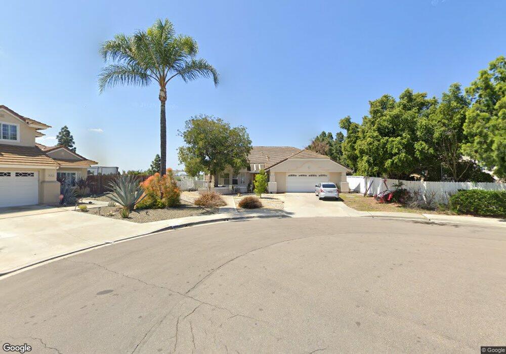
2055 Port Cardiff Chula Vista, CA 91913
Eastlake NeighborhoodEstimated Value: $1,047,952 - $1,091,000
4
Beds
2
Baths
2,219
Sq Ft
$483/Sq Ft
Est. Value
About This Home
This home is located at 2055 Port Cardiff, Chula Vista, CA 91913 and is currently estimated at $1,070,738, approximately $482 per square foot. 2055 Port Cardiff is a home located in San Diego County with nearby schools including Eastlake Elementary School, Bonita Vista Middle School, and Bonita Vista Senior High School.
Ownership History
Date
Name
Owned For
Owner Type
Purchase Details
Closed on
Jan 11, 2000
Sold by
Hansen Richard Alan and Hansen Larry Ernest
Bought by
Hansen Rodney and Hansen Carol
Current Estimated Value
Home Financials for this Owner
Home Financials are based on the most recent Mortgage that was taken out on this home.
Original Mortgage
$150,000
Outstanding Balance
$47,766
Interest Rate
7.87%
Estimated Equity
$1,022,972
Purchase Details
Closed on
Oct 28, 1988
Create a Home Valuation Report for This Property
The Home Valuation Report is an in-depth analysis detailing your home's value as well as a comparison with similar homes in the area
Home Values in the Area
Average Home Value in this Area
Purchase History
| Date | Buyer | Sale Price | Title Company |
|---|---|---|---|
| Hansen Rodney | $188,000 | -- | |
| -- | $230,900 | -- |
Source: Public Records
Mortgage History
| Date | Status | Borrower | Loan Amount |
|---|---|---|---|
| Open | Hansen Rodney | $150,000 |
Source: Public Records
Tax History Compared to Growth
Tax History
| Year | Tax Paid | Tax Assessment Tax Assessment Total Assessment is a certain percentage of the fair market value that is determined by local assessors to be the total taxable value of land and additions on the property. | Land | Improvement |
|---|---|---|---|---|
| 2025 | $4,496 | $399,594 | $153,688 | $245,906 |
| 2024 | $4,496 | $391,760 | $150,675 | $241,085 |
| 2023 | $4,420 | $384,079 | $147,721 | $236,358 |
| 2022 | $4,292 | $376,549 | $144,825 | $231,724 |
| 2021 | $4,185 | $369,167 | $141,986 | $227,181 |
| 2020 | $4,083 | $365,383 | $140,531 | $224,852 |
| 2019 | $3,973 | $358,220 | $137,776 | $220,444 |
| 2018 | $3,986 | $351,197 | $135,075 | $216,122 |
| 2017 | $11 | $344,312 | $132,427 | $211,885 |
| 2016 | $3,805 | $337,562 | $129,831 | $207,731 |
| 2015 | $3,749 | $332,492 | $127,881 | $204,611 |
| 2014 | $3,682 | $325,979 | $125,376 | $200,603 |
Source: Public Records
Map
Nearby Homes
- 2018 Bridgeport
- 2100 Northshore Dr Unit A
- 1950 Rue Michelle
- 725 Brookstone Rd Unit 101
- 2015 Lakeridge Cir Unit 301
- 678 Rue Avallon
- 749 Brookstone Rd Unit 101
- 731 Brookstone Rd Unit 103
- 773 Brookstone Rd Unit 304
- 2151 Northshore Dr
- 761 Brookstone Rd Unit 203
- 742 Eastshore Terrace Unit 98
- 707 Eastshore Terrace Unit 26
- 2180 Hamden Dr
- 732 Eastshore Terrace Unit 77
- 2083 Lakeridge Cir Unit 104
- 746 Eastshore Terrace Unit 108
- 774 Eastshore Terrace Unit 169
- 750 Eastshore Terrace Unit 120
- 753 Eastshore Terrace Unit 127
- 2053 Port Cardiff
- 640 Port Ashley
- 644 Port Ashley
- 2051 Port Cardiff Unit 7
- 2049 Port Cardiff
- 2047 Port Cardiff Unit 7
- 1991 Rue Chateau
- 1995 Rue Chateau
- 2044 Port Cardiff
- 639 Port Ashley
- 2045 Port Cardiff
- 643 Port Ashley
- 635 Port Ashley
- 1988 Rue Michelle
- 1987 Rue Chateau
- 1987 Rue Michelle
- 1994 Rue Chateau
- 1986 Rue Michelle
- 2043 Port Cardiff
- 2042 Port Cardiff