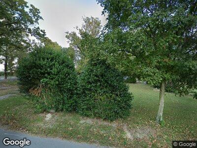
2059 Davis Curbow Rd Old Fort, TN 37362
Estimated Value: $173,720 - $302,000
--
Bed
1
Bath
1,543
Sq Ft
$160/Sq Ft
Est. Value
About This Home
This home is located at 2059 Davis Curbow Rd, Old Fort, TN 37362 and is currently estimated at $247,180, approximately $160 per square foot. 2059 Davis Curbow Rd is a home located in Polk County.
Ownership History
Date
Name
Owned For
Owner Type
Purchase Details
Closed on
Mar 15, 2018
Sold by
Davis Melvin and Davis Rick
Bought by
Dunn Michael C and Dunn Connie F
Current Estimated Value
Purchase Details
Closed on
Nov 20, 2017
Sold by
Davis Melvin and Davis Rick
Bought by
Russell Aaron
Purchase Details
Closed on
Oct 25, 2017
Sold by
Davis Melvin and Davis Rick
Bought by
Davis Scottie
Purchase Details
Closed on
Jan 1, 1955
Bought by
Davis Ray and Davis Cleo
Purchase Details
Closed on
Jan 2, 1953
Create a Home Valuation Report for This Property
The Home Valuation Report is an in-depth analysis detailing your home's value as well as a comparison with similar homes in the area
Home Values in the Area
Average Home Value in this Area
Purchase History
| Date | Buyer | Sale Price | Title Company |
|---|---|---|---|
| Dunn Michael C | $9,000 | Equititle Inc | |
| Russell Aaron | -- | None Available | |
| Davis Scottie | -- | None Available | |
| Davis Ray | -- | -- | |
| -- | -- | -- |
Source: Public Records
Mortgage History
| Date | Status | Borrower | Loan Amount |
|---|---|---|---|
| Open | Davis Scottie K | $60,000 | |
| Previous Owner | Davis Scottie K | $60,000 | |
| Previous Owner | Davis Cleo | $8,198 |
Source: Public Records
Tax History Compared to Growth
Tax History
| Year | Tax Paid | Tax Assessment Tax Assessment Total Assessment is a certain percentage of the fair market value that is determined by local assessors to be the total taxable value of land and additions on the property. | Land | Improvement |
|---|---|---|---|---|
| 2024 | $578 | $34,225 | $2,500 | $31,725 |
| 2023 | $578 | $34,225 | $0 | $0 |
| 2022 | $539 | $21,475 | $2,500 | $18,975 |
| 2021 | $539 | $21,475 | $2,500 | $18,975 |
| 2020 | $539 | $21,475 | $2,500 | $18,975 |
| 2019 | $539 | $21,475 | $2,500 | $18,975 |
| 2018 | $539 | $21,475 | $2,500 | $18,975 |
| 2017 | $660 | $26,175 | $7,075 | $19,100 |
| 2016 | $629 | $26,175 | $7,075 | $19,100 |
| 2015 | $629 | $26,175 | $7,075 | $19,100 |
| 2014 | $628 | $26,161 | $0 | $0 |
Source: Public Records
Map
Nearby Homes
- 177 Ridge Rd
- 231 Rymer Rd
- 0 Bates Park SE Unit 20244855
- 5 Ac Bates Pike
- 125 Fox Trail Dr
- 1520 Old Federal Rd
- 0 Bates Pike SE
- 300 Norman Rd SE
- 3600 Highway 411
- 176 Dixon Rd
- 135 White Rd SE
- 323 Bohannons Rd SE
- 347 Bohannons Rd SE
- 1451 Sloan Gap Rd
- 1415 Sloan Gap Rd
- 1461 Sloan Gap Rd
- 123 Cherokee Ridge Dr
- 131 Cherokee Ridge Dr
- 147 Cherokee Ridge Dr
- 128 Cherokee Ridge Dr
- 2059 Davis Curbow Rd
- 742 Davis-Curbow Rd SE
- 742 Davis Curbow Rd SE
- 146 Dunn Ln
- 2091 Davis Curbow Rd
- 774 Davis Curbow Rd SE
- 62 Dunn Ln
- 716 Davis Curbow Rd SE
- 2007 Davis Rd
- 2094 Davis Curbow Rd
- 2007 Davis Curbow Rd
- 754 Davis Curbow Rd SE
- 604 Davis Curbow Rd SE
- 624 Davis Curbow Rd SE
- 0 Dunn Unit 20173433
- 000 Dunn Ln
- 000 Dunn Rd
- 0 Dunn Unit 1081991
- 2726 Highway 411
- 570 Davis Curbow Rd SE
