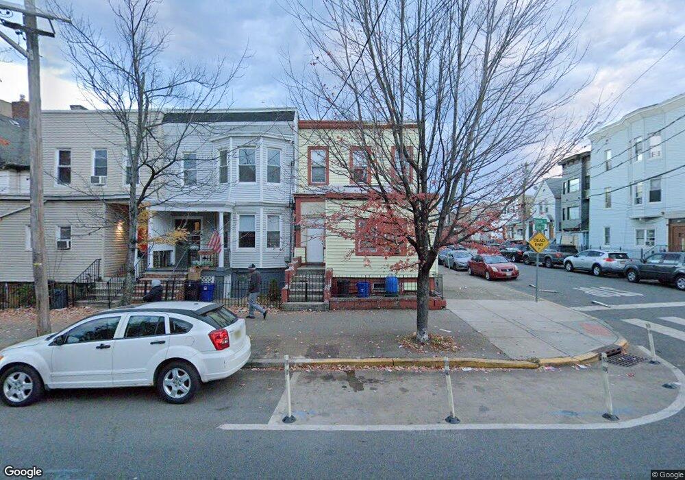
206 Duncan Ave Jersey City, NJ 07306
West Side NeighborhoodEstimated Value: $505,000 - $581,018
3
Beds
--
Bath
1,311
Sq Ft
$421/Sq Ft
Est. Value
About This Home
This home is located at 206 Duncan Ave, Jersey City, NJ 07306 and is currently estimated at $551,505, approximately $420 per square foot. 206 Duncan Ave is a home located in Hudson County with nearby schools including Dr. Charles P. DeFuccio School - P.S. 39, Liberty High School, and Lincoln High School.
Ownership History
Date
Name
Owned For
Owner Type
Purchase Details
Closed on
Mar 11, 1999
Sold by
Marcus Lucille S and Rodriguez Luis A
Bought by
Cooke Leslyn E
Current Estimated Value
Home Financials for this Owner
Home Financials are based on the most recent Mortgage that was taken out on this home.
Original Mortgage
$60,000
Outstanding Balance
$14,558
Interest Rate
6.78%
Estimated Equity
$536,947
Purchase Details
Closed on
May 23, 1995
Sold by
Webster Edward J
Bought by
Citicorp Mtg Inc
Create a Home Valuation Report for This Property
The Home Valuation Report is an in-depth analysis detailing your home's value as well as a comparison with similar homes in the area
Home Values in the Area
Average Home Value in this Area
Purchase History
| Date | Buyer | Sale Price | Title Company |
|---|---|---|---|
| Cooke Leslyn E | $120,000 | -- | |
| Citicorp Mtg Inc | -- | -- |
Source: Public Records
Mortgage History
| Date | Status | Borrower | Loan Amount |
|---|---|---|---|
| Open | Cooke Leslyn E | $60,000 |
Source: Public Records
Tax History Compared to Growth
Tax History
| Year | Tax Paid | Tax Assessment Tax Assessment Total Assessment is a certain percentage of the fair market value that is determined by local assessors to be the total taxable value of land and additions on the property. | Land | Improvement |
|---|---|---|---|---|
| 2025 | $7,177 | $321,400 | $160,000 | $161,400 |
| 2024 | $7,222 | $321,400 | $160,000 | $161,400 |
| 2023 | $7,222 | $321,400 | $160,000 | $161,400 |
| 2022 | $6,807 | $321,400 | $160,000 | $161,400 |
| 2021 | $5,155 | $321,400 | $160,000 | $161,400 |
| 2020 | $5,175 | $321,400 | $160,000 | $161,400 |
| 2019 | $4,950 | $321,400 | $160,000 | $161,400 |
| 2018 | $1,184 | $321,400 | $160,000 | $161,400 |
| 2017 | $6,209 | $79,600 | $11,000 | $68,600 |
| 2016 | $6,130 | $79,600 | $11,000 | $68,600 |
| 2015 | $5,956 | $79,600 | $11,000 | $68,600 |
| 2014 | $5,917 | $79,600 | $11,000 | $68,600 |
Source: Public Records
Map
Nearby Homes
- 210 Nunda Ave
- 196 Delaware Ave Unit 2
- 199 Duncan Ave
- 163 Delaware Ave Unit 2
- 163 Delaware Ave Unit 1
- 163 Delaware Ave Unit 3
- 165 Delaware Ave Unit 1
- 165 Delaware Ave Unit 2
- 165 Delaware Ave Unit 3
- 445 Fairmount Ave
- 38 Gautier Ave
- 429 Fairmount Ave Unit 106
- 429 Fairmount Ave Unit 212
- 429 Fairmount Ave Unit 508
- 429 Fairmount Ave Unit 305
- 141 Duncan Ave Unit 6
- 5 Apollo St
- 211 Plainfield Ave
- 294 Duncan Ave
- 126 Delaware Ave Unit 12
- 208 Duncan Ave Unit 2
- 210 Duncan Ave
- 204 Duncan Ave
- 204 Duncan Ave Unit 2
- 204 Duncan Ave
- 204 Duncan Ave Unit 3
- 212 Duncan Ave
- 191 Olean Ave
- 202 Duncan Ave
- 193 Olean Ave
- 190 Olean Ave Unit 1
- 190 Olean Ave
- 200 Duncan Ave
- 195 Olean Ave
- 192 Olean Ave
- 198 Duncan Ave
- 198 Duncan Ave Unit A
- 192 Belvidere Ave
- 197 Olean Ave
- 197 Olean Ave Unit 197