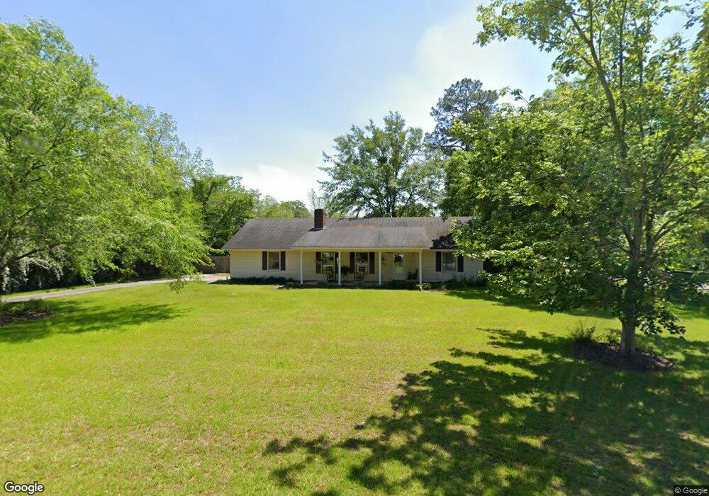
206 E Adams St Boston, GA 31626
Estimated Value: $233,393 - $309,000
Studio
2
Baths
1,788
Sq Ft
$152/Sq Ft
Est. Value
About This Home
This home is located at 206 E Adams St, Boston, GA 31626 and is currently estimated at $271,598, approximately $151 per square foot. 206 E Adams St is a home located in Thomas County with nearby schools including Hand in Hand Primary School, Garrison-Pilcher Elementary School, and Cross Creek Elementary School.
Ownership History
Date
Name
Owned For
Owner Type
Purchase Details
Closed on
Feb 27, 2018
Sold by
Choate Thomas G
Bought by
Terrell Lori E
Current Estimated Value
Home Financials for this Owner
Home Financials are based on the most recent Mortgage that was taken out on this home.
Original Mortgage
$77,500
Outstanding Balance
$54,597
Interest Rate
4.4%
Mortgage Type
New Conventional
Estimated Equity
$217,001
Purchase Details
Closed on
Jun 17, 2011
Sold by
Choate Lori T
Bought by
Choate Lori T and Choate Thomas G
Home Financials for this Owner
Home Financials are based on the most recent Mortgage that was taken out on this home.
Original Mortgage
$115,000
Interest Rate
4.63%
Mortgage Type
New Conventional
Purchase Details
Closed on
Jul 2, 2001
Sold by
Land Mark Travis and Land L
Bought by
Land Lori Terrell
Purchase Details
Closed on
Feb 25, 2000
Sold by
Reynolds Robert Lee
Bought by
Land Mark Travis and Land L
Purchase Details
Closed on
Jan 15, 1997
Bought by
Reynolds Robert Lee
Create a Home Valuation Report for This Property
The Home Valuation Report is an in-depth analysis detailing your home's value as well as a comparison with similar homes in the area
Purchase History
| Date | Buyer | Sale Price | Title Company |
|---|---|---|---|
| Terrell Lori E | -- | -- | |
| Choate Lori T | -- | -- | |
| Land Lori Terrell | -- | -- | |
| Land Mark Travis | $98,500 | -- | |
| Reynolds Robert Lee | $90,000 | -- |
Source: Public Records
Mortgage History
| Date | Status | Borrower | Loan Amount |
|---|---|---|---|
| Open | Terrell Lori E | $77,500 | |
| Previous Owner | Choate Lori T | $115,000 |
Source: Public Records
Tax History
| Year | Tax Paid | Tax Assessment Tax Assessment Total Assessment is a certain percentage of the fair market value that is determined by local assessors to be the total taxable value of land and additions on the property. | Land | Improvement |
|---|---|---|---|---|
| 2025 | $6,473 | $80,130 | $3,888 | $76,242 |
| 2024 | $2,468 | $77,650 | $3,888 | $73,762 |
| 2023 | $2,315 | $72,816 | $3,888 | $68,928 |
| 2022 | $1,540 | $64,131 | $2,916 | $61,215 |
| 2021 | $1,460 | $55,336 | $2,916 | $52,420 |
| 2020 | $1,441 | $53,387 | $2,916 | $50,471 |
| 2019 | $1,450 | $53,387 | $2,916 | $50,471 |
| 2018 | $1,402 | $52,905 | $2,916 | $49,989 |
| 2017 | $1,423 | $52,897 | $2,595 | $50,302 |
| 2016 | $1,392 | $51,666 | $2,595 | $49,071 |
| 2015 | $1,383 | $50,879 | $2,420 | $48,458 |
| 2014 | $1,362 | $49,826 | $2,420 | $47,405 |
| 2013 | -- | $49,825 | $2,420 | $47,405 |
Source: Public Records
Map
Nearby Homes
- 611 Bn S Main St
- 365& 371 Oakridge Ave
- 612-BN W Railroad Ave
- 536 N Leaphart St
- 146 Old Highway 84 W
- 2773 Georgia 33
- 75 Southern Breeze Ln
- 2815 Parker Rd
- 0000 0000 Ozell Road (15+ - Acres)
- 9900 Ozell Rd
- 0 Ozell Rd Unit 26629849
- 2156 County Road 78
- 390 Crabapple Dr
- 1477 Fox Meadow Ln
- 7402 Coffee Rd
- 00 Cone Road & Beulah Church Rd
- 2195 Coffee Rd
- 138
- 2951 Summerhill Rd
- 12431 US Highway 84 E
- 130 E Adams St
- 220 E Adams St
- 223 E Adams St
- 133 E Adams St
- 226 E Adams St
- 123 E Adams St
- 220 S Stephens St
- 225 E Adams St
- 122 E Adams St
- 130 S Stephens St
- 225 S Stephens St
- 237 E Adams St
- 230 S Stephens St
- 223 E Jackson St Unit BN
- 122 S Stephens St
- 117 S Stephens St
- 131 S Main St
- 231 E Jackson St Unit BN
- 304 E Adams St
- 305 E Adams St
Your Personal Tour Guide
Ask me questions while you tour the home.