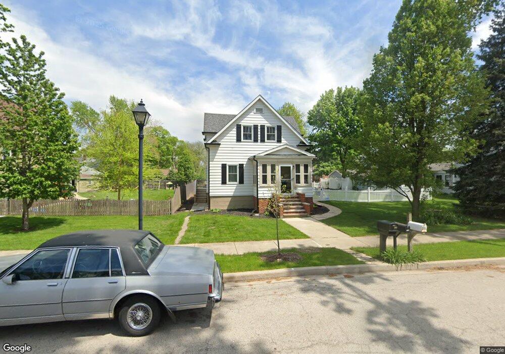
206 Massasoit St Minooka, IL 60447
Estimated Value: $308,000 - $350,368
4
Beds
3
Baths
1,959
Sq Ft
$166/Sq Ft
Est. Value
About This Home
This home is located at 206 Massasoit St, Minooka, IL 60447 and is currently estimated at $325,842, approximately $166 per square foot. 206 Massasoit St is a home with nearby schools including Minooka Primary Center, Minooka Elementary School, and Minooka Junior High School.
Ownership History
Date
Name
Owned For
Owner Type
Purchase Details
Closed on
Apr 20, 2023
Sold by
Pokryfke Jeffrey
Bought by
Egan John J
Current Estimated Value
Home Financials for this Owner
Home Financials are based on the most recent Mortgage that was taken out on this home.
Original Mortgage
$205,800
Outstanding Balance
$200,215
Interest Rate
6.73%
Mortgage Type
New Conventional
Estimated Equity
$125,627
Purchase Details
Closed on
Apr 19, 2022
Sold by
Gates Gregory W and Gates Debra
Bought by
Pokryfke Jeffrey
Create a Home Valuation Report for This Property
The Home Valuation Report is an in-depth analysis detailing your home's value as well as a comparison with similar homes in the area
Home Values in the Area
Average Home Value in this Area
Purchase History
| Date | Buyer | Sale Price | Title Company |
|---|---|---|---|
| Egan John J | $294,000 | Fidelity National Title | |
| Pokryfke Jeffrey | $95,000 | None Listed On Document |
Source: Public Records
Mortgage History
| Date | Status | Borrower | Loan Amount |
|---|---|---|---|
| Open | Egan John J | $205,800 |
Source: Public Records
Tax History Compared to Growth
Tax History
| Year | Tax Paid | Tax Assessment Tax Assessment Total Assessment is a certain percentage of the fair market value that is determined by local assessors to be the total taxable value of land and additions on the property. | Land | Improvement |
|---|---|---|---|---|
| 2024 | $5,585 | $69,628 | $14,537 | $55,091 |
| 2023 | $5,091 | $63,465 | $13,250 | $50,215 |
| 2022 | $4,252 | $59,010 | $12,320 | $46,690 |
| 2021 | $4,061 | $55,859 | $11,662 | $44,197 |
| 2020 | $3,953 | $53,434 | $11,156 | $42,278 |
| 2019 | $3,718 | $49,476 | $10,330 | $39,146 |
| 2018 | $3,748 | $48,766 | $10,214 | $38,552 |
| 2017 | $3,630 | $46,568 | $9,754 | $36,814 |
| 2016 | $3,377 | $43,713 | $9,156 | $34,557 |
| 2015 | $1,574 | $39,736 | $8,323 | $31,413 |
| 2014 | $1,304 | $37,544 | $7,864 | $29,680 |
| 2013 | $2,683 | $38,050 | $7,970 | $30,080 |
Source: Public Records
Map
Nearby Homes
- 201 W Church St
- 405 W Mondamin St
- 103 E Coady Dr
- 308 Wabasso Place
- LOT 1 Bob Blair Rd
- 101 Fieldcrest Ct
- 107 Sibley Dr
- 303 Grande Dr Unit A
- 504 Flanagan Dr Unit A
- 401 Feeney Dr
- 9015 E Mcevilly Rd
- 103 Northfield Dr
- 601 Edgewater Dr
- 406 Mccoy Ct
- 105 Northfield Dr
- LOT 28 O Toole Dr
- 817 Casey Dr
- 605 High Grove Dr
- 314 Golden Rod Dr
- 278,279,280,281 Clover Cir
- 208 Massasoit St
- 204 Massasoit St
- 210 Massasoit St
- 205 Massasoit St
- 207 W Saint Marys St
- 203 Osceola St
- 205 N Osceola St
- 207 Massasoit St
- 209 Massasoit St
- 203 N Osceola St
- 207 N Osceola St
- 209 N Osceola St
- 308 Massasoit St
- 211 Massasoit St
- 201 N Osceola St
- 304 W Church St
- 203 W Church St
- 110 Massasoit St
- 109 N Osceola St
- 305 W St Marys St