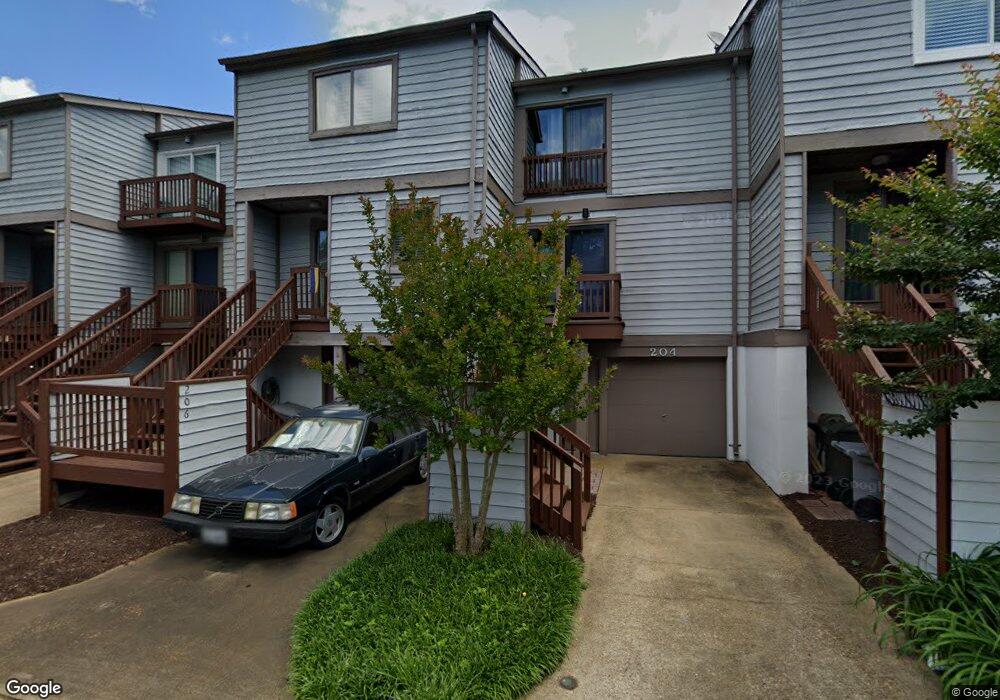
206 Mill Point Dr Hampton, VA 23669
Downtown Hampton NeighborhoodEstimated Value: $284,000 - $329,000
2
Beds
3
Baths
1,559
Sq Ft
$194/Sq Ft
Est. Value
About This Home
This home is located at 206 Mill Point Dr, Hampton, VA 23669 and is currently estimated at $302,391, approximately $193 per square foot. 206 Mill Point Dr is a home located in Hampton City with nearby schools including Capt. John Smith Elementary School, C. Alton Lindsay Middle School, and Phoebus High School.
Ownership History
Date
Name
Owned For
Owner Type
Purchase Details
Closed on
Sep 19, 2016
Sold by
The Secretary Of Housing And Urban Devel
Bought by
Rogers Barbara G
Current Estimated Value
Purchase Details
Closed on
May 18, 2016
Sold by
Professional Foreclosure Corporation Of and Hall Nathan W
Bought by
Secretary Of Veterans Affairs
Purchase Details
Closed on
Apr 18, 2011
Sold by
Holmes Michael B
Bought by
Hall Nathan W
Home Financials for this Owner
Home Financials are based on the most recent Mortgage that was taken out on this home.
Original Mortgage
$219,622
Interest Rate
4.9%
Mortgage Type
VA
Purchase Details
Closed on
Jun 7, 2001
Sold by
Muller Merrilyn S
Bought by
Holmes Michael B
Home Financials for this Owner
Home Financials are based on the most recent Mortgage that was taken out on this home.
Original Mortgage
$80,000
Interest Rate
7.09%
Create a Home Valuation Report for This Property
The Home Valuation Report is an in-depth analysis detailing your home's value as well as a comparison with similar homes in the area
Home Values in the Area
Average Home Value in this Area
Purchase History
| Date | Buyer | Sale Price | Title Company |
|---|---|---|---|
| Rogers Barbara G | $159,000 | Attorney | |
| Secretary Of Veterans Affairs | $140,332 | None Available | |
| Hall Nathan W | $215,000 | -- | |
| Holmes Michael B | $125,000 | -- |
Source: Public Records
Mortgage History
| Date | Status | Borrower | Loan Amount |
|---|---|---|---|
| Previous Owner | Hall Nathan W | $219,622 | |
| Previous Owner | Holmes Michael B | $80,000 |
Source: Public Records
Tax History
| Year | Tax Paid | Tax Assessment Tax Assessment Total Assessment is a certain percentage of the fair market value that is determined by local assessors to be the total taxable value of land and additions on the property. | Land | Improvement |
|---|---|---|---|---|
| 2025 | $3,137 | $273,100 | $103,400 | $169,700 |
| 2024 | $2,865 | $249,100 | $87,500 | $161,600 |
| 2023 | $2,761 | $238,000 | $87,500 | $150,500 |
| 2022 | $2,541 | $215,300 | $87,500 | $127,800 |
| 2021 | $2,595 | $198,800 | $87,500 | $111,300 |
| 2020 | $2,376 | $191,600 | $87,500 | $104,100 |
| 2019 | $2,378 | $191,800 | $87,500 | $104,300 |
| 2018 | $2,451 | $190,100 | $87,500 | $102,600 |
| 2017 | $2,451 | $0 | $0 | $0 |
| 2016 | $2,404 | $190,100 | $0 | $0 |
| 2015 | $2,451 | $0 | $0 | $0 |
| 2014 | $2,441 | $190,100 | $87,500 | $102,600 |
Source: Public Records
Map
Nearby Homes
- 233 Mill Point Dr
- 301 Washington St
- 329 Elm Ave
- 115 E Pembroke Ave
- 418 Wine St
- 603 Washington St
- 606 Washington St
- 542 River St
- 314 Cooper St
- 720 River St
- 311 Cooper St
- 433 Cooper St
- 439 Cooper St
- 16 S Cypress St
- 221 Island Cove Ct Unit C
- 144 Meredith St
- 116 Linden Ave
- 212 Dockside Dr Unit C
- 1002 E Pembroke Ave
- 27 Bacon St
- 208 Mill Point Dr
- 204 Mill Point Dr
- 202 Mill Point Dr
- 210 Mill Point Dr
- 200 Mill Point Dr
- 212 Mill Point Dr
- 214 Mill Point Dr
- 170 Mill Point Dr
- 205 Mill Point Dr
- 218 Mill Point Dr
- 203 Mill Point Dr
- 207 Mill Point Dr
- 201 Mill Point Dr
- 209 Mill Point Dr
- 220 Mill Point Dr
- 211 Mill Point Dr
- 164 Mill Point Dr
- 165 Mill Point Dr
- 162 Mill Point Dr
- 222 Mill Point Dr
Your Personal Tour Guide
Ask me questions while you tour the home.