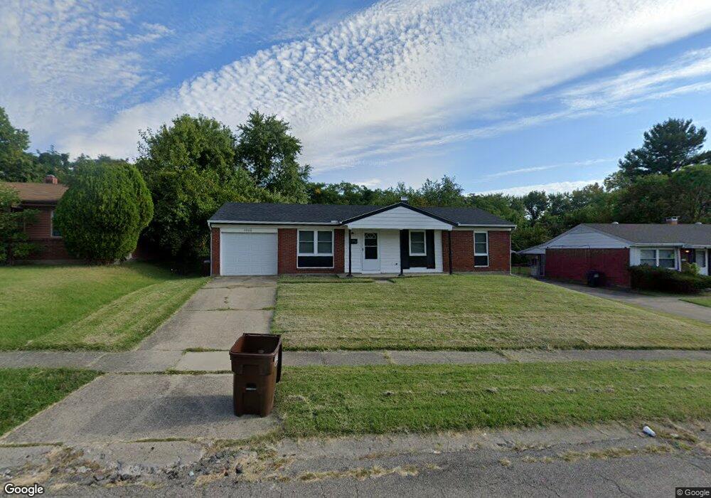
2060 Roosevelt Ave Cincinnati, OH 45240
New Burlington NeighborhoodEstimated Value: $132,000 - $174,000
3
Beds
1
Bath
1,000
Sq Ft
$154/Sq Ft
Est. Value
About This Home
This home is located at 2060 Roosevelt Ave, Cincinnati, OH 45240 and is currently estimated at $154,248, approximately $154 per square foot. 2060 Roosevelt Ave is a home located in Hamilton County with nearby schools including Mt Healthy High School, Hamilton County Mathematics and Science Academy, and Central Montessori Academy.
Ownership History
Date
Name
Owned For
Owner Type
Purchase Details
Closed on
Aug 25, 2022
Sold by
Conrex Master Llc
Bought by
Vb Six Llc
Current Estimated Value
Purchase Details
Closed on
Aug 1, 2018
Sold by
Mishler Mark D
Bought by
Conrex Master Llc
Purchase Details
Closed on
Jul 15, 1996
Sold by
Kusuhari Investments
Bought by
Mishler Mark D
Home Financials for this Owner
Home Financials are based on the most recent Mortgage that was taken out on this home.
Original Mortgage
$45,600
Interest Rate
8.33%
Create a Home Valuation Report for This Property
The Home Valuation Report is an in-depth analysis detailing your home's value as well as a comparison with similar homes in the area
Home Values in the Area
Average Home Value in this Area
Purchase History
| Date | Buyer | Sale Price | Title Company |
|---|---|---|---|
| Vb Six Llc | -- | -- | |
| Conrex Master Llc | $55,500 | None Available | |
| Mishler Mark D | $57,000 | -- |
Source: Public Records
Mortgage History
| Date | Status | Borrower | Loan Amount |
|---|---|---|---|
| Previous Owner | Mishler Mark D | $45,600 |
Source: Public Records
Tax History
| Year | Tax Paid | Tax Assessment Tax Assessment Total Assessment is a certain percentage of the fair market value that is determined by local assessors to be the total taxable value of land and additions on the property. | Land | Improvement |
|---|---|---|---|---|
| 2025 | $1,680 | $27,934 | $5,401 | $22,533 |
| 2023 | $1,599 | $27,934 | $5,401 | $22,533 |
| 2022 | $1,542 | $19,426 | $4,757 | $14,669 |
| 2021 | $1,535 | $19,426 | $4,757 | $14,669 |
| 2020 | $1,516 | $19,426 | $4,757 | $14,669 |
| 2019 | $915 | $10,823 | $4,323 | $6,500 |
| 2018 | $920 | $10,823 | $4,323 | $6,500 |
| 2017 | $887 | $10,823 | $4,323 | $6,500 |
| 2016 | $807 | $9,587 | $5,023 | $4,564 |
| 2015 | $801 | $9,587 | $5,023 | $4,564 |
| 2014 | $796 | $9,587 | $5,023 | $4,564 |
| 2013 | $936 | $11,551 | $6,052 | $5,499 |
Source: Public Records
Map
Nearby Homes
- 2071 Roosevelt Ave
- 1958 Bluehill Dr
- 1931 Lotushill Dr
- 10877 Birchridge Dr
- 10897 Sprucehill Dr
- 1887 Lotushill Dr
- 10908 Tangleberry Ct
- 1854 Windmill Way
- 1858 Aspenhill Dr
- 10945 Crystalhill Ct
- 2342 Washington Ave
- 2508 Wilson Ave
- 2192 Pinney Ln
- 2540 Wilson Ave
- 10474 Gloria Ave
- 10918 Newmarket Dr
- 10493 Mill Rd
- 2776 Klondike Ct
- 10453 Mill Rd
- 2617 Chesterhill Dr
- 2068 Roosevelt Ave
- 2054 Roosevelt Ave
- 2046 Roosevelt Ave
- 2065 Roosevelt Ave
- 2057 Roosevelt Ave
- 2040 Roosevelt Ave
- 2082 Roosevelt Ave
- 2049 Roosevelt Ave
- 2041 Roosevelt Ave
- 2079 Roosevelt Ave
- 2032 Roosevelt Ave
- 2088 Roosevelt Ave
- 2033 Roosevelt Ave
- 2087 Roosevelt Ave
- 2068 Bluehill Dr
- 2058 Bluehill Dr
- 2026 Roosevelt Ave
- 2076 Bluehill Dr
- 2050 Bluehill Dr
- 10824 Sprucehill Dr
Your Personal Tour Guide
Ask me questions while you tour the home.