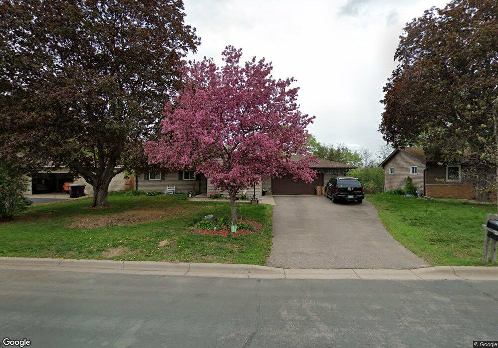
2061 Bluestone Ln Saint Paul, MN 55122
Estimated Value: $346,051 - $374,000
3
Beds
2
Baths
1,248
Sq Ft
$290/Sq Ft
Est. Value
About This Home
This home is located at 2061 Bluestone Ln, Saint Paul, MN 55122 and is currently estimated at $361,513, approximately $289 per square foot. 2061 Bluestone Ln is a home located in Dakota County with nearby schools including Burnsville High School, Gateway STEM Academy, and Sunrise International Montessori School.
Ownership History
Date
Name
Owned For
Owner Type
Purchase Details
Closed on
Oct 9, 2025
Sold by
Hansen Paul M and Hansen Carole M
Bought by
Carole M Hansen And Paul Milton Hansen Joint and Hansen
Current Estimated Value
Purchase Details
Closed on
Aug 3, 2016
Sold by
Hansen Paul M and Hansen Carole M
Bought by
Hansen Paul M and Hansen Carole M
Purchase Details
Closed on
Jul 31, 1997
Sold by
Schulz Jeffrey D and Schulz Sonya M
Bought by
Kerchiel Phyllis A
Purchase Details
Closed on
Jul 30, 1997
Sold by
Scott Gary L and Scott Marilyn
Bought by
Schulz Jeffrey D and Schulz Sonya M
Create a Home Valuation Report for This Property
The Home Valuation Report is an in-depth analysis detailing your home's value as well as a comparison with similar homes in the area
Home Values in the Area
Average Home Value in this Area
Purchase History
| Date | Buyer | Sale Price | Title Company |
|---|---|---|---|
| Carole M Hansen And Paul Milton Hansen Joint | $500 | None Listed On Document | |
| Hansen Paul M | -- | Attorney | |
| Kerchiel Phyllis A | $119,500 | -- | |
| Schulz Jeffrey D | $98,235 | -- |
Source: Public Records
Mortgage History
| Date | Status | Borrower | Loan Amount |
|---|---|---|---|
| Closed | Schulz Jeffrey D | -- | |
| Closed | Schulz Jeffrey D | $13,855 |
Source: Public Records
Tax History
| Year | Tax Paid | Tax Assessment Tax Assessment Total Assessment is a certain percentage of the fair market value that is determined by local assessors to be the total taxable value of land and additions on the property. | Land | Improvement |
|---|---|---|---|---|
| 2024 | $3,170 | $332,000 | $85,800 | $246,200 |
| 2023 | $3,100 | $335,500 | $86,000 | $249,500 |
| 2022 | $2,434 | $322,500 | $85,800 | $236,700 |
| 2021 | $2,852 | $279,500 | $74,600 | $204,900 |
| 2020 | $2,488 | $258,200 | $71,100 | $187,100 |
| 2019 | $2,873 | $257,200 | $67,800 | $189,400 |
| 2018 | $2,653 | $245,100 | $64,500 | $180,600 |
| 2017 | $2,668 | $218,300 | $61,400 | $156,900 |
| 2016 | $2,539 | $203,900 | $58,500 | $145,400 |
| 2015 | $2,195 | $199,100 | $58,500 | $140,600 |
| 2014 | -- | $174,220 | $51,099 | $123,121 |
| 2013 | -- | $145,553 | $44,786 | $100,767 |
Source: Public Records
Map
Nearby Homes
- 4002 Cedar Grove Ln
- 2156 Cedar Grove Trail
- 4022 Cedar Grove Ln
- 2128 River Valley Ln
- 3981 Cedar Grove Ln
- 3976 Cedar Grove Ln
- 3904 Rahn Rd
- 3902 Rahn Rd
- 4110 Rahn Rd Unit 201
- 4110 Rahn Rd Unit 115
- 4110 Rahn Rd Unit 121
- 4110 Rahn Rd Unit 317
- 4130 Rahn Rd Unit B119
- 4130 Rahn Rd Unit B206
- 2078 Diffley Rd
- 3861 Gold Point Unit B
- 2232 White Water Way
- 3873 Dolomite Dr
- 4125 Ruby Ln
- 1978 Timber Wolf Trail S
- 2065 Bluestone Ln
- 2057 Bluestone Ln
- 2069 Bluestone Ln
- 4006 Cedar Grove Ln
- 4008 Cedar Grove Ln
- 4010 Cedar Grove Ln
- 2054 Bluestone Ln
- 4012 Cedar Grove Ln
- 4000 Cedar Grove Ln
- 2053 Bluestone Ln
- 4014 Cedar Grove Ln
- 2066 Bluestone Ln
- 2070 Bluestone Ln
- 2073 Bluestone Ln
- 2049 Bluestone Ln
- 2050 Bluestone Ln
- 4016 Cedar Grove Ln
- 2074 Bluestone Ln
- 4018 Cedar Grove Ln
- 4020 Cedar Grove Ln
Your Personal Tour Guide
Ask me questions while you tour the home.