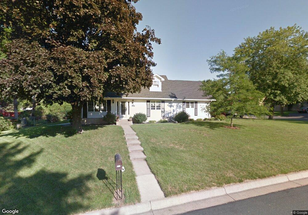
2061 Thorndale Ave New Brighton, MN 55112
Estimated Value: $389,706 - $484,000
4
Beds
2
Baths
1,840
Sq Ft
$242/Sq Ft
Est. Value
About This Home
This home is located at 2061 Thorndale Ave, New Brighton, MN 55112 and is currently estimated at $446,177, approximately $242 per square foot. 2061 Thorndale Ave is a home located in Ramsey County with nearby schools including Sunnyside Elementary School, Edgewood Middle School, and Irondale Senior High School.
Ownership History
Date
Name
Owned For
Owner Type
Purchase Details
Closed on
Apr 28, 2015
Sold by
Iacarella Kevin S and Iacarella Cynthia L
Bought by
Ostrom Jeffrey and Ostrom Kristina
Current Estimated Value
Home Financials for this Owner
Home Financials are based on the most recent Mortgage that was taken out on this home.
Original Mortgage
$231,920
Outstanding Balance
$178,663
Interest Rate
3.68%
Mortgage Type
New Conventional
Estimated Equity
$267,514
Create a Home Valuation Report for This Property
The Home Valuation Report is an in-depth analysis detailing your home's value as well as a comparison with similar homes in the area
Home Values in the Area
Average Home Value in this Area
Purchase History
| Date | Buyer | Sale Price | Title Company |
|---|---|---|---|
| Ostrom Jeffrey | $298,684 | Edina Realty Title Inc |
Source: Public Records
Mortgage History
| Date | Status | Borrower | Loan Amount |
|---|---|---|---|
| Open | Ostrom Jeffrey | $231,920 |
Source: Public Records
Tax History Compared to Growth
Tax History
| Year | Tax Paid | Tax Assessment Tax Assessment Total Assessment is a certain percentage of the fair market value that is determined by local assessors to be the total taxable value of land and additions on the property. | Land | Improvement |
|---|---|---|---|---|
| 2025 | $5,178 | $387,500 | $75,000 | $312,500 |
| 2023 | $5,178 | $391,100 | $75,000 | $316,100 |
| 2022 | $4,792 | $384,200 | $75,000 | $309,200 |
| 2021 | $4,610 | $337,600 | $75,000 | $262,600 |
| 2020 | $4,708 | $336,600 | $77,200 | $259,400 |
| 2019 | $4,330 | $316,600 | $77,200 | $239,400 |
| 2018 | $3,940 | $308,000 | $77,200 | $230,800 |
| 2017 | $3,708 | $275,500 | $77,200 | $198,300 |
| 2016 | $3,794 | $0 | $0 | $0 |
| 2015 | $3,816 | $258,400 | $72,000 | $186,400 |
| 2014 | $3,568 | $0 | $0 | $0 |
Source: Public Records
Map
Nearby Homes
- 1942 Mounds Ave
- 1921 Mounds Ave
- 2087 Violet Ln
- 2001 Long Lake Rd
- 2189 Long Lake Rd
- 1939 Long Lake Rd
- 1540 Mississippi St
- 2344 Thorndale Ave
- 1937 Longview Dr
- 2211 Brittany Ct
- 2005 28th Ave NW Unit 102
- 1451 18th St NW
- 1703 18th Ave NW
- 1364 Rockstone Ln
- 7625 Pleasant View Dr
- 2454 Long Lake Rd
- 1638 23rd Ave NW
- 2872 18th St NW
- 1272 Poppyseed Dr
- 2247 Walnut Ct S
- 1994 Mounds Ave
- 1964 Mounds Ave
- 2043 Thorndale Ave
- 2072 Thorndale Ave
- 2088 Mounds Ave
- 1999 Mounds Ave
- 2140 Thorndale Ave
- 2111 Mounds Ave
- 1965 Mounds Ave
- 2132 Thorndale Ave
- 2124 Thorndale Ave
- 2092 Mounds Ave
- 2019 Thorndale Ave
- 1941 Mounds Ave
- 2100 Thorndale Ave
- 2080 Thorndale Ave
- 1920 Mounds Ave
- 2032 Thorndale Ave
- 2092 Thorndale Ave
- 2134 Mounds Ave