20611 122nd St Birmingham, IA 52535
Estimated Value: $273,163 - $640,000
5
Beds
1
Bath
1,954
Sq Ft
$233/Sq Ft
Est. Value
About This Home
This home is located at 20611 122nd St, Birmingham, IA 52535 and is currently estimated at $454,541, approximately $232 per square foot. 20611 122nd St is a home located in Van Buren County with nearby schools including Van Buren Elementary School, Harmony Center Elementary School, and Van Buren High School.
Ownership History
Date
Name
Owned For
Owner Type
Purchase Details
Closed on
Jul 22, 2010
Sold by
Hall Diane E and Hall Rex
Bought by
Corry Roger D and Corry Anita E
Current Estimated Value
Home Financials for this Owner
Home Financials are based on the most recent Mortgage that was taken out on this home.
Original Mortgage
$90,000
Outstanding Balance
$34,594
Interest Rate
4.74%
Mortgage Type
Stand Alone Second
Estimated Equity
$301,958
Create a Home Valuation Report for This Property
The Home Valuation Report is an in-depth analysis detailing your home's value as well as a comparison with similar homes in the area
Home Values in the Area
Average Home Value in this Area
Purchase History
| Date | Buyer | Sale Price | Title Company |
|---|---|---|---|
| Corry Roger D | $191,000 | None Available |
Source: Public Records
Mortgage History
| Date | Status | Borrower | Loan Amount |
|---|---|---|---|
| Open | Corry Roger D | $90,000 | |
| Closed | Corry Roger Dayne | $85,860 | |
| Closed | Corry Roger | $65,000 |
Source: Public Records
Tax History Compared to Growth
Tax History
| Year | Tax Paid | Tax Assessment Tax Assessment Total Assessment is a certain percentage of the fair market value that is determined by local assessors to be the total taxable value of land and additions on the property. | Land | Improvement |
|---|---|---|---|---|
| 2024 | $1,412 | $153,970 | $6,600 | $147,370 |
| 2023 | $1,412 | $153,970 | $6,600 | $147,370 |
| 2022 | $1,422 | $122,940 | $5,020 | $117,920 |
| 2021 | $1,366 | $123,750 | $5,020 | $118,730 |
| 2020 | $1,366 | $112,900 | $3,830 | $109,070 |
| 2019 | $1,380 | $112,900 | $3,830 | $109,070 |
| 2018 | $1,490 | $109,070 | $5,380 | $103,690 |
| 2017 | $1,374 | $109,070 | $5,380 | $103,690 |
| 2016 | $1,820 | $126,830 | $0 | $0 |
| 2015 | $1,736 | $122,470 | $0 | $0 |
| 2014 | $1,736 | $122,470 | $0 | $0 |
Source: Public Records
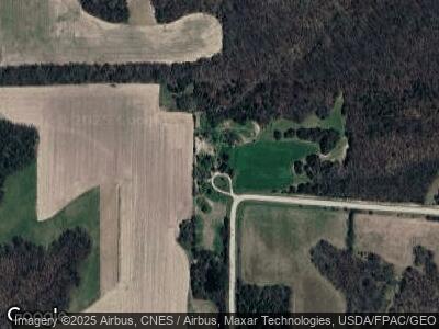
Map
Nearby Homes
- 0 125th Rd
- 14233 King Trail
- 13078 Meadow Ave
- 0 Hickory Ave
- 18260 Jefferson van Buren St
- 16245 Iowa Oak Grove Ave
- 17248 Highway 1
- 18161 Highway 1
- 2309 Kale Blvd
- 104 E Maple Ave
- 19090 Iowa 1
- 404 Washington St
- 611 Union St
- 1505 240th St
- 214 Cedar St
- 2503 Glasgow Rd
- 2219 Westhills Dr
- 201 Lincoln Ave
- 1508 Southview Cir
- 1982 Pine Tree Blvd