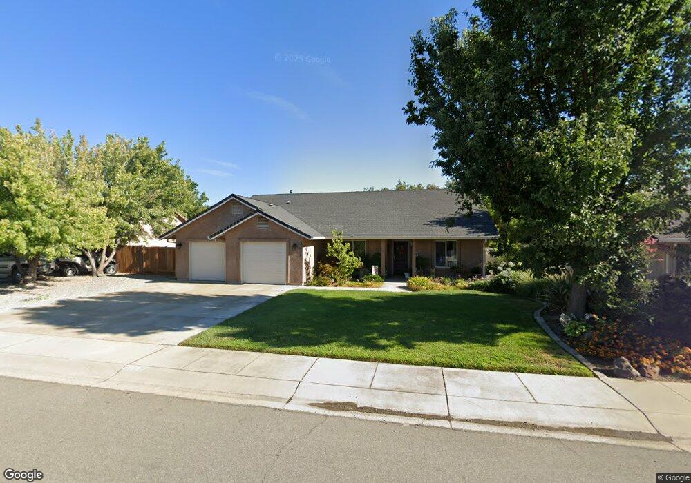
20620 Collin Ct Cottonwood, CA 96022
Estimated Value: $382,196 - $435,000
4
Beds
2
Baths
1,618
Sq Ft
$258/Sq Ft
Est. Value
About This Home
This home is located at 20620 Collin Ct, Cottonwood, CA 96022 and is currently estimated at $417,549, approximately $258 per square foot. 20620 Collin Ct is a home located in Shasta County with nearby schools including North Cottonwood, West Cottonwood Junior High School, and Cottonwood Creek Charter School.
Ownership History
Date
Name
Owned For
Owner Type
Purchase Details
Closed on
May 14, 2010
Sold by
Turner Sherol A
Bought by
Ritcheson Lorri
Current Estimated Value
Purchase Details
Closed on
Dec 14, 2005
Sold by
The Kennett Group Inc
Bought by
Turner Sherol A
Home Financials for this Owner
Home Financials are based on the most recent Mortgage that was taken out on this home.
Original Mortgage
$239,900
Interest Rate
6.75%
Mortgage Type
Fannie Mae Freddie Mac
Create a Home Valuation Report for This Property
The Home Valuation Report is an in-depth analysis detailing your home's value as well as a comparison with similar homes in the area
Home Values in the Area
Average Home Value in this Area
Purchase History
| Date | Buyer | Sale Price | Title Company |
|---|---|---|---|
| Ritcheson Lorri | $202,000 | Fidelity Natl Title Co Of Ca | |
| Turner Sherol A | $300,000 | Chicago Title Company |
Source: Public Records
Mortgage History
| Date | Status | Borrower | Loan Amount |
|---|---|---|---|
| Previous Owner | Turner Sherol A | $239,900 |
Source: Public Records
Tax History Compared to Growth
Tax History
| Year | Tax Paid | Tax Assessment Tax Assessment Total Assessment is a certain percentage of the fair market value that is determined by local assessors to be the total taxable value of land and additions on the property. | Land | Improvement |
|---|---|---|---|---|
| 2025 | $2,938 | $260,730 | $64,533 | $196,197 |
| 2024 | $2,883 | $255,618 | $63,268 | $192,350 |
| 2023 | $2,883 | $250,607 | $62,028 | $188,579 |
| 2022 | $2,822 | $245,694 | $60,812 | $184,882 |
| 2021 | $2,807 | $240,877 | $59,620 | $181,257 |
| 2020 | $2,742 | $238,408 | $59,009 | $179,399 |
| 2019 | $2,711 | $233,734 | $57,852 | $175,882 |
| 2018 | $2,662 | $229,152 | $56,718 | $172,434 |
| 2017 | $2,667 | $224,659 | $55,606 | $169,053 |
| 2016 | $2,455 | $220,255 | $54,516 | $165,739 |
| 2015 | $2,234 | $195,000 | $55,000 | $140,000 |
| 2014 | $2,119 | $185,000 | $50,000 | $135,000 |
Source: Public Records
Map
Nearby Homes
- Lot 4 Rhonda Rd
- 3796 Country Estates Dr
- 20472 Robinson Glen Dr
- 20605 Beta Ct
- 0 Main St Unit 25-870
- 0 Main St Unit 25-715
- 3850 Main St Unit 4
- 3850 Main St Unit 23
- 3850 Main St Unit 17
- 3850 Main St Unit 22
- 20720 2nd St
- 16857 Gas Point Rd
- 20882 3rd St
- 3382 Willow St
- 3349 Willow St
- Lot 13 Castlewood Ln
- 20933 Foster St
- 20960 1st St
- 3393 Shirley St
- 20280 Trefoil Ln
- 20610 Collin Ct
- 20630 Collin Ct
- 20640 Collin Ct
- 20625 Collin Ct
- 20615 Collin Ct
- 20635 Collin Ct
- 3646 Rhonda Rd
- 3651 Rhonda Rd
- 20650 Collin Ct
- 20645 Collin Ct
- 3654 Rhonda Rd
- 20625 Mayfair Ct
- 3674 Park Dr
- 20655 Collin Ct
- 20629 Mayfair Ct
- 3634 Rhonda Rd
- 3668 Park Dr
- 3620 Rhonda Rd
- 20665 Collin Ct
- 20610 Mayfair 1weup7mr20t3