Estimated Value: $73,000 - $272,000
2
Beds
1
Bath
780
Sq Ft
$256/Sq Ft
Est. Value
About This Home
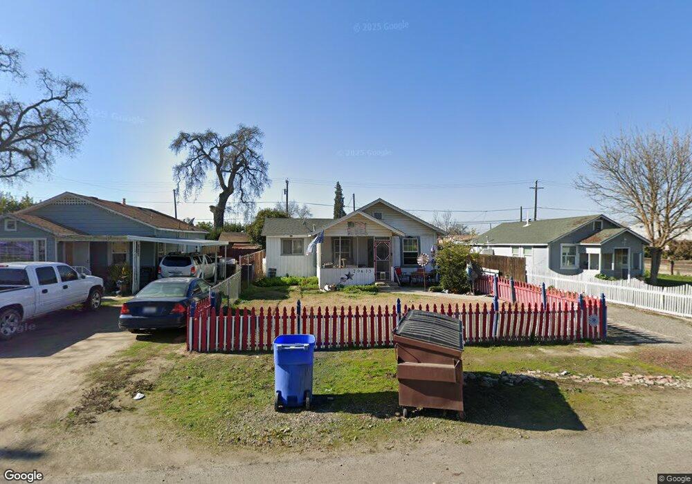
This home is located at 20649 S Castro Ave, Laton, CA 93242 and is currently estimated at $199,691, approximately $256 per square foot. 20649 S Castro Ave is a home located in Fresno County with nearby schools including Laton Elementary School, Conejo Middle School, and Laton High School.
Ownership History
Date
Name
Owned For
Owner Type
Purchase Details
Closed on
Apr 8, 2010
Sold by
Stockton Pauline M and Stockton Wayne Curtis
Bought by
Ramirez Francisco Morales
Current Estimated Value
Home Financials for this Owner
Home Financials are based on the most recent Mortgage that was taken out on this home.
Original Mortgage
$105,061
Outstanding Balance
$69,696
Interest Rate
4.92%
Mortgage Type
FHA
Estimated Equity
$129,995
Purchase Details
Closed on
Dec 22, 2008
Sold by
Stockton Pauline M and Stockton Wayne Curtis
Bought by
Stockton Pauline M and Stockton Wayne Curtis
Purchase Details
Closed on
Oct 17, 2000
Sold by
Stockton Pauline M
Bought by
Stockton Pauline M and Stockton Wayne Curtis
Create a Home Valuation Report for This Property
The Home Valuation Report is an in-depth analysis detailing your home's value as well as a comparison with similar homes in the area
Home Values in the Area
Average Home Value in this Area
Purchase History
| Date | Buyer | Sale Price | Title Company |
|---|---|---|---|
| Ramirez Francisco Morales | $107,000 | Placer Title Company | |
| Stockton Pauline M | -- | None Available | |
| Stockton Pauline M | -- | -- |
Source: Public Records
Mortgage History
| Date | Status | Borrower | Loan Amount |
|---|---|---|---|
| Open | Ramirez Francisco Morales | $105,061 |
Source: Public Records
Tax History Compared to Growth
Tax History
| Year | Tax Paid | Tax Assessment Tax Assessment Total Assessment is a certain percentage of the fair market value that is determined by local assessors to be the total taxable value of land and additions on the property. | Land | Improvement |
|---|---|---|---|---|
| 2025 | $1,366 | $138,106 | $38,719 | $99,387 |
| 2023 | $1,342 | $132,745 | $37,216 | $95,529 |
| 2022 | $1,320 | $130,143 | $36,487 | $93,656 |
| 2021 | $1,294 | $127,592 | $35,772 | $91,820 |
| 2020 | $1,262 | $126,285 | $35,406 | $90,879 |
| 2019 | $1,256 | $123,810 | $34,712 | $89,098 |
| 2018 | $1,240 | $121,383 | $34,032 | $87,351 |
| 2017 | $1,149 | $119,004 | $33,365 | $85,639 |
| 2016 | $1,106 | $116,671 | $32,711 | $83,960 |
| 2015 | $1,088 | $114,919 | $32,220 | $82,699 |
| 2014 | $1,051 | $111,100 | $31,100 | $80,000 |
Source: Public Records
Map
Nearby Homes
- 6585 Murphy Ave
- 5721 E Riverdale Ave
- 5675 E Letson Ave
- 12837 Douglas Ave
- 0 S Sunnyside Ave
- 7476 E Mount Whitney Ave
- 4603 12th Ave
- 4769 13 1 4 Ave
- 21530 Tiburico Ave
- 0 E Clovis Unit 202404013
- 1 Davis Ave
- 9 1/2 Avenue
- 9700 Excelsior Ave
- 0 Dover Ave
- 15400 Excelsior Ave
- 5775 N 11th Ave
- 19360 Maple Ave
- 8646 Cairo Ave
- 16495 S Minnewawa Ave
- 21600 Cedar St
- 20635 S Castro Ave
- 20659 S Castro Ave
- 20625 S Castro Ave
- 20610 S Castro Ave
- 20630 S Castro Ave
- 20636 S Fowler Ave
- 20674 S Castro Ave
- 6331 E Tache Ave
- 20660 S Fowler Ave
- 6234 E Murphy Ave
- 6322 E Murphy Ave
- 20589 S Castro Ave
- 20674 S Fowler Ave
- 6332 E Tache Ave
- 6224 E Tache Ave
- 20569 S Castro Ave
- 6344 E Murphy Ave
- 20611 S Pio Pico Ave
- 20562 S Castro Ave
- 20715 S Castro Ave