2065 Panora Ave New Hampton, IA 50659
Estimated Value: $393,000 - $591,000
5
Beds
7
Baths
2,702
Sq Ft
$181/Sq Ft
Est. Value
About This Home
This home is located at 2065 Panora Ave, New Hampton, IA 50659 and is currently estimated at $488,022, approximately $180 per square foot. 2065 Panora Ave is a home located in Chickasaw County with nearby schools including New Hampton Elementary School, New Hampton Middle School, and New Hampton High School.
Ownership History
Date
Name
Owned For
Owner Type
Purchase Details
Closed on
May 13, 2021
Sold by
Lora Dungey
Bought by
Dungey Family Properties Ii Llc
Current Estimated Value
Purchase Details
Closed on
Jan 31, 2011
Sold by
New Hampton Golf & Country Club
Bought by
Dungey Trace and Dungey Lora
Create a Home Valuation Report for This Property
The Home Valuation Report is an in-depth analysis detailing your home's value as well as a comparison with similar homes in the area
Home Values in the Area
Average Home Value in this Area
Purchase History
| Date | Buyer | Sale Price | Title Company |
|---|---|---|---|
| Dungey Family Properties Ii Llc | -- | None Listed On Document | |
| Dungey Family Properties I Llc | -- | None Listed On Document | |
| Dungey Trace | -- | None Available |
Source: Public Records
Mortgage History
| Date | Status | Borrower | Loan Amount |
|---|---|---|---|
| Previous Owner | Dungey Trace | $198,000 | |
| Previous Owner | Dungey Trace | $210,750 |
Source: Public Records
Tax History Compared to Growth
Tax History
| Year | Tax Paid | Tax Assessment Tax Assessment Total Assessment is a certain percentage of the fair market value that is determined by local assessors to be the total taxable value of land and additions on the property. | Land | Improvement |
|---|---|---|---|---|
| 2024 | $4,598 | $442,200 | $29,400 | $412,800 |
| 2023 | $5,374 | $442,200 | $29,400 | $412,800 |
| 2022 | $5,146 | $466,300 | $29,400 | $436,900 |
| 2021 | $5,146 | $466,300 | $29,400 | $436,900 |
| 2020 | $4,982 | $420,000 | $20,000 | $400,000 |
| 2019 | $4,906 | $391,600 | $0 | $0 |
| 2018 | $4,906 | $391,600 | $0 | $0 |
| 2017 | $4,866 | $359,800 | $0 | $0 |
| 2016 | $4,500 | $359,800 | $0 | $0 |
| 2015 | $4,060 | $359,800 | $0 | $0 |
| 2014 | $4,060 | $331,900 | $0 | $0 |
Source: Public Records
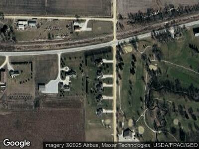
Map
Nearby Homes
- 1855 Odessa Ave
- 806 E Main St
- 714 E Main St
- 712 E Main St
- 416 E Main St
- 306 E Prospect St
- 226 S Water Ave
- 342 S Locust Ave
- 103 E Logan St
- 221 S Locust Ave
- 215 N Chestnut Ave
- 269 S Chestnut Ave
- 11 W Gardner St
- 507 W Main St
- 201 N Brush St
- 204 S Benz St
- 1451 Quinlan Ave
- 2428 270th St
- 2409 Hwy 18
- 160 S Hamilton Ave
- 2065 Panora Ave
- 2067 Panora Ave
- 2063 Panora Ave
- 2069 Panora Ave
- 2546 Highway 24
- 2071 Panora Ave
- 2542 Highway 24
- 2530 205th St
- 2584 Highway 24
- 2540 Highway 24
- 2084 Panora Ave
- 2590 205th St
- 2097 Panora Ave
- 2095 Panora Ave
- 2520 205th St
- 2576 Josephson Ct
- 2594 205th St
- 2523 Panora Ln
- 2578 Josephson Ct
- 2580 Josephson Ct