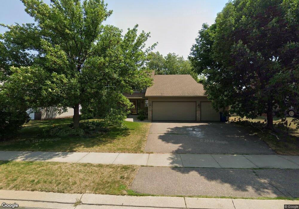
2065 Williams St Shakopee, MN 55379
Estimated Value: $494,000 - $540,000
5
Beds
4
Baths
2,164
Sq Ft
$242/Sq Ft
Est. Value
About This Home
This home is located at 2065 Williams St, Shakopee, MN 55379 and is currently estimated at $523,593, approximately $241 per square foot. 2065 Williams St is a home located in Scott County with nearby schools including Sun Path Elementary School, Shakopee West Middle School, and Shakopee Senior High School.
Ownership History
Date
Name
Owned For
Owner Type
Purchase Details
Closed on
Apr 13, 2017
Sold by
Marker William C and Marker Amy R
Bought by
Suda Morris Jodi
Current Estimated Value
Home Financials for this Owner
Home Financials are based on the most recent Mortgage that was taken out on this home.
Original Mortgage
$313,065
Outstanding Balance
$260,660
Interest Rate
4.23%
Mortgage Type
New Conventional
Estimated Equity
$262,933
Purchase Details
Closed on
Oct 31, 2001
Sold by
Key-Land Homes
Bought by
Marker William C and Marker Amy R
Purchase Details
Closed on
May 24, 2001
Sold by
Pheasant Run Of Shakopee Ii Inc
Bought by
Key Land Homes
Create a Home Valuation Report for This Property
The Home Valuation Report is an in-depth analysis detailing your home's value as well as a comparison with similar homes in the area
Home Values in the Area
Average Home Value in this Area
Purchase History
| Date | Buyer | Sale Price | Title Company |
|---|---|---|---|
| Suda Morris Jodi | $347,851 | Edina Realty Title Inc | |
| Marker William C | $244,120 | -- | |
| Key Land Homes | $61,900 | -- |
Source: Public Records
Mortgage History
| Date | Status | Borrower | Loan Amount |
|---|---|---|---|
| Open | Suda Morris Jodi | $313,065 | |
| Closed | Key Land Homes | -- |
Source: Public Records
Tax History Compared to Growth
Tax History
| Year | Tax Paid | Tax Assessment Tax Assessment Total Assessment is a certain percentage of the fair market value that is determined by local assessors to be the total taxable value of land and additions on the property. | Land | Improvement |
|---|---|---|---|---|
| 2025 | $5,220 | $490,700 | $140,100 | $350,600 |
| 2024 | $4,894 | $496,000 | $140,100 | $355,900 |
| 2023 | $5,144 | $456,700 | $134,300 | $322,400 |
| 2022 | $4,926 | $471,500 | $152,600 | $318,900 |
| 2021 | $4,222 | $387,300 | $122,000 | $265,300 |
| 2020 | $4,604 | $362,800 | $117,000 | $245,800 |
| 2019 | $4,690 | $347,500 | $104,000 | $243,500 |
| 2018 | $4,486 | $0 | $0 | $0 |
| 2016 | $4,368 | $0 | $0 | $0 |
| 2014 | -- | $0 | $0 | $0 |
Source: Public Records
Map
Nearby Homes
- 2518 Green Ash Ave
- 2529 Green Ash Ave
- Berkley Plan at Arbor Bluff - Venture Collection
- 2551 Aspen Ct
- Clark Plan at Arbor Bluff - Venture Collection
- 2548 Aspen Ct
- Itasca Plan at Arbor Bluff - Landmark Collection
- Sequoia Plan at Arbor Bluff - Venture Collection
- Markham Plan at Arbor Bluff - Venture Collection
- 2340 Rock Elm Rd
- Lewis Plan at Arbor Bluff - Landmark Collection
- McKinley Plan at Arbor Bluff - Landmark Collection
- 2584 Aspen Ct
- 2606 Green Ash Ave
- Marquette Plan at Arbor Bluff - Venture Collection
- 2689 Aspen Dr
- Sinclair Plan at Arbor Bluff - Landmark Collection
- Burnham Plan at Arbor Bluff - Venture Collection
- Washburn Plan at Arbor Bluff - Landmark Collection
- 2960 Molina St
- 2057 Williams St
- 2073 Williams St
- 2066 Ormond Dr
- 2058 Ormond Dr
- 2049 Williams St
- 2062 Williams St
- 2050 Ormond Dr
- 2054 Williams St
- 2041 Williams St
- 2046 Williams St
- 2081 Williams St
- 2042 Ormond Dr
- 2082 Ormond Dr
- 2078 Williams St
- 2038 Williams St
- 2033 Williams St
- 2071 Ormond Dr
- 2063 Ormond Dr
- 2061 Cardinal Dr
- 2034 Ormond Dr