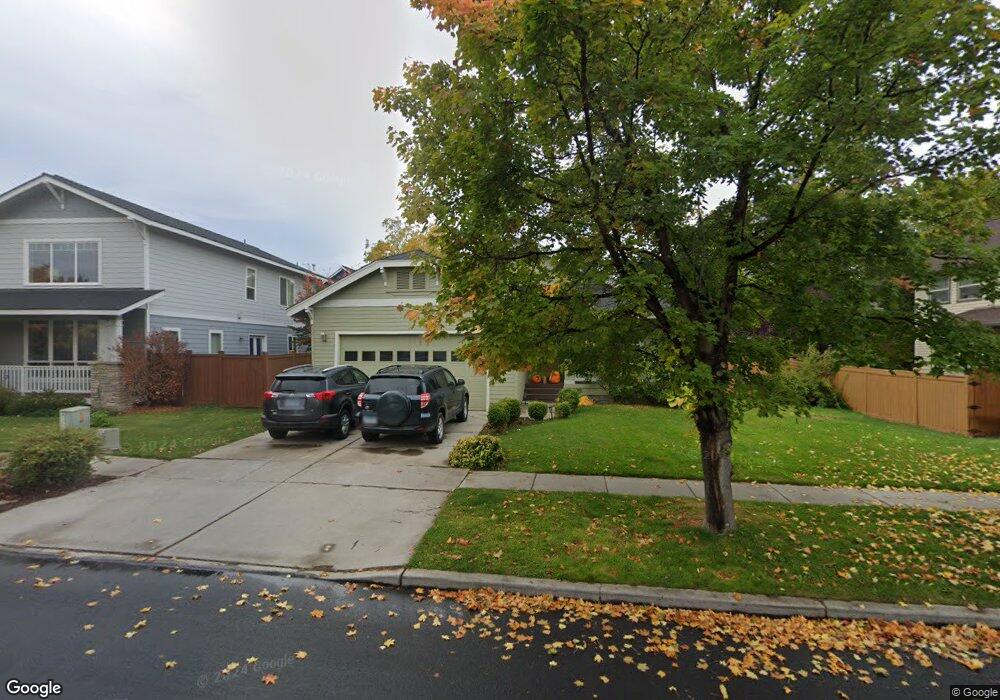
20651 NE Sierra Dr Bend, OR 97701
Boyd Acres NeighborhoodEstimated Value: $585,514 - $670,000
3
Beds
2
Baths
1,683
Sq Ft
$370/Sq Ft
Est. Value
About This Home
This home is located at 20651 NE Sierra Dr, Bend, OR 97701 and is currently estimated at $623,129, approximately $370 per square foot. 20651 NE Sierra Dr is a home located in Deschutes County with nearby schools including Lava Ridge Elementary School, Sky View Middle School, and Mountain View Senior High School.
Ownership History
Date
Name
Owned For
Owner Type
Purchase Details
Closed on
Jul 13, 2012
Sold by
Nash Randall F and Nash Linda F
Bought by
Grossman Richard Peter and Richard Peter Grossman Revocable Trust
Current Estimated Value
Purchase Details
Closed on
Aug 9, 2005
Sold by
Leagjeld David S and Leagjeld Ruth
Bought by
Nash Randall F and Nash Linda F
Home Financials for this Owner
Home Financials are based on the most recent Mortgage that was taken out on this home.
Original Mortgage
$235,920
Interest Rate
5.48%
Mortgage Type
Fannie Mae Freddie Mac
Create a Home Valuation Report for This Property
The Home Valuation Report is an in-depth analysis detailing your home's value as well as a comparison with similar homes in the area
Home Values in the Area
Average Home Value in this Area
Purchase History
| Date | Buyer | Sale Price | Title Company |
|---|---|---|---|
| Grossman Richard Peter | $186,500 | Deschutes County Title Co | |
| Nash Randall F | $294,900 | Amerititle |
Source: Public Records
Mortgage History
| Date | Status | Borrower | Loan Amount |
|---|---|---|---|
| Previous Owner | Nash Randall F | $235,920 |
Source: Public Records
Tax History Compared to Growth
Tax History
| Year | Tax Paid | Tax Assessment Tax Assessment Total Assessment is a certain percentage of the fair market value that is determined by local assessors to be the total taxable value of land and additions on the property. | Land | Improvement |
|---|---|---|---|---|
| 2025 | $4,489 | $265,700 | -- | -- |
| 2024 | $4,319 | $257,970 | -- | -- |
| 2023 | $4,004 | $250,460 | $0 | $0 |
| 2022 | $3,736 | $236,090 | $0 | $0 |
| 2021 | $3,741 | $229,220 | $0 | $0 |
| 2020 | $3,550 | $229,220 | $0 | $0 |
| 2019 | $3,451 | $222,550 | $0 | $0 |
| 2018 | $3,353 | $216,070 | $0 | $0 |
| 2017 | $3,255 | $209,780 | $0 | $0 |
| 2016 | $3,104 | $203,670 | $0 | $0 |
| 2015 | $3,018 | $197,740 | $0 | $0 |
| 2014 | $2,929 | $191,990 | $0 | $0 |
Source: Public Records
Map
Nearby Homes
- 20663 NE Sierra Dr
- 63190 Carly Ln
- 63150 Peale St
- 20585 Fred Meyers Rd
- 20577 NE Sierra Dr
- 20570 Fred Meyers Rd
- Avery Plan at Acadia Pointe
- Jade Plan at Acadia Pointe
- Hickory Plan at Acadia Pointe
- Larwood Plan at Acadia Pointe
- Magnolia Plan at Acadia Pointe
- Leverich Plan at Acadia Pointe
- Ashland Plan at Acadia Pointe
- Cypress Plan at Acadia Pointe
- 20629 Whitewing Ct
- 63210 Carly Ln
- 63217 Carly Ln
- 63218 Carly Ln
- 20560 Boyd Ct
- 63221 Carly Ln
- 20651 Sierra Dr
- 20655 Sierra Dr
- 20647 Sierra Dr
- 20652 Blanca Dr
- 20658 Blanca Dr
- 20659 Sierra Dr
- 20659 NE Sierra Dr
- 20643 Sierra Dr
- 20640 Blanca Dr
- 20650 Sierra Dr
- 20646 Sierra Dr
- 20654 Sierra Dr
- 20663 Sierra Dr
- 20662 Blanca Dr
- 0 Blanca Dr
- 20642 Sierra Dr
- 20635 Sierra Dr
- 20658 Sierra Dr
- 20634 Blanca Dr
- 20668 Blanca Dr