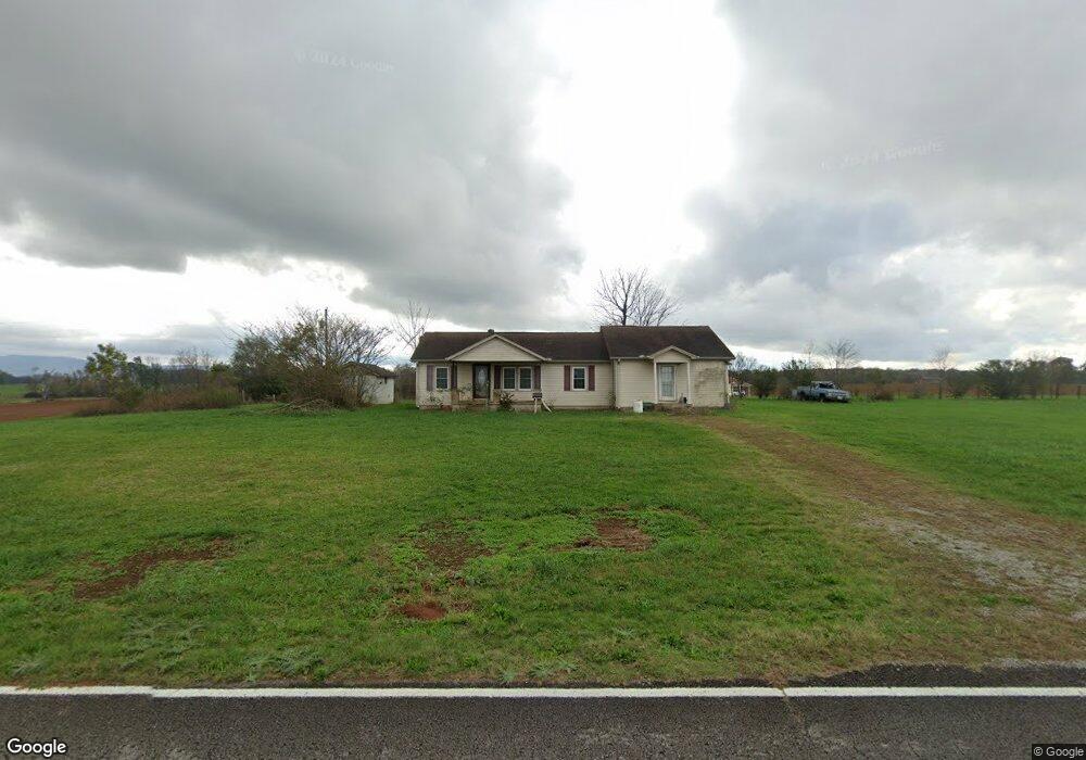
2066 Monroe Floyd Rd Decherd, TN 37324
Estimated Value: $280,000 - $938,697
Studio
1
Bath
1,550
Sq Ft
$406/Sq Ft
Est. Value
About This Home
This home is located at 2066 Monroe Floyd Rd, Decherd, TN 37324 and is currently estimated at $629,674, approximately $406 per square foot. 2066 Monroe Floyd Rd is a home located in Franklin County with nearby schools including North Middle School and Franklin County High School.
Ownership History
Date
Name
Owned For
Owner Type
Purchase Details
Closed on
Sep 7, 2013
Sold by
Morris Mabel I
Bought by
Morris Ernest Clinton
Current Estimated Value
Purchase Details
Closed on
Oct 11, 2005
Sold by
Morris Ernest Clinton
Bought by
Morris Jacob P
Purchase Details
Closed on
Jan 3, 2001
Sold by
Davis Margaret
Bought by
Morris Ernest and Morris Mable
Purchase Details
Closed on
May 26, 2000
Sold by
Davis Margaret
Bought by
Tucker Dan H and Tucker Terry L
Purchase Details
Closed on
Nov 1, 1949
Bought by
Davis Margaret
Create a Home Valuation Report for This Property
The Home Valuation Report is an in-depth analysis detailing your home's value as well as a comparison with similar homes in the area
Purchase History
| Date | Buyer | Sale Price | Title Company |
|---|---|---|---|
| Morris Ernest Clinton | $4,143 | -- | |
| Morris Jacob P | $240,000 | -- | |
| Morris Ernest | $24,000 | -- | |
| Tucker Dan H | $11,200 | -- | |
| Davis Margaret | -- | -- |
Source: Public Records
Tax History
| Year | Tax Paid | Tax Assessment Tax Assessment Total Assessment is a certain percentage of the fair market value that is determined by local assessors to be the total taxable value of land and additions on the property. | Land | Improvement |
|---|---|---|---|---|
| 2025 | $1,371 | $68,725 | $42,025 | $26,700 |
| 2024 | $1,371 | $68,725 | $42,025 | $26,700 |
| 2023 | $1,371 | $68,725 | $42,025 | $26,700 |
| 2022 | $1,289 | $68,725 | $42,025 | $26,700 |
| 2021 | $1,287 | $68,725 | $42,025 | $26,700 |
| 2020 | $1,326 | $44,725 | $32,750 | $11,975 |
| 2019 | $1,287 | $44,725 | $32,750 | $11,975 |
| 2018 | $1,196 | $44,725 | $32,750 | $11,975 |
| 2017 | $1,196 | $44,725 | $32,750 | $11,975 |
| 2016 | $1,064 | $39,800 | $29,050 | $10,750 |
| 2015 | $1,064 | $39,800 | $29,050 | $10,750 |
| 2014 | $1,064 | $39,794 | $0 | $0 |
Source: Public Records
Map
Nearby Homes
- 999 Sherrill Rd
- 511 Woods Lake Rd
- 0 Gum Creek Rd
- 113 Worley Ln
- 0 Aedc Rd Unit RTC2974915
- 0 Aedc Rd Unit RTC2974914
- 50 Aedc Lakeview Rd
- 60 Worley Ln
- 3770 Penile Hill Rd
- 1645 Oak Grove Rd
- 542 Aedc Lakeview Rd
- 8184 Aedc Rd
- 403 Bland Rd
- 0 Oak Grove Rd Unit RTC3117233
- 0 Oak Grove Rd Unit RTC3117211
- 296 Penile Dr
- 56 Lightfoot Ln
- 460 Walls Ln
- 435 Penile Dr
- 3336 Oak Grove Rd
- 2024 Monroe Floyd Rd
- 199 Finney Rd
- 894 Sherrill Rd
- 842 Sherrill Rd
- 2317 Monroe Floyd Rd
- 897 Sherrill Rd
- 971 Sherrill Rd
- 931 Sherrill Rd
- 694 Sherrill Rd
- 654 Sherrill Rd
- 2402 Monroe Floyd Rd
- 1697 Monroe Floyd Rd
- 1620 Monroe Floyd Rd
- 1582 Monroe Floyd Rd
- 0 Monroe Floyd Rd
- 639 Sherrill Rd
- 570 Sherrill Rd
- 5 Monroe Floyd Rd
- 6 Monroe Floyd Rd
- 4 Monroe Floyd Rd
Your Personal Tour Guide
Ask me questions while you tour the home.