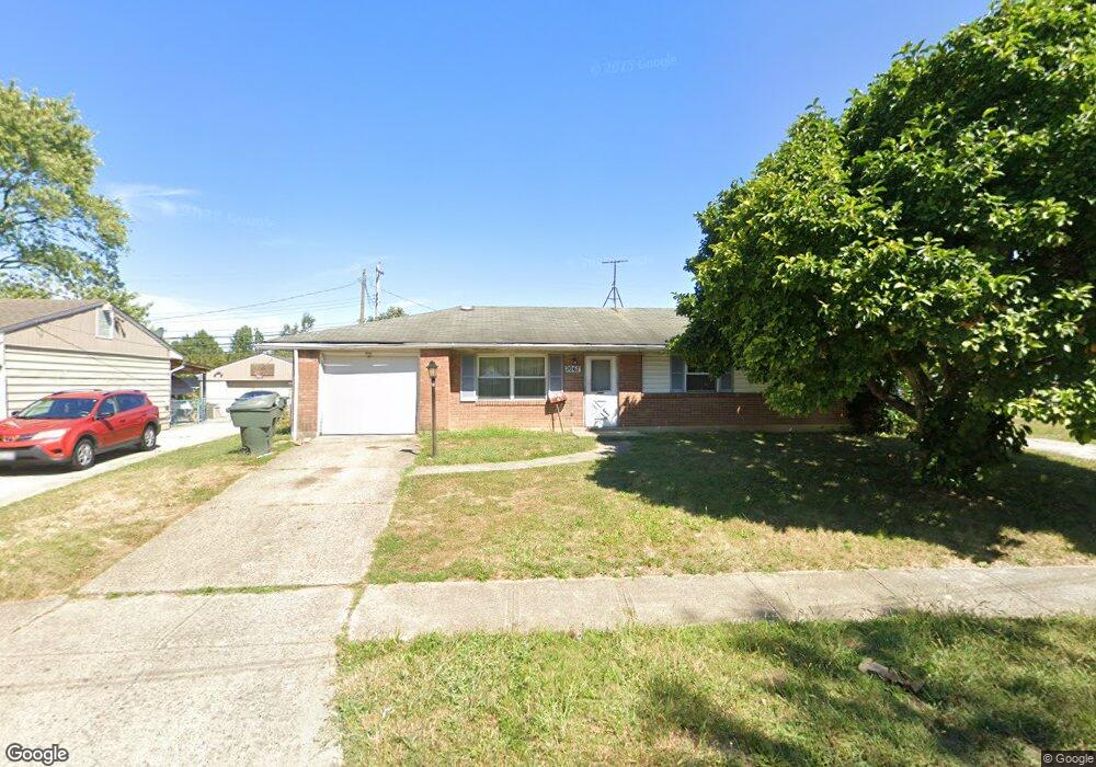
2067 Easthaven Dr Columbus, OH 43232
Glenbrook NeighborhoodEstimated Value: $195,000 - $207,788
3
Beds
2
Baths
1,164
Sq Ft
$172/Sq Ft
Est. Value
About This Home
This home is located at 2067 Easthaven Dr, Columbus, OH 43232 and is currently estimated at $200,447, approximately $172 per square foot. 2067 Easthaven Dr is a home located in Franklin County with nearby schools including Easthaven Elementary School, Yorktown Middle School, and Independence High School.
Ownership History
Date
Name
Owned For
Owner Type
Purchase Details
Closed on
Aug 21, 2023
Sold by
Hill Shermaine E
Bought by
Hawkins Donald L
Current Estimated Value
Purchase Details
Closed on
Jun 1, 2023
Sold by
Hill Robert J
Bought by
Hill Shermaine E
Purchase Details
Closed on
Sep 1, 1995
Sold by
Litteral Louie
Bought by
Shermaine E Hawkins
Home Financials for this Owner
Home Financials are based on the most recent Mortgage that was taken out on this home.
Original Mortgage
$63,600
Interest Rate
7.88%
Mortgage Type
New Conventional
Purchase Details
Closed on
Jul 1, 1977
Create a Home Valuation Report for This Property
The Home Valuation Report is an in-depth analysis detailing your home's value as well as a comparison with similar homes in the area
Home Values in the Area
Average Home Value in this Area
Purchase History
| Date | Buyer | Sale Price | Title Company |
|---|---|---|---|
| Hawkins Donald L | -- | None Listed On Document | |
| Hill Shermaine E | -- | None Listed On Document | |
| Shermaine E Hawkins | $67,000 | -- | |
| -- | $32,500 | -- |
Source: Public Records
Mortgage History
| Date | Status | Borrower | Loan Amount |
|---|---|---|---|
| Previous Owner | Shermaine E Hawkins | $63,600 |
Source: Public Records
Tax History Compared to Growth
Tax History
| Year | Tax Paid | Tax Assessment Tax Assessment Total Assessment is a certain percentage of the fair market value that is determined by local assessors to be the total taxable value of land and additions on the property. | Land | Improvement |
|---|---|---|---|---|
| 2024 | $5,104 | $54,220 | $17,850 | $36,370 |
| 2023 | $2,454 | $54,220 | $17,850 | $36,370 |
| 2022 | $2,440 | $30,450 | $9,240 | $21,210 |
| 2021 | $1,621 | $30,450 | $9,240 | $21,210 |
| 2020 | $1,624 | $30,450 | $9,240 | $21,210 |
| 2019 | $1,495 | $24,050 | $7,420 | $16,630 |
| 2018 | $1,497 | $24,050 | $7,420 | $16,630 |
| 2017 | $1,495 | $24,050 | $7,420 | $16,630 |
| 2016 | $1,648 | $24,260 | $5,780 | $18,480 |
| 2015 | $1,501 | $24,260 | $5,780 | $18,480 |
| 2014 | $1,504 | $24,260 | $5,780 | $18,480 |
| 2013 | $796 | $25,550 | $6,090 | $19,460 |
Source: Public Records
Map
Nearby Homes
- 3054 Wadsworth Ct
- 3038 Wadsworth Ct
- 3036 Wadsworth Ct
- 2971 Queensrowe Dr
- 0 Ravenswood Ct
- 1782 Newfield Rd
- 2252 Meridian Ct
- 2275 Cardston Ct
- 2840 Manola Dr
- 1637 S James Rd
- 3365 Bruceton Ave
- 3246 E Deshler Ave
- 3325 E Deshler Ave
- 1710 Kenwick Rd
- 1664 Barnett Rd
- 1677 Kenview Rd
- 1624 Miltwood Rd
- 3031 Janwood Dr
- 2894 Landon Dr
- 2639 Halleck Dr
- 2067 Wadsworth Dr
- 2069 Easthaven Dr
- 2045 Wadsworth Dr
- 2071 Easthaven Dr
- 2077 Wadsworth Dr
- 2073 Easthaven Dr
- 2070 Easthaven Dr
- 2068 Wadsworth Dr
- 2058 Wadsworth Dr
- 2074 Easthaven Dr
- 2048 Wadsworth Dr
- 2078 Wadsworth Dr
- 2075 Easthaven Dr
- 2085 Wadsworth Dr
- 3080 Petzinger Rd
- 3062 Wadsworth Ct
- 2086 Wadsworth Dr
- 2078 Easthaven Dr
- 3119 Petzinger Rd
- 2077 Easthaven Dr