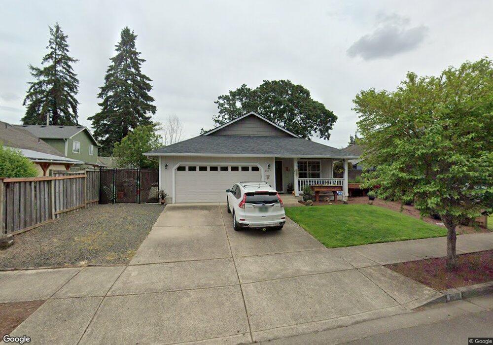
2069 Anthony Way Eugene, OR 97404
River Road NeighborhoodEstimated Value: $409,000 - $432,000
3
Beds
2
Baths
1,356
Sq Ft
$307/Sq Ft
Est. Value
About This Home
This home is located at 2069 Anthony Way, Eugene, OR 97404 and is currently estimated at $416,647, approximately $307 per square foot. 2069 Anthony Way is a home located in Lane County with nearby schools including Irving Elementary School, Shasta Middle School, and Willamette High School.
Ownership History
Date
Name
Owned For
Owner Type
Purchase Details
Closed on
Apr 4, 2023
Sold by
Winsor James M
Bought by
Page Kay Lorraine and Page Russell
Current Estimated Value
Home Financials for this Owner
Home Financials are based on the most recent Mortgage that was taken out on this home.
Original Mortgage
$345,000
Outstanding Balance
$334,503
Interest Rate
6.5%
Mortgage Type
New Conventional
Estimated Equity
$82,144
Purchase Details
Closed on
Mar 3, 1998
Sold by
Marvin Investments Inc
Bought by
Winsor James M
Home Financials for this Owner
Home Financials are based on the most recent Mortgage that was taken out on this home.
Original Mortgage
$113,500
Interest Rate
6.99%
Create a Home Valuation Report for This Property
The Home Valuation Report is an in-depth analysis detailing your home's value as well as a comparison with similar homes in the area
Home Values in the Area
Average Home Value in this Area
Purchase History
| Date | Buyer | Sale Price | Title Company |
|---|---|---|---|
| Page Kay Lorraine | $400,000 | Cascade Title | |
| Winsor James M | $119,500 | Western Pioneer Title Co |
Source: Public Records
Mortgage History
| Date | Status | Borrower | Loan Amount |
|---|---|---|---|
| Open | Page Kay Lorraine | $345,000 | |
| Previous Owner | Winsor James M | $113,500 |
Source: Public Records
Tax History
| Year | Tax Paid | Tax Assessment Tax Assessment Total Assessment is a certain percentage of the fair market value that is determined by local assessors to be the total taxable value of land and additions on the property. | Land | Improvement |
|---|---|---|---|---|
| 2025 | $3,982 | $228,925 | -- | -- |
| 2024 | $3,882 | $222,258 | -- | -- |
| 2023 | $3,882 | $215,785 | $0 | $0 |
| 2022 | $3,613 | $209,500 | $0 | $0 |
| 2021 | $3,537 | $203,399 | $0 | $0 |
| 2020 | $3,434 | $197,475 | $0 | $0 |
| 2019 | $3,265 | $191,724 | $0 | $0 |
| 2018 | $3,174 | $180,718 | $0 | $0 |
| 2017 | $3,033 | $180,718 | $0 | $0 |
| 2016 | $2,956 | $175,454 | $0 | $0 |
| 2015 | $2,898 | $170,344 | $0 | $0 |
| 2014 | $2,854 | $165,383 | $0 | $0 |
Source: Public Records
Map
Nearby Homes
- 1307 Bramblewood Ln
- 2488 Northampton
- 1755 Brentwood Ave
- 805 Impala Ave
- 541 Durham Ave
- 1682 Hemlock St
- 2563 York St
- 2580 Crowther Dr
- 2610 Crowther Dr
- 1566 Maywood Ave
- 3906 Century Dr
- 2721 La Darrah St
- 3886 Aerial Way
- 3717 Riviera
- 2931 Shelby Way
- 303 Lenore Loop
- 2965 Teal Place
- 4114 Jessen Dr
- 401 Sterling Dr
- 2987 Dry Creek Rd
- 2033 Anthony Way
- 590 Bushnell Ln
- 570 Bushnell Ln
- 2017 Anthony Way
- 550 Bushnell Ln
- 2062 Anthony Way
- 600 Bushnell Ln
- 1983 Anthony Way
- 530 Bushnell Ln
- 2010 Anthony Way
- 2048 Anthony Way
- 610 Bushnell Ln
- 2029 Plentywood Ln
- 1959 Anthony Way
- 2026 Anthony Way
- 574 Hollyhock Ln
- 1930 Debra Sue Ct
- 1970 Anthony Way
- 620 Bushnell Ln
- 590 Hollyhock Ln
Your Personal Tour Guide
Ask me questions while you tour the home.