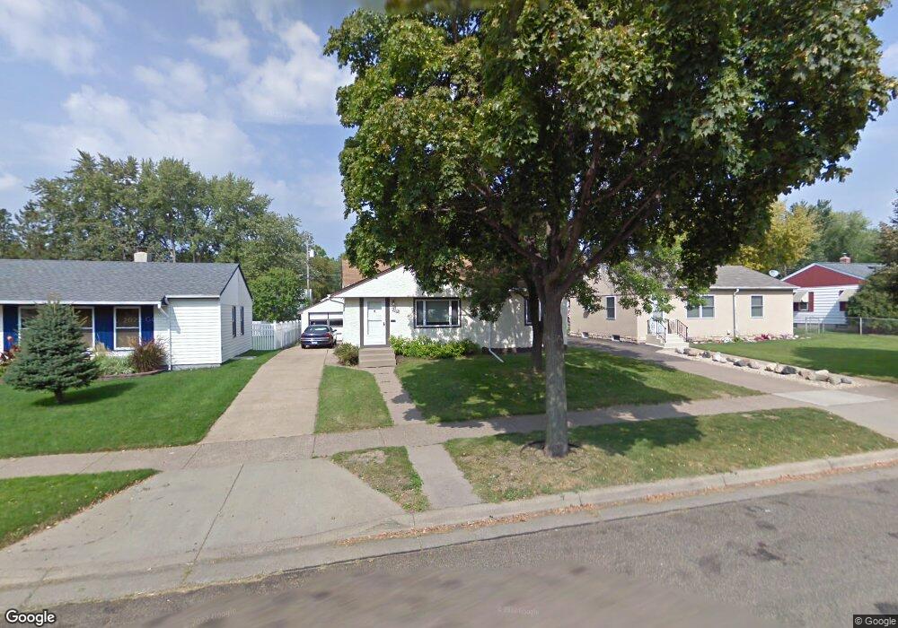
2069 Ivy Ave E Saint Paul, MN 55119
Southern Hayden Heights NeighborhoodEstimated Value: $268,000 - $296,000
3
Beds
2
Baths
594
Sq Ft
$475/Sq Ft
Est. Value
About This Home
This home is located at 2069 Ivy Ave E, Saint Paul, MN 55119 and is currently estimated at $282,446, approximately $475 per square foot. 2069 Ivy Ave E is a home located in Ramsey County with nearby schools including The Heights Community School, Txuj Ci HMong Language and Culture Upper Campus, and Johnson Senior High School.
Ownership History
Date
Name
Owned For
Owner Type
Purchase Details
Closed on
Nov 23, 2022
Sold by
Myaing Aung & Pa
Bought by
Myaing Aung and Lai Pa
Current Estimated Value
Purchase Details
Closed on
Jul 29, 2016
Sold by
Thao Roxanne and Lor Beckham
Bought by
Myaing Aung and Lai Pa
Home Financials for this Owner
Home Financials are based on the most recent Mortgage that was taken out on this home.
Original Mortgage
$173,350
Interest Rate
3.48%
Mortgage Type
New Conventional
Purchase Details
Closed on
Aug 18, 2014
Sold by
Rivertown Development Group Llc
Bought by
Thao Roxanne and Lor Beckham
Home Financials for this Owner
Home Financials are based on the most recent Mortgage that was taken out on this home.
Original Mortgage
$147,184
Interest Rate
4.25%
Mortgage Type
FHA
Purchase Details
Closed on
Jan 19, 2004
Sold by
Oberg Roger D and Oberg Vickie L
Bought by
Rivertown Development Group Llc
Create a Home Valuation Report for This Property
The Home Valuation Report is an in-depth analysis detailing your home's value as well as a comparison with similar homes in the area
Home Values in the Area
Average Home Value in this Area
Purchase History
| Date | Buyer | Sale Price | Title Company |
|---|---|---|---|
| Myaing Aung | $500 | -- | |
| Myaing Aung | $188,030 | Gibraltar Title Agency Llc | |
| Thao Roxanne | $154,442 | The Title Group Inc | |
| Rivertown Development Group Llc | $86,055 | None Available |
Source: Public Records
Mortgage History
| Date | Status | Borrower | Loan Amount |
|---|---|---|---|
| Previous Owner | Myaing Aung | $173,350 | |
| Previous Owner | Thao Roxanne | $147,184 |
Source: Public Records
Tax History Compared to Growth
Tax History
| Year | Tax Paid | Tax Assessment Tax Assessment Total Assessment is a certain percentage of the fair market value that is determined by local assessors to be the total taxable value of land and additions on the property. | Land | Improvement |
|---|---|---|---|---|
| 2025 | $4,220 | $275,600 | $30,000 | $245,600 |
| 2023 | $4,220 | $269,200 | $25,000 | $244,200 |
| 2022 | $3,536 | $269,100 | $25,000 | $244,100 |
| 2021 | $3,144 | $230,200 | $25,000 | $205,200 |
| 2020 | $2,962 | $214,100 | $24,300 | $189,800 |
| 2019 | $2,982 | $191,100 | $24,300 | $166,800 |
| 2018 | $2,748 | $186,400 | $24,300 | $162,100 |
| 2017 | $2,238 | $181,300 | $24,300 | $157,000 |
| 2016 | $2,154 | $0 | $0 | $0 |
| 2015 | $2,060 | $147,900 | $24,300 | $123,600 |
| 2014 | $1,484 | $0 | $0 | $0 |
Source: Public Records
Map
Nearby Homes
- 2112 Cottage Ave E
- 2032 Hyacinth Ave E
- 2102 Sherwood Ave
- 1406 Furness Pkwy
- 1976 Orange Ave E
- 1931 Hawthorne Ave E
- 1868 Ivy Ave E
- 1250 Mcknight Rd N
- 1891 Maryland Ave E
- 2311 Nokomis Ave
- 1828 Arlington Ave E
- 1905 Montana Ave E
- 1806 Sherwood Ave
- 1840 Hoyt Ave E
- 2401 Bison Dr
- 2317 Arlington Ave E
- 1840 Iowa Ave E
- 2076 Larpenteur Ave E
- 1729 Sherwood Ave
- 1732 Maryland Ave E
- 2063 Ivy Ave E
- 2063 2063 Ivy-Avenue-e
- 2075 Ivy Ave E
- 2075 2075 Ivy Ave E
- 2057 Ivy Ave E
- 2081 Ivy Ave E
- 2068 Clear Ave
- 2062 Clear Ave
- 2074 Clear Ave
- 2051 Ivy Ave E
- 2058 Clear Ave
- 2085 Ivy Ave E
- 2085 2085 Ivy-Avenue-e
- 2085 2085 Ivy Ave E
- 2080 Clear Ave
- 2072 Ivy Ave E
- 2064 Ivy Ave E
- 2080 Ivy Ave E
- 2080 2080 Ivy-Avenue-e
- 2052 Clear Ave