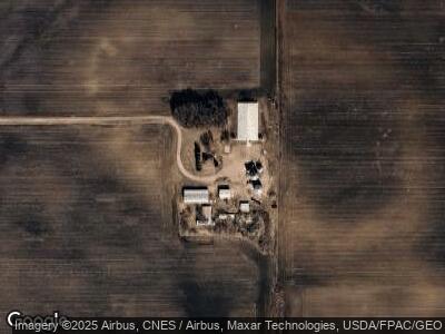
2069 State Highway 4 Trimont, MN 56176
Estimated Value: $251,000 - $751,835
3
Beds
2
Baths
2,142
Sq Ft
$234/Sq Ft
Est. Value
About This Home
This home is located at 2069 State Highway 4, Trimont, MN 56176 and is currently estimated at $501,418, approximately $234 per square foot. 2069 State Highway 4 is a home located in Martin County with nearby schools including Trimont Elementary School, Welcome Elementary School, and Sherburn Elementary School.
Ownership History
Date
Name
Owned For
Owner Type
Purchase Details
Closed on
Sep 14, 2013
Sold by
Anderson Clifford and Anderson Marla K
Bought by
Anderson Clifford and Anderson Marla K
Current Estimated Value
Purchase Details
Closed on
Sep 13, 2013
Sold by
Anderson Betty L
Bought by
Anderson Clifford
Purchase Details
Closed on
Sep 12, 2013
Sold by
Anderson Clifford and Anderson Marla K
Bought by
Anderson Betty L
Purchase Details
Closed on
Sep 6, 2012
Sold by
Anderson Gary C and Anderson Betty L
Bought by
Anderson Betty L
Create a Home Valuation Report for This Property
The Home Valuation Report is an in-depth analysis detailing your home's value as well as a comparison with similar homes in the area
Home Values in the Area
Average Home Value in this Area
Purchase History
| Date | Buyer | Sale Price | Title Company |
|---|---|---|---|
| Anderson Clifford | -- | None Available | |
| Anderson Clifford | -- | None Available | |
| Anderson Betty L | -- | None Available |
Source: Public Records
Mortgage History
| Date | Status | Borrower | Loan Amount |
|---|---|---|---|
| Closed | Anderson Clifford | $157,000 |
Source: Public Records
Tax History Compared to Growth
Tax History
| Year | Tax Paid | Tax Assessment Tax Assessment Total Assessment is a certain percentage of the fair market value that is determined by local assessors to be the total taxable value of land and additions on the property. | Land | Improvement |
|---|---|---|---|---|
| 2024 | $3,208 | $1,029,100 | $92,300 | $936,800 |
| 2023 | $3,862 | $956,300 | $92,300 | $864,000 |
| 2022 | $1,444 | $984,700 | $83,700 | $901,000 |
| 2021 | $2,902 | $729,100 | $71,800 | $657,300 |
| 2020 | $3,040 | $761,200 | $71,900 | $689,300 |
| 2019 | $3,108 | $754,600 | $68,700 | $685,900 |
| 2018 | $3,174 | $827,500 | $68,900 | $758,600 |
| 2013 | $22 | $144,000 | $52,689 | $91,311 |
Source: Public Records
Map
Nearby Homes
- 350 Birch St E
- 774 170th St
- 404 1st St
- 43397 43397 685th Ave
- 106 106 Co Rd 19 So
- 103 103 E Cherry St
- 204 N 2nd St
- 801 140th St
- 1267 76th Ave
- 40668 E Long Lake Ln
- 0 Parcel Id: 055100010 Unit 7033932
- 0 Parcel Id: 055100060 Unit 7033937
- 0 Parcel Id: 055100050 Unit 7033936
- 0 Parcel Id: 055100020 Unit 7033933
- 0 Parcel Id: 055100040 Unit 7033935
- 207 van Amber St W
- 109 N Main St
- 100 N Main St
- 409 409 N Prairie St
- 409 N Prairie St