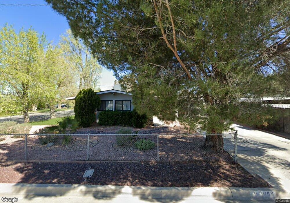
2069 W Lingard St Lancaster, CA 93536
West Lancaster NeighborhoodEstimated Value: $383,990 - $435,000
4
Beds
2
Baths
1,187
Sq Ft
$337/Sq Ft
Est. Value
About This Home
This home is located at 2069 W Lingard St, Lancaster, CA 93536 and is currently estimated at $399,498, approximately $336 per square foot. 2069 W Lingard St is a home located in Los Angeles County with nearby schools including Monte Vista Elementary School, Amargosa Creek Middle School, and Lancaster High School.
Ownership History
Date
Name
Owned For
Owner Type
Purchase Details
Closed on
May 2, 2012
Sold by
Monter Victoria L and Walden Raquel
Bought by
Monter Victoria L and Walden Raquel
Current Estimated Value
Home Financials for this Owner
Home Financials are based on the most recent Mortgage that was taken out on this home.
Original Mortgage
$171,200
Interest Rate
3.98%
Mortgage Type
New Conventional
Purchase Details
Closed on
Jun 25, 2004
Sold by
Monter Victoria L
Bought by
Monter Victoria L and Monroy Raquel
Home Financials for this Owner
Home Financials are based on the most recent Mortgage that was taken out on this home.
Original Mortgage
$100,000
Interest Rate
6.31%
Mortgage Type
New Conventional
Purchase Details
Closed on
May 27, 1994
Sold by
Monter Alejandro and Monter Juan
Bought by
Monter Victoria L
Create a Home Valuation Report for This Property
The Home Valuation Report is an in-depth analysis detailing your home's value as well as a comparison with similar homes in the area
Home Values in the Area
Average Home Value in this Area
Purchase History
| Date | Buyer | Sale Price | Title Company |
|---|---|---|---|
| Monter Victoria L | -- | None Available | |
| Walden Raquel | -- | None Available | |
| Monter Victoria L | -- | United Title Company Los Ang | |
| Monter Victoria L | -- | Continental Land Title | |
| Monter Victoria L | -- | Continental Land Title |
Source: Public Records
Mortgage History
| Date | Status | Borrower | Loan Amount |
|---|---|---|---|
| Closed | Monter Victoria L | $171,200 | |
| Closed | Monter Victoria L | $100,000 |
Source: Public Records
Tax History
| Year | Tax Paid | Tax Assessment Tax Assessment Total Assessment is a certain percentage of the fair market value that is determined by local assessors to be the total taxable value of land and additions on the property. | Land | Improvement |
|---|---|---|---|---|
| 2025 | $2,648 | $115,863 | $31,896 | $83,967 |
| 2024 | $2,648 | $113,592 | $31,271 | $82,321 |
| 2023 | $2,594 | $111,365 | $30,658 | $80,707 |
| 2022 | $2,417 | $109,182 | $30,057 | $79,125 |
| 2021 | $2,041 | $107,042 | $29,468 | $77,574 |
| 2019 | $1,989 | $103,869 | $28,595 | $75,274 |
| 2018 | $1,954 | $101,834 | $28,035 | $73,799 |
| 2016 | $1,859 | $97,882 | $26,948 | $70,934 |
| 2015 | $1,838 | $96,413 | $26,544 | $69,869 |
| 2014 | $1,844 | $94,526 | $26,025 | $68,501 |
Source: Public Records
Map
Nearby Homes
- 44728 21st St W
- 2005 W Milling St
- 44654 20th St W
- 2114 El Domingo Cir Unit 8
- 44761 18th St W
- 2005 W Norberry St
- 1754 W Milling St
- 44916 18th St W
- 1662 W Lumber St
- 0 W Newgrove St
- 44528 Camolin Ln
- 0 W 50th Street West and Lumber St
- 45035 18th St W
- 1639 W Norberry St
- 44515 Tarragon Dr
- 45011 Lorimer Ave
- 44338 23rd St W
- 44420 Tarragon Dr
- 0 W Newgrove St
- 2634 Minford St
- 2061 W Lingard St
- 2068 W Lancaster Blvd
- 2060 W Lancaster Blvd
- 2053 W Lingard St
- 44741 21st St W
- 44747 21st St W
- 44733 21st St W
- 2054 W Lancaster Blvd
- 2056 W Lingard St
- 44716 21st St W
- 2047 W Lingard St
- 44727 21st St W
- 2046 W Lancaster Blvd
- 2048 W Lingard St
- 44719 21st St W
- 44710 21st St W
- 2039 W Lingard St
- 2040 W Lancaster Blvd
- 2053 W Lumber St
- 2040 W Lingard St
Your Personal Tour Guide
Ask me questions while you tour the home.