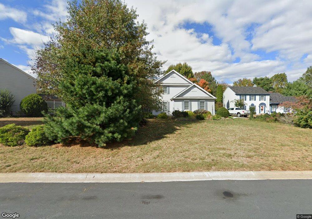
207 Eagle Nest Dr Camden Wyoming, DE 19934
Estimated Value: $419,000 - $430,000
4
Beds
3
Baths
2,400
Sq Ft
$177/Sq Ft
Est. Value
About This Home
This home is located at 207 Eagle Nest Dr, Camden Wyoming, DE 19934 and is currently estimated at $425,037, approximately $177 per square foot. 207 Eagle Nest Dr is a home located in Kent County with nearby schools including Allen Frear Elementary School, F. Niel Postlethwait Middle School, and Caesar Rodney High School.
Ownership History
Date
Name
Owned For
Owner Type
Purchase Details
Closed on
Jan 19, 2023
Sold by
Mosley Catherine M and Mosley Dupont W
Bought by
Mosley Catherine M
Current Estimated Value
Home Financials for this Owner
Home Financials are based on the most recent Mortgage that was taken out on this home.
Original Mortgage
$252,000
Outstanding Balance
$244,035
Interest Rate
6.48%
Mortgage Type
VA
Estimated Equity
$181,002
Purchase Details
Closed on
Dec 1, 1990
Bought by
Mosley Dupont W
Create a Home Valuation Report for This Property
The Home Valuation Report is an in-depth analysis detailing your home's value as well as a comparison with similar homes in the area
Home Values in the Area
Average Home Value in this Area
Purchase History
| Date | Buyer | Sale Price | Title Company |
|---|---|---|---|
| Mosley Catherine M | -- | -- | |
| Mosley Catherine M | -- | None Listed On Document | |
| Mosley Dupont W | $150,800 | -- |
Source: Public Records
Mortgage History
| Date | Status | Borrower | Loan Amount |
|---|---|---|---|
| Open | Mosley Catherine M | $252,000 | |
| Closed | Mosley Catherine M | $252,000 |
Source: Public Records
Tax History Compared to Growth
Tax History
| Year | Tax Paid | Tax Assessment Tax Assessment Total Assessment is a certain percentage of the fair market value that is determined by local assessors to be the total taxable value of land and additions on the property. | Land | Improvement |
|---|---|---|---|---|
| 2025 | $1,984 | $378,900 | $97,300 | $281,600 |
| 2024 | $1,984 | $378,900 | $97,300 | $281,600 |
| 2023 | $2,158 | $66,300 | $13,300 | $53,000 |
| 2022 | $2,045 | $66,300 | $13,300 | $53,000 |
| 2021 | $2,023 | $66,300 | $13,300 | $53,000 |
| 2020 | $1,980 | $66,300 | $13,300 | $53,000 |
| 2019 | $1,918 | $66,300 | $13,300 | $53,000 |
| 2018 | $1,865 | $66,300 | $13,300 | $53,000 |
| 2017 | $1,841 | $67,100 | $0 | $0 |
| 2016 | $1,768 | $67,100 | $0 | $0 |
| 2015 | $1,537 | $67,100 | $0 | $0 |
| 2014 | $1,528 | $67,100 | $0 | $0 |
Source: Public Records
Map
Nearby Homes
- 103 Osprey Ct
- 106 Steffens Blvd
- 83 Homestead Dr
- 464 Orchard Grove Dr
- 55 Orchard Grove Ct
- 45 Brookfield Dr
- 42 Brookfield Dr
- 19 S Main St
- 256 Headstart Ln
- 111 Meeting House Ln
- 2043 Highland Ave
- 237 E Camden Wyoming Ave
- 224 King Henry Ct
- 272 King Henry Ct
- Lot 22 Bee Brookfield Dr
- 16 Lone Tree Dr
- 210 Cambridge Rd
- LOT 102 AST King Henry Ct
- LOT 105 SYC Brookfield Dr
- 123 Candlewick Dr
- 205 Eagle Nest Dr
- 201 Eagle Crest Dr
- 203 Eagle Crest Dr
- 214 Eagle View Ln
- 203 Eagle Nest Dr
- 216 Eagle View Ln
- 208 Eagle Nest Dr
- 206 Eagle Nest Dr
- 205 Eagle Crest Dr
- 210 Eagle Nest Dr
- 204 Eagle Nest Dr
- 200 Eagle Crest Dr
- 212 Eagle View Ln
- 202 Eagle Crest Dr
- 200 Eagle View Ln
- 300 Eagle Nest Dr
- 202 Eagle Nest Dr
- 300 Eagle View Ln
- 118 Gardengate Rd
- 208 Eagle View Ln