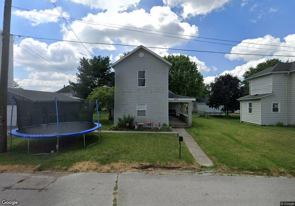
207 Hazel St Covington, OH 45318
Estimated Value: $116,000 - $395,000
Studio
--
Bath
--
Sq Ft
6,970
Sq Ft
About This Home
This home is located at 207 Hazel St, Covington, OH 45318 and is currently estimated at $214,857. 207 Hazel St is a home located in Miami County with nearby schools including Covington Elementary/Junior High School, Covington Junior High School, and Covington High School.
Ownership History
Date
Name
Owned For
Owner Type
Purchase Details
Closed on
Nov 9, 2015
Sold by
Loper Johnnie and Loper Sharon
Bought by
Jennings Thomas and Jennings April
Current Estimated Value
Purchase Details
Closed on
Sep 27, 2005
Sold by
Wogoman Dale A
Bought by
Loper Johnnie and Loper Sharon
Purchase Details
Closed on
May 1, 1988
Bought by
Wogoman Dale A
Create a Home Valuation Report for This Property
The Home Valuation Report is an in-depth analysis detailing your home's value as well as a comparison with similar homes in the area
Home Values in the Area
Average Home Value in this Area
Purchase History
| Date | Buyer | Sale Price | Title Company |
|---|---|---|---|
| Jennings Thomas | -- | Attorney | |
| Loper Johnnie | $36,000 | -- | |
| Wogoman Dale A | -- | -- |
Source: Public Records
Tax History
| Year | Tax Paid | Tax Assessment Tax Assessment Total Assessment is a certain percentage of the fair market value that is determined by local assessors to be the total taxable value of land and additions on the property. | Land | Improvement |
|---|---|---|---|---|
| 2024 | $442 | $13,590 | $10,050 | $3,540 |
| 2023 | $521 | $13,590 | $10,050 | $3,540 |
| 2022 | $519 | $13,590 | $10,050 | $3,540 |
| 2021 | $432 | $10,470 | $7,740 | $2,730 |
| 2020 | $433 | $10,470 | $7,740 | $2,730 |
| 2019 | $435 | $10,470 | $7,740 | $2,730 |
| 2018 | $293 | $7,040 | $4,240 | $2,800 |
| 2017 | $298 | $7,040 | $4,240 | $2,800 |
| 2016 | $295 | $7,040 | $4,240 | $2,800 |
| 2015 | $271 | $6,760 | $4,060 | $2,700 |
| 2014 | $271 | $6,760 | $4,060 | $2,700 |
| 2013 | $262 | $6,760 | $4,060 | $2,700 |
Source: Public Records
Map
Nearby Homes
- 207 Hazel St
- 201 Hazel St
- 308 E Broadway St
- 314 E Broadway St
- 300 E Broadway St
- 318 E Broadway St
- 258 E Broadway St
- 258 E Broadway St Unit X
- 326 E Broadway St
- 404 E Broadway St
- 323 E Broadway St
- 303 E Broadway St
- 408 E Broadway St
- 311 E Broadway St
- 315 E Broadway St
- 414 E Broadway St
- 243 E Broadway St
- 401 E Broadway St
- 224 E Broadway St
- 312 N Grant St
Your Personal Tour Guide
Ask me questions while you tour the home.