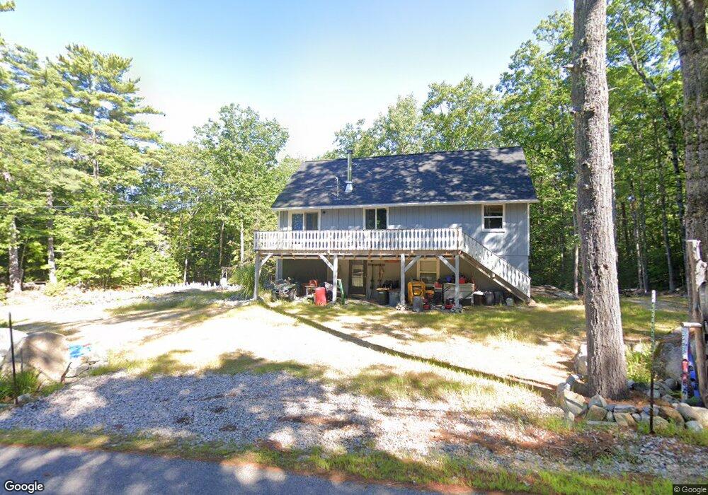
207 King Pine Rd Madison, NH 03849
Estimated Value: $348,000 - $545,000
2
Beds
2
Baths
1,840
Sq Ft
$224/Sq Ft
Est. Value
About This Home
This home is located at 207 King Pine Rd, Madison, NH 03849 and is currently estimated at $411,905, approximately $223 per square foot. 207 King Pine Rd is a home with nearby schools including Madison Elementary School.
Ownership History
Date
Name
Owned For
Owner Type
Purchase Details
Closed on
May 9, 2023
Sold by
Garbacz Laurie L
Bought by
Garbacz Laurie L and Garbacz Christine L
Current Estimated Value
Purchase Details
Closed on
Nov 25, 2019
Sold by
Curran Lawrence T and Curarn Madeline A
Bought by
Garbacz Christine L
Home Financials for this Owner
Home Financials are based on the most recent Mortgage that was taken out on this home.
Original Mortgage
$174,600
Interest Rate
3.5%
Mortgage Type
Purchase Money Mortgage
Create a Home Valuation Report for This Property
The Home Valuation Report is an in-depth analysis detailing your home's value as well as a comparison with similar homes in the area
Home Values in the Area
Average Home Value in this Area
Purchase History
| Date | Buyer | Sale Price | Title Company |
|---|---|---|---|
| Garbacz Laurie L | -- | None Available | |
| Garbacz Christine L | $180,000 | -- |
Source: Public Records
Mortgage History
| Date | Status | Borrower | Loan Amount |
|---|---|---|---|
| Previous Owner | Garbacz Christine L | $174,600 |
Source: Public Records
Tax History
| Year | Tax Paid | Tax Assessment Tax Assessment Total Assessment is a certain percentage of the fair market value that is determined by local assessors to be the total taxable value of land and additions on the property. | Land | Improvement |
|---|---|---|---|---|
| 2025 | $3,171 | $353,100 | $138,000 | $215,100 |
| 2024 | $2,966 | $188,100 | $69,000 | $119,100 |
| 2023 | $3,194 | $188,100 | $69,000 | $119,100 |
| 2022 | $2,914 | $188,100 | $69,000 | $119,100 |
| 2021 | $2,590 | $188,100 | $69,000 | $119,100 |
| 2020 | $2,878 | $188,100 | $69,000 | $119,100 |
| 2019 | $3,416 | $187,100 | $70,600 | $116,500 |
| 2018 | $3,542 | $187,100 | $70,600 | $116,500 |
| 2017 | $3,162 | $187,100 | $70,600 | $116,500 |
| 2015 | $3,089 | $187,100 | $70,600 | $116,500 |
| 2014 | $2,758 | $172,800 | $50,400 | $122,400 |
| 2013 | $2,727 | $172,800 | $50,400 | $122,400 |
Source: Public Records
Map
Nearby Homes
- 46 Red Pine Rd
- 0 Burnham Rd Unit 35
- TBD Youngs Rd
- 915 E Madison Rd
- TBD Towle Hill Rd
- 00 Mooney Hill Rd
- Lot 12 Friedman Ln
- 408 Albert Rd
- 65 Conway Rd
- 33 Roberts Rd
- 121 Charlotte Point Rd
- 70 Peak Vista Ln
- 0 Willis Bean Unit 5006353
- 34 Abenaki Dr
- 2,4,6 Willis Bean Rd
- 0 Highlands Dr Unit 50, 51, 57
- 74 Garmish Rd
- 5 Friedman Ln
- 5-11 Friedman Ln
- 29 Milford Ave
- 0 Pokey Pine Rd Unit 4446491
- 0 Pokey Pine Rd Unit 4785402
- 229 King Pine Rd
- 36 Pokey Pine Rd
- 57 Pokey Pine Rd
- 21 Pokey Pine Rd
- 00 Pokey Pine Rd
- 0 Pokey Pine Rd
- 158 King Pine Rd
- 235 King Pine Rd
- 20 Scotch Pine Rd
- 255 King Pine Rd
- 161 King Pine Rd
- 20 White Pine Rd
- 274 King Pine Rd
- 301 King Pine Rd
- 79 Pokey Pine Rd
- 38 Scotch Pine Rd
- 146 King Pine Rd
- 94 Pokey Pine Rd
Your Personal Tour Guide
Ask me questions while you tour the home.