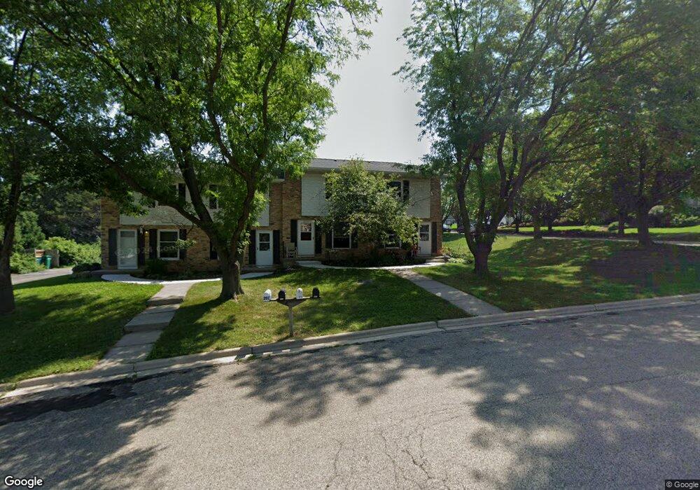
207 N Brookwood Dr Unit 207 Mount Horeb, WI 53572
Estimated Value: $229,380 - $458,000
2
Beds
2
Baths
1,000
Sq Ft
$310/Sq Ft
Est. Value
About This Home
This home is located at 207 N Brookwood Dr Unit 207, Mount Horeb, WI 53572 and is currently estimated at $310,095, approximately $310 per square foot. 207 N Brookwood Dr Unit 207 is a home located in Dane County with nearby schools including Mount Horeb Intermediate School, Mount Horeb Primary Center, and Mount Horeb Middle School.
Ownership History
Date
Name
Owned For
Owner Type
Purchase Details
Closed on
Jul 11, 2008
Sold by
Jensen Mary G and Ofenbeck Mary G
Bought by
Kessenich Colleen M
Current Estimated Value
Home Financials for this Owner
Home Financials are based on the most recent Mortgage that was taken out on this home.
Original Mortgage
$80,000
Outstanding Balance
$17,998
Interest Rate
6.1%
Mortgage Type
Purchase Money Mortgage
Estimated Equity
$292,097
Create a Home Valuation Report for This Property
The Home Valuation Report is an in-depth analysis detailing your home's value as well as a comparison with similar homes in the area
Home Values in the Area
Average Home Value in this Area
Purchase History
| Date | Buyer | Sale Price | Title Company |
|---|---|---|---|
| Kessenich Colleen M | $115,800 | None Available |
Source: Public Records
Mortgage History
| Date | Status | Borrower | Loan Amount |
|---|---|---|---|
| Open | Kessenich Colleen M | $80,000 |
Source: Public Records
Tax History Compared to Growth
Tax History
| Year | Tax Paid | Tax Assessment Tax Assessment Total Assessment is a certain percentage of the fair market value that is determined by local assessors to be the total taxable value of land and additions on the property. | Land | Improvement |
|---|---|---|---|---|
| 2024 | $2,397 | $169,500 | $36,000 | $133,500 |
| 2023 | $2,268 | $169,500 | $36,000 | $133,500 |
| 2021 | $2,414 | $130,400 | $36,000 | $94,400 |
| 2020 | $2,415 | $130,400 | $36,000 | $94,400 |
| 2019 | $2,412 | $130,400 | $36,000 | $94,400 |
| 2018 | $2,558 | $139,600 | $31,800 | $107,800 |
| 2017 | $2,455 | $123,500 | $31,800 | $91,700 |
| 2016 | $2,254 | $123,500 | $31,800 | $91,700 |
| 2015 | $2,138 | $123,500 | $31,800 | $91,700 |
| 2014 | $2,217 | $123,500 | $31,800 | $91,700 |
| 2013 | $2,245 | $123,500 | $31,800 | $91,700 |
Source: Public Records
Map
Nearby Homes
- Lot 2 Eastwood Way
- Lot 4 Jamie Jo Cir
- Lot 8 Jamie Jo Cir
- Lot 5 Jamie Jo Cir
- 113 Jamie Jo Lot 9 Cir
- Lot 7 Jamie Jo Cir
- The McKinley Plan at Sienna Hills
- The Cypress Plan at Sienna Hills
- The Willow Plan at Sienna Hills
- The Madison Plan at Sienna Hills
- The Linden Plan at Sienna Hills
- The Kennedy Plan at Sienna Hills
- The Juniper Plan at Sienna Hills
- The Lincoln Plan at Sienna Hills
- The Aspen Plan at Sienna Hills
- The Reagan Plan at Sienna Hills
- The Grant Plan at Sienna Hills
- The Taylor Plan at Sienna Hills
- The Filmore Plan at Sienna Hills
- The Rowan Plan at Sienna Hills
- 201 N Brookwood Dr
- 205 N Brookwood Dr Unit 205
- 203 N Brookwood Dr
- 1900 Fox Run
- 211 N Brookwood Dr
- 324 Shenandoah Way
- 1903 Fox Run
- 125 N Brookwood Dr
- 125 N Brookwood Dr
- 1907 Fox Run
- 1905 Fox Run Unit 2
- 217 N Brookwood Dr
- 215 N Brookwood Dr
- 1903 Eastwood Way
- 328 Shenandoah Way
- 1905 Eastwood Way
- 303 N Brookwood Dr
- 332 Shenandoah Way
- 1932 Fox Run
- 1932 Fox Run Unit 1932