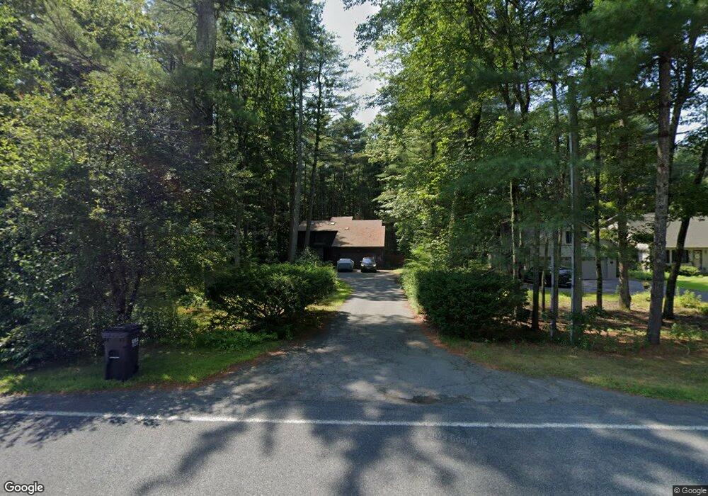
207 Plumtree Rd Sunderland, MA 01375
Estimated Value: $570,000 - $762,000
4
Beds
3
Baths
2,296
Sq Ft
$275/Sq Ft
Est. Value
About This Home
This home is located at 207 Plumtree Rd, Sunderland, MA 01375 and is currently estimated at $632,018, approximately $275 per square foot. 207 Plumtree Rd is a home located in Franklin County with nearby schools including Sunderland Elementary School and Frontier Regional School.
Ownership History
Date
Name
Owned For
Owner Type
Purchase Details
Closed on
Mar 2, 2022
Sold by
Krimsky Barry A and Krimsky Carol M
Bought by
Krimsky Ft
Current Estimated Value
Purchase Details
Closed on
Sep 25, 2018
Sold by
Krimsky Barry A
Bought by
Krimsky Barry A and Krimsky Carol M
Purchase Details
Closed on
Mar 10, 2000
Sold by
Harrison Linda J and Korpita Linda J
Bought by
Krimsky Barry A
Create a Home Valuation Report for This Property
The Home Valuation Report is an in-depth analysis detailing your home's value as well as a comparison with similar homes in the area
Home Values in the Area
Average Home Value in this Area
Purchase History
| Date | Buyer | Sale Price | Title Company |
|---|---|---|---|
| Krimsky Ft | -- | None Available | |
| Krimsky Barry A | -- | -- | |
| Krimsky Barry A | $233,000 | -- |
Source: Public Records
Mortgage History
| Date | Status | Borrower | Loan Amount |
|---|---|---|---|
| Previous Owner | Krimsky Barry A | $131,600 | |
| Previous Owner | Krimsky Barry A | $50,000 | |
| Previous Owner | Krimsky Barry A | $180,000 |
Source: Public Records
Tax History
| Year | Tax Paid | Tax Assessment Tax Assessment Total Assessment is a certain percentage of the fair market value that is determined by local assessors to be the total taxable value of land and additions on the property. | Land | Improvement |
|---|---|---|---|---|
| 2025 | $66 | $504,700 | $123,300 | $381,400 |
| 2024 | $6,632 | $504,700 | $123,300 | $381,400 |
| 2023 | $6,090 | $475,800 | $112,100 | $363,700 |
| 2022 | $6,148 | $418,200 | $96,100 | $322,100 |
| 2021 | $5,804 | $374,700 | $89,100 | $285,600 |
| 2020 | $5,782 | $374,500 | $89,100 | $285,400 |
| 2019 | $5,595 | $365,000 | $86,500 | $278,500 |
| 2018 | $5,160 | $344,000 | $83,000 | $261,000 |
| 2017 | $4,956 | $345,600 | $83,000 | $262,600 |
| 2016 | $5,074 | $346,100 | $81,400 | $264,700 |
| 2015 | $4,953 | $346,100 | $81,400 | $264,700 |
| 2014 | $4,838 | $346,100 | $81,400 | $264,700 |
Source: Public Records
Map
Nearby Homes
- 15 S Plain Rd
- 13 Shattuck Rd
- 3 Frost Ln
- 10 Depot Rd
- 208 Pine St Unit 53
- 113 Juggler Meadow Rd
- 43 Morgan Cir
- 79 State Rd
- 37 River Rd
- 33 Bridge St
- 277 River Dr
- 185 Cherry Ln
- Lot A Kingman Rd
- 36 Swamp Rd
- 0 Straits Rd
- 136 Main St
- 0 North St Unit 73407299
- 0 Greenfield Rd Unit 73472322
- 14 Sugarloaf St
- 50 Mount Pleasant
- 213 Plumtree Rd
- 201 Plumtree Rd
- 219 Plumtree Rd
- 208 Plumtree Rd
- 195 Plumtree Rd
- 202 Plumtree Rd
- 214 Plumtree Rd
- 223 Plumtree Rd
- 220 Plumtree Rd
- 196 Plumtree Rd
- 191 Plumtree Rd
- 189 Plumtree Rd
- 224 Plumtree Rd
- 229 Plumtree Rd
- 231 Plumtree Rd
- 205 Plumtree Rd
- 187 Plumtree Rd
- 210 Plumtree Rd
- 5 Pine Ct
- 230 Plumtree Rd
Your Personal Tour Guide
Ask me questions while you tour the home.