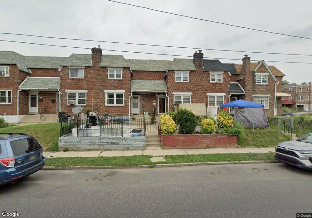
207 Sherbrook Blvd Upper Darby, PA 19082
Estimated Value: $180,401 - $200,000
3
Beds
2
Baths
1,272
Sq Ft
$153/Sq Ft
Est. Value
About This Home
This home is located at 207 Sherbrook Blvd, Upper Darby, PA 19082 and is currently estimated at $194,350, approximately $152 per square foot. 207 Sherbrook Blvd is a home located in Delaware County with nearby schools including Bywood Elementary School, Upper Darby Kdg Center, and Upper Darby High School.
Ownership History
Date
Name
Owned For
Owner Type
Purchase Details
Closed on
Oct 12, 1995
Sold by
Siegel Sylvia K
Bought by
Taylor Tyrone V and Ross Kenneth L
Current Estimated Value
Home Financials for this Owner
Home Financials are based on the most recent Mortgage that was taken out on this home.
Original Mortgage
$57,900
Outstanding Balance
$406
Interest Rate
7.6%
Mortgage Type
Purchase Money Mortgage
Estimated Equity
$193,944
Create a Home Valuation Report for This Property
The Home Valuation Report is an in-depth analysis detailing your home's value as well as a comparison with similar homes in the area
Home Values in the Area
Average Home Value in this Area
Purchase History
| Date | Buyer | Sale Price | Title Company |
|---|---|---|---|
| Taylor Tyrone V | $58,000 | -- |
Source: Public Records
Mortgage History
| Date | Status | Borrower | Loan Amount |
|---|---|---|---|
| Open | Taylor Tyrone V | $57,900 |
Source: Public Records
Tax History
| Year | Tax Paid | Tax Assessment Tax Assessment Total Assessment is a certain percentage of the fair market value that is determined by local assessors to be the total taxable value of land and additions on the property. | Land | Improvement |
|---|---|---|---|---|
| 2025 | $3,448 | $81,520 | $22,610 | $58,910 |
| 2024 | $3,448 | $81,520 | $22,610 | $58,910 |
| 2023 | $3,415 | $81,520 | $22,610 | $58,910 |
| 2022 | $3,323 | $81,520 | $22,610 | $58,910 |
| 2021 | $4,481 | $81,520 | $22,610 | $58,910 |
| 2020 | $3,555 | $54,950 | $17,590 | $37,360 |
| 2019 | $3,492 | $54,950 | $17,590 | $37,360 |
| 2018 | $3,452 | $54,950 | $0 | $0 |
| 2017 | $3,362 | $54,950 | $0 | $0 |
| 2016 | $302 | $54,950 | $0 | $0 |
| 2015 | $302 | $54,950 | $0 | $0 |
| 2014 | $302 | $54,950 | $0 | $0 |
Source: Public Records
Map
Nearby Homes
- 360 Huntley Rd
- 319 Avon Rd
- 305 Margate Rd
- 309 Margate Rd
- 311 Margate Rd
- 318 Margate Rd
- 7303 Sherbrook Blvd
- 332 Springton Rd
- 7243 Calvin Rd
- 7283 Bradford Rd
- 7266 Spruce St
- 329 Sanford Rd
- 7265 Calvin Rd
- 7261 Calvin Rd
- 367 Margate Rd
- 244 Wembly Rd
- 295 Braddock Ave
- 91 Lamport Rd
- 274 Avon Rd
- 291 N Wycombe Ave
- 205 Sherbrook Blvd
- 209 Sherbrook Blvd
- 211 Sherbrook Blvd
- 203 Sherbrook Blvd
- 213 Sherbrook Blvd
- 215 Sherbrook Blvd
- 204 Margate Rd
- 202 Margate Rd
- 217 Sherbrook Blvd
- 214 Margate Rd
- 201 Sherbrook Blvd
- 219 Sherbrook Blvd
- 216 Margate Rd
- 218 Margate Rd
- 221 Sherbrook Blvd
- 220 Margate Rd
- 223 Sherbrook Blvd
- 222 Margate Rd
- 143 Sherbrook Blvd
- 224 Margate Rd
Your Personal Tour Guide
Ask me questions while you tour the home.