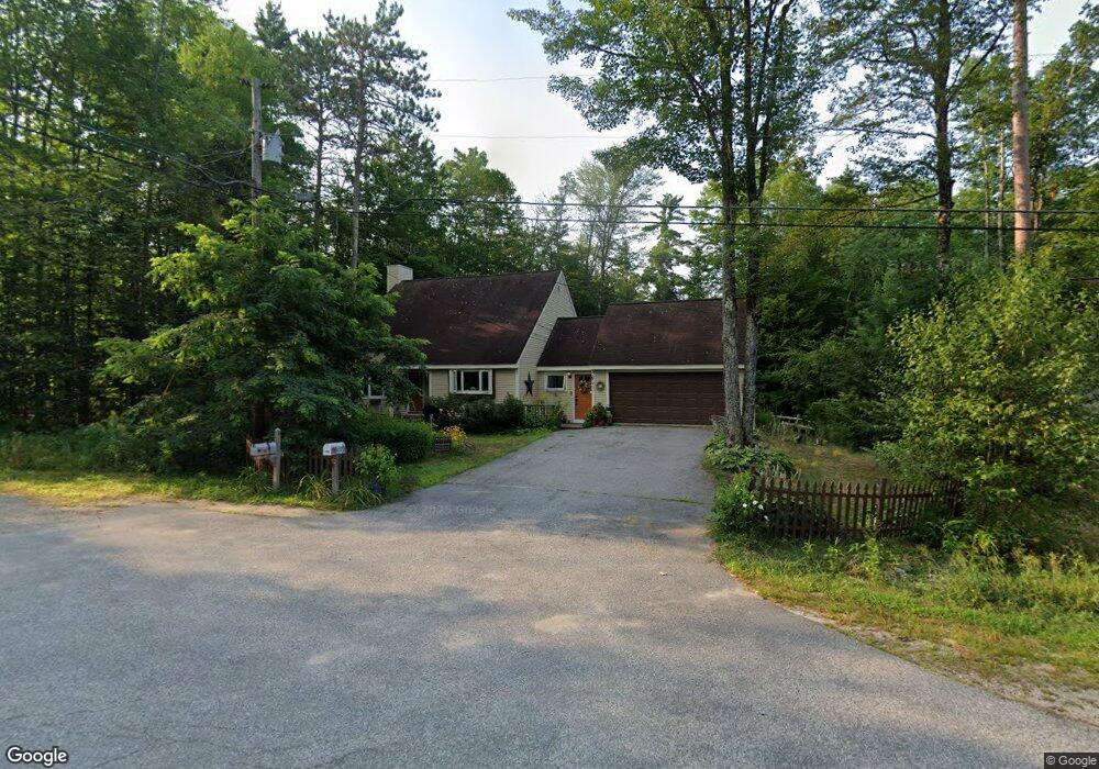
207 Thompson Rd North Conway, NH 03860
Estimated Value: $497,299 - $667,000
3
Beds
2
Baths
1,900
Sq Ft
$300/Sq Ft
Est. Value
About This Home
This home is located at 207 Thompson Rd, North Conway, NH 03860 and is currently estimated at $569,075, approximately $299 per square foot. 207 Thompson Rd is a home located in Carroll County with nearby schools including A. Crosby Kennett Middle School, Kennett High School, and The Lilliputian School.
Ownership History
Date
Name
Owned For
Owner Type
Purchase Details
Closed on
Apr 22, 2016
Sold by
Clark Brian J and Clark Reine
Bought by
Katz Marc and Katz Leana
Current Estimated Value
Purchase Details
Closed on
Jul 26, 2007
Sold by
Willman Wayne E
Bought by
Clark Brian J and Clark Reine
Home Financials for this Owner
Home Financials are based on the most recent Mortgage that was taken out on this home.
Original Mortgage
$100,000
Interest Rate
6.78%
Mortgage Type
Purchase Money Mortgage
Create a Home Valuation Report for This Property
The Home Valuation Report is an in-depth analysis detailing your home's value as well as a comparison with similar homes in the area
Home Values in the Area
Average Home Value in this Area
Purchase History
| Date | Buyer | Sale Price | Title Company |
|---|---|---|---|
| Katz Marc | $221,000 | -- | |
| Clark Brian J | $181,000 | -- |
Source: Public Records
Mortgage History
| Date | Status | Borrower | Loan Amount |
|---|---|---|---|
| Previous Owner | Clark Brian J | $108,000 | |
| Previous Owner | Clark Brian J | $100,000 |
Source: Public Records
Tax History Compared to Growth
Tax History
| Year | Tax Paid | Tax Assessment Tax Assessment Total Assessment is a certain percentage of the fair market value that is determined by local assessors to be the total taxable value of land and additions on the property. | Land | Improvement |
|---|---|---|---|---|
| 2024 | $6,144 | $487,600 | $192,400 | $295,200 |
| 2023 | $5,588 | $487,600 | $192,400 | $295,200 |
| 2022 | $4,283 | $223,300 | $85,300 | $138,000 |
| 2021 | $3,649 | $223,300 | $85,300 | $138,000 |
| 2020 | $4,169 | $223,300 | $85,300 | $138,000 |
| 2019 | $3,868 | $223,300 | $85,300 | $138,000 |
| 2018 | $3,625 | $163,800 | $50,300 | $113,500 |
| 2017 | $3,273 | $163,800 | $50,300 | $113,500 |
| 2016 | $3,163 | $163,800 | $50,300 | $113,500 |
| 2015 | $3,127 | $163,800 | $50,300 | $113,500 |
| 2014 | $3,089 | $163,800 | $50,300 | $113,500 |
| 2013 | $3,008 | $168,400 | $50,300 | $118,100 |
Source: Public Records
Map
Nearby Homes
- 11 Black Diamond Rd Unit 3
- 7 Black Diamond Rd Unit 2
- 137 Skimobile Rd Unit 3
- 239 Skimobile Rd Unit 314
- 239 Skimobile Rd Unit 305
- 239 Skimobile Rd Unit 304
- 00 Artist Falls Rd
- 00 White Mountain Hwy Unit 38
- 235 Skimobile Rd Unit 1404
- 243 Skimobile Rd Unit 252
- 243 Skimobile Rd Unit 355
- 243 Skimobile Rd Unit 354
- 243 Skimobile Rd Unit 255
- 85 Amethyst Hill Rd
- 128 Valley View Rd
- 168 Old Bartlett Rd Unit A
- 2760 New Hampshire 16 Unit E008A Week 29
- 72 Cranmore Woods Ln Unit 2
- 72 Cranmore Woods Ln Unit 4
- 2906 White Mountain Hwy
- 197 Thompson Rd
- 16 Mountain Meadow Cir
- 16 Mountain Meadow Cir
- 16 Mountain Meadow Cir
- 213 Thompson Rd
- 216 Thompson Rd
- 20 Mountain Meadow Cir
- 221 Thompson Rd
- 11 Thompson Rd
- 241 Thompson Rd
- 17 High Rd
- 298 Thompson Rd
- 251 Thompson Rd
- 21 High Rd
- 25 Hawk Rd Unit 9A
- 25 Hawk Rd Unit 2A
- 25 Hawk Rd Unit 1A
- 25 Hawk Rd Unit 4A
- 25 Hawk Rd Unit 6A
- 25 Hawk Rd Unit 12 A