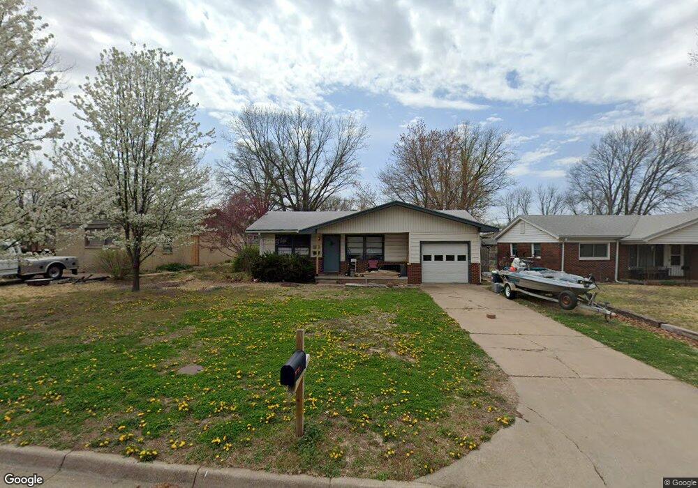
207 W Collier St Mulvane, KS 67110
Estimated Value: $172,235 - $186,000
3
Beds
2
Baths
939
Sq Ft
$191/Sq Ft
Est. Value
About This Home
This home is located at 207 W Collier St, Mulvane, KS 67110 and is currently estimated at $179,118, approximately $190 per square foot. 207 W Collier St is a home located in Sedgwick County with nearby schools including Munson Primary School, Mulvane Grade School, and Mulvane Middle School.
Ownership History
Date
Name
Owned For
Owner Type
Purchase Details
Closed on
Apr 26, 2001
Sold by
Bird Michael A
Bought by
Parks Floyd E
Current Estimated Value
Home Financials for this Owner
Home Financials are based on the most recent Mortgage that was taken out on this home.
Original Mortgage
$89,610
Outstanding Balance
$32,915
Interest Rate
6.81%
Mortgage Type
VA
Estimated Equity
$146,203
Purchase Details
Closed on
Oct 25, 1999
Sold by
Bird Jennifer L
Bought by
Bird Michael A
Create a Home Valuation Report for This Property
The Home Valuation Report is an in-depth analysis detailing your home's value as well as a comparison with similar homes in the area
Home Values in the Area
Average Home Value in this Area
Purchase History
| Date | Buyer | Sale Price | Title Company |
|---|---|---|---|
| Parks Floyd E | -- | Orourke Title Company | |
| Bird Michael A | -- | -- |
Source: Public Records
Mortgage History
| Date | Status | Borrower | Loan Amount |
|---|---|---|---|
| Open | Parks Floyd E | $89,610 |
Source: Public Records
Tax History
| Year | Tax Paid | Tax Assessment Tax Assessment Total Assessment is a certain percentage of the fair market value that is determined by local assessors to be the total taxable value of land and additions on the property. | Land | Improvement |
|---|---|---|---|---|
| 2025 | $2,187 | $16,572 | $3,738 | $12,834 |
| 2023 | $2,187 | $13,950 | $2,208 | $11,742 |
| 2022 | $1,907 | $13,134 | $2,082 | $11,052 |
| 2021 | $1,712 | $12,513 | $2,082 | $10,431 |
| 2020 | $1,566 | $11,581 | $2,082 | $9,499 |
| 2019 | $1,623 | $11,581 | $2,082 | $9,499 |
| 2018 | $1,438 | $10,627 | $1,576 | $9,051 |
| 2017 | $1,438 | $0 | $0 | $0 |
| 2016 | $1,442 | $0 | $0 | $0 |
| 2015 | $1,392 | $0 | $0 | $0 |
| 2014 | $1,361 | $0 | $0 | $0 |
Source: Public Records
Map
Nearby Homes
- 503 Charles Ave
- 217 E Filmore
- 225 Filmore St
- 515 Franklin Ave
- 1602 N Topaz Ln
- 219 Pioneer Place
- 10100 S Rock Rd
- 203 W Bridge St
- 742 Sullivan Dr
- 703 Heidi Ln
- 514 E Vine St
- 105 E Burlington Dr
- 170 Chestnut Dr
- 00000 N Pope Dr
- 1850 N Rock Rd
- 1619 N Rock Rd
- 1657 N Prairie Run Cir
- 911 E Jade Ct
- 919 E Jade Ct
- 918 E Jade Ct
- 203 W Collier St
- 211 W Collier St
- 202 W Glenn St
- 206 W Glenn St
- 206 W Collier St
- 210 W Glenn St
- 210 W Collier St
- 607 Edgemoor Dr
- 302 W Glenn St
- 522 Edgemoor Dr
- 601 Edgewood Dr
- 514 Edgemoor Dr
- 306 W Glenn St
- 610 Edgewood Dr
- 205 W Glenn St
- 207 W Glenn St
- 611 Edgemoor Dr
- 211 W Glenn St
- 605 Edgewood Dr
- 115 W Collier St
Your Personal Tour Guide
Ask me questions while you tour the home.