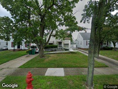
20715 Raymond St Maple Heights, OH 44137
Estimated Value: $97,000 - $116,000
3
Beds
1
Bath
1,473
Sq Ft
$71/Sq Ft
Est. Value
About This Home
This home is located at 20715 Raymond St, Maple Heights, OH 44137 and is currently estimated at $104,832, approximately $71 per square foot. 20715 Raymond St is a home located in Cuyahoga County with nearby schools including Abraham Lincoln Elementary School, Rockside/ J.F. Kennedy School, and Barack Obama School.
Ownership History
Date
Name
Owned For
Owner Type
Purchase Details
Closed on
Mar 3, 2000
Sold by
Graham Richard W
Bought by
Howard Andrew L and Ford Howard Kyllan D
Current Estimated Value
Home Financials for this Owner
Home Financials are based on the most recent Mortgage that was taken out on this home.
Original Mortgage
$74,184
Interest Rate
8.3%
Purchase Details
Closed on
Jan 1, 1975
Bought by
Graham Madonna R
Create a Home Valuation Report for This Property
The Home Valuation Report is an in-depth analysis detailing your home's value as well as a comparison with similar homes in the area
Home Values in the Area
Average Home Value in this Area
Purchase History
| Date | Buyer | Sale Price | Title Company |
|---|---|---|---|
| Howard Andrew L | $77,000 | Title Xperts Agency Inc | |
| Graham Madonna R | -- | -- |
Source: Public Records
Mortgage History
| Date | Status | Borrower | Loan Amount |
|---|---|---|---|
| Open | Howard Andrew L | $102,060 | |
| Closed | Howard Andrew L | $85,500 | |
| Closed | Howard Andrew L | $74,184 |
Source: Public Records
Tax History Compared to Growth
Tax History
| Year | Tax Paid | Tax Assessment Tax Assessment Total Assessment is a certain percentage of the fair market value that is determined by local assessors to be the total taxable value of land and additions on the property. | Land | Improvement |
|---|---|---|---|---|
| 2024 | $3,077 | $33,915 | $6,965 | $26,950 |
| 2023 | $2,288 | $21,280 | $3,990 | $17,290 |
| 2022 | $2,280 | $21,280 | $3,990 | $17,290 |
| 2021 | $2,429 | $21,280 | $3,990 | $17,290 |
| 2020 | $2,075 | $16,100 | $3,010 | $13,090 |
| 2019 | $2,064 | $46,000 | $8,600 | $37,400 |
| 2018 | $2,053 | $16,100 | $3,010 | $13,090 |
| 2017 | $1,940 | $14,700 | $2,800 | $11,900 |
| 2016 | $1,877 | $14,700 | $2,800 | $11,900 |
| 2015 | $3,899 | $14,700 | $2,800 | $11,900 |
| 2014 | $3,899 | $16,140 | $3,080 | $13,060 |
Source: Public Records
Map
Nearby Homes
- 20806 Watson Rd
- 20814 Raymond St
- 21011 Hansen Rd
- 20909 Kenyon Dr
- 20503 Mountville Dr
- 21411 Clare Ave
- 21507 Hillgrove Ave
- 21417 Gardenview Dr
- 19605 Fairway Ave
- 21407 Libby Rd
- 19802 Mountville Dr
- 21880 Louis Rd
- 19505 Preston Rd
- 19816 Stockton Ave
- 19407 Gardenview Dr
- 5141 Camden Rd
- 19288 Stockton Ave
- 19315 Libby Rd
- 5335 Mardale Ave
- 20607 Donny Brook Rd
- 20715 Raymond St
- 20719 Raymond St
- 20711 Raymond St
- 20803 Raymond St
- 20709 Raymond St
- 20807 Raymond St
- 20714 Watson Rd
- 20703 Raymond St
- 20710 Watson Rd
- 20718 Watson Rd
- 20802 Watson Rd
- 20706 Watson Rd
- 20811 Raymond St
- 20714 Raymond St
- 20710 Raymond St
- 20702 Watson Rd
- 20802 Raymond St
- 20706 Raymond St
- 20815 Raymond St
- 20810 Watson Rd