
Seller's Agent in 2020
Greg Broderick
Stellar Realty Northwest
(541) 280-2363
2 in this area
71 Total Sales
Estimated Value: $2,624,000 - $3,609,000
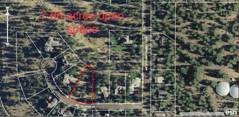
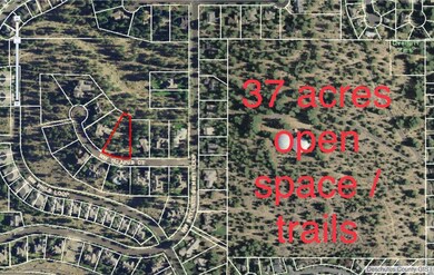
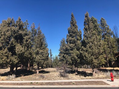
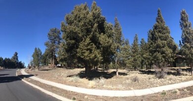
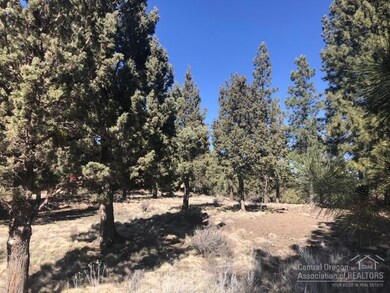
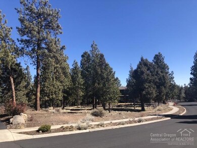
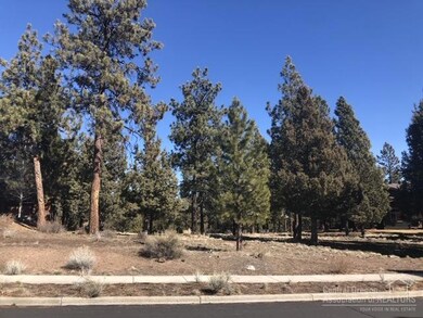
Spectacular upscale privacy in the heart of NW Bend! Rare new construction opportunity on this spectacular 2/3 acre wooded lot, bordered by 7 acres of neighborhood common area. Talapus Ct. is a coveted cul-de-sac street which features high end luxury homes and privacy not typically observed on Bend's NW side. Predominantly LEVEL building site on an exclusive, quiet cul-de-sac situated high above and opposite the Broken Top Golf Community. This lot backs to 7.66 acres of neighborhood green space with close proximity to downtown Bend, Old Mill, and Mt.Bachelor. 37 acres of City land with walking trails, an old forest fire service lookout, and a City dog park are all situated a mere 600' East of this lot. Talapus Ct. is a special street which rarely has any type of offering for the discriminating buyer tired of golf course lots. HOA fees are only $300 year! A HOA and architectural review committee assure this neighborhood will remain pristine.
Last Agent to Sell the Property
Stellar Realty Northwest License #200304085 Listed on: 03/10/2020
| Date | Buyer | Sale Price | Title Company |
|---|---|---|---|
| Paulson Kale | $490,000 | First American Title | |
| Wuthrich Patricia M | $485,000 | First Amer Title Ins Co Or | |
| Keys Family Holdings Llc | $357,500 | Amerititle |
| Date | Status | Borrower | Loan Amount |
|---|---|---|---|
| Open | Paulson Kale | $367,500 |
| Date | Event | Price | List to Sale | Price per Sq Ft |
|---|---|---|---|---|
| 09/30/2020 09/30/20 | Sold | $490,000 | -2.0% | -- |
| 08/26/2020 08/26/20 | Pending | -- | -- | -- |
| 03/10/2020 03/10/20 | For Sale | $499,900 | -- | -- |
| Year | Tax Paid | Tax Assessment Tax Assessment Total Assessment is a certain percentage of the fair market value that is determined by local assessors to be the total taxable value of land and additions on the property. | Land | Improvement |
|---|---|---|---|---|
| 2025 | $20,142 | $1,192,120 | -- | -- |
| 2024 | $19,379 | $1,157,400 | -- | -- |
| 2023 | $17,964 | $1,123,690 | $0 | $0 |
| 2022 | $11,612 | $300,690 | $0 | $0 |
| 2021 | $4,765 | $291,940 | $0 | $0 |
| 2020 | $4,521 | $291,940 | $0 | $0 |
| 2019 | $4,395 | $283,440 | $0 | $0 |
| 2018 | $4,271 | $275,190 | $0 | $0 |
| 2017 | $4,164 | $267,180 | $0 | $0 |
| 2016 | $3,972 | $259,400 | $0 | $0 |
| 2015 | $3,863 | $251,850 | $0 | $0 |
| 2014 | $3,750 | $244,520 | $0 | $0 |
Seller's Agent in 2020
Greg Broderick
Stellar Realty Northwest
(541) 280-2363
2 in this area
71 Total Sales
G
Buyer's Agent in 2020
Gregory Pieraccini
Works Real Estate
(541) 233-3422
20 Total Sales
Source: Oregon Datashare
MLS Number: 202001865
APN: 203855
Disclaimer: Certain information contained herein is derived from information provided by parties other than Homes.com. All information provided is deemed reliable, but is not guaranteed to be accurate and should be independently verified.
![]() © 2025 Oregon Datashare (KCAR | MLSCO | SOMLS). All rights reserved. The data relating to real estate for sale on this web site comes in part from the Internet Data Exchange Program of the Oregon Datashare. Real estate listings held by IDX Brokerage firms other than Ten-X are marked with the Internet Data Exchange logo or the Internet Data Exchange thumbnail logo and detailed information about them includes the name of the listing Brokers. Information provided is for consumers' personal, non-commercial use and may not be used for any purpose other than to identify prospective properties the viewer may be interested in purchasing. The consumer will not copy, retransmit nor redistribute any of the content from this website. Information provided is deemed reliable, but not guaranteed.
© 2025 Oregon Datashare (KCAR | MLSCO | SOMLS). All rights reserved. The data relating to real estate for sale on this web site comes in part from the Internet Data Exchange Program of the Oregon Datashare. Real estate listings held by IDX Brokerage firms other than Ten-X are marked with the Internet Data Exchange logo or the Internet Data Exchange thumbnail logo and detailed information about them includes the name of the listing Brokers. Information provided is for consumers' personal, non-commercial use and may not be used for any purpose other than to identify prospective properties the viewer may be interested in purchasing. The consumer will not copy, retransmit nor redistribute any of the content from this website. Information provided is deemed reliable, but not guaranteed.