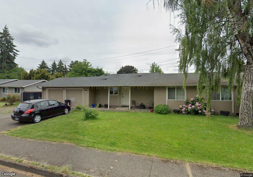
2075 Berwin Ln Eugene, OR 97404
River Road NeighborhoodEstimated Value: $448,000 - $465,000
4
Beds
3
Baths
1,860
Sq Ft
$247/Sq Ft
Est. Value
About This Home
This home is located at 2075 Berwin Ln, Eugene, OR 97404 and is currently estimated at $458,633, approximately $246 per square foot. 2075 Berwin Ln is a home located in Lane County with nearby schools including Howard Elementary School, Kelly Middle School, and North Eugene High School.
Ownership History
Date
Name
Owned For
Owner Type
Purchase Details
Closed on
Feb 24, 2016
Sold by
Fannie Mae
Bought by
Woods Thomas C
Current Estimated Value
Home Financials for this Owner
Home Financials are based on the most recent Mortgage that was taken out on this home.
Original Mortgage
$216,930
Outstanding Balance
$172,303
Interest Rate
3.92%
Mortgage Type
VA
Estimated Equity
$286,330
Purchase Details
Closed on
Aug 16, 2015
Sold by
Moninger Kelly E and Moninger Kami J
Bought by
Federal National Mortgage Association
Create a Home Valuation Report for This Property
The Home Valuation Report is an in-depth analysis detailing your home's value as well as a comparison with similar homes in the area
Home Values in the Area
Average Home Value in this Area
Purchase History
| Date | Buyer | Sale Price | Title Company |
|---|---|---|---|
| Woods Thomas C | $210,000 | Evergreen Land Title Co | |
| Federal National Mortgage Association | -- | None Available |
Source: Public Records
Mortgage History
| Date | Status | Borrower | Loan Amount |
|---|---|---|---|
| Open | Woods Thomas C | $216,930 |
Source: Public Records
Tax History
| Year | Tax Paid | Tax Assessment Tax Assessment Total Assessment is a certain percentage of the fair market value that is determined by local assessors to be the total taxable value of land and additions on the property. | Land | Improvement |
|---|---|---|---|---|
| 2025 | $4,059 | $241,609 | -- | -- |
| 2024 | $4,015 | $234,572 | -- | -- |
| 2023 | $4,015 | $227,740 | $0 | $0 |
| 2022 | $3,776 | $221,107 | $0 | $0 |
| 2021 | $3,512 | $214,667 | $0 | $0 |
| 2020 | $3,537 | $208,415 | $0 | $0 |
| 2019 | $3,412 | $202,345 | $0 | $0 |
| 2018 | $3,182 | $190,730 | $0 | $0 |
| 2017 | $3,008 | $190,730 | $0 | $0 |
| 2016 | $2,856 | $185,175 | $0 | $0 |
| 2015 | $2,738 | $179,782 | $0 | $0 |
| 2014 | $2,731 | $174,546 | $0 | $0 |
Source: Public Records
Map
Nearby Homes
- 1755 Brentwood Ave
- 1682 Hemlock St
- 1384 David Ave
- 2563 York St
- 2418 Kalmia St
- 303 Lenore Loop
- 1566 Maywood Ave
- 401 Sterling Dr
- 805 Impala Ave
- 2488 Northampton
- 2721 La Darrah St
- 2439 Quince St
- 2740 Stark St
- 1880 Manihi Dr
- 193 Santa Clara Ave
- 349 Irving Rd
- 389 Maxwell Rd
- 215 Jonquil Ave
- 200 Irving Rd
- 2580 Crowther Dr
- 2069 Berwin Ln
- 2091 Berwin Ln
- 2074 N Park Ave
- 2057 Berwin Ln
- 2056 N Park Ave
- 2098 N Park Ave
- 2080 Berwin Ln
- 2107 Berwin Ln
- 2094 Berwin Ln
- 2043 Berwin Ln
- 2038 N Park Ave
- 2066 Berwin Ln
- 2110 Berwin Ln
- 2112 N Park Ave
- 2123 Berwin Ln
- 2039 Berwin Ln
- 2054 Berwin Ln
- 325 Bushnell Ln
- 892 Silver Ln
- 2051 N Park Ave
Your Personal Tour Guide
Ask me questions while you tour the home.