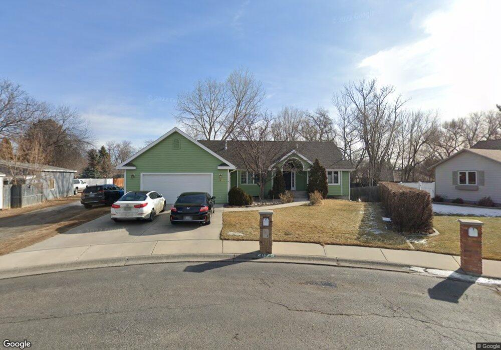
2075 Faye Cir Billings, MT 59102
North Central Billings NeighborhoodEstimated Value: $451,000 - $497,653
3
Beds
3
Baths
3,000
Sq Ft
$161/Sq Ft
Est. Value
About This Home
This home is located at 2075 Faye Cir, Billings, MT 59102 and is currently estimated at $481,663, approximately $160 per square foot. 2075 Faye Cir is a home located in Yellowstone County with nearby schools including Boulder School, Will James Junior High School, and Billings Senior High School.
Ownership History
Date
Name
Owned For
Owner Type
Purchase Details
Closed on
May 1, 2019
Sold by
Peak James H and Argani Faranak
Bought by
Burtell Justin and Alguire Kyra
Current Estimated Value
Home Financials for this Owner
Home Financials are based on the most recent Mortgage that was taken out on this home.
Original Mortgage
$276,450
Outstanding Balance
$242,063
Interest Rate
4%
Mortgage Type
New Conventional
Estimated Equity
$239,600
Create a Home Valuation Report for This Property
The Home Valuation Report is an in-depth analysis detailing your home's value as well as a comparison with similar homes in the area
Home Values in the Area
Average Home Value in this Area
Purchase History
| Date | Buyer | Sale Price | Title Company |
|---|---|---|---|
| Burtell Justin | -- | First Montana Title Co |
Source: Public Records
Mortgage History
| Date | Status | Borrower | Loan Amount |
|---|---|---|---|
| Open | Burtell Justin | $276,450 |
Source: Public Records
Tax History Compared to Growth
Tax History
| Year | Tax Paid | Tax Assessment Tax Assessment Total Assessment is a certain percentage of the fair market value that is determined by local assessors to be the total taxable value of land and additions on the property. | Land | Improvement |
|---|---|---|---|---|
| 2025 | $4,487 | $508,000 | $105,807 | $402,193 |
| 2024 | $4,487 | $469,300 | $96,591 | $372,709 |
| 2023 | $4,483 | $469,300 | $96,591 | $372,709 |
| 2022 | $3,701 | $337,700 | $0 | $0 |
| 2021 | $3,516 | $337,700 | $0 | $0 |
| 2020 | $3,541 | $326,200 | $0 | $0 |
| 2019 | $3,377 | $326,200 | $0 | $0 |
| 2018 | $3,258 | $308,500 | $0 | $0 |
| 2017 | $3,165 | $308,500 | $0 | $0 |
| 2016 | $2,999 | $295,700 | $0 | $0 |
| 2015 | $2,933 | $295,700 | $0 | $0 |
| 2014 | $2,523 | $134,408 | $0 | $0 |
Source: Public Records
Map
Nearby Homes
- 3033 Avenue F
- 0 Julianne Dr Unit 356457
- 2820 Boulder Ave
- 1907 Patricia Ln
- 1820 Patricia Ln
- 1825 28th St W
- 3107 Poly Dr
- 2516 Lyndale Ln
- 2717 Patricia Ln
- 2420 Elizabeth St
- 1606 Golden Blvd
- 2060 Edgewood Dr
- 1524 Golden Blvd
- 2624 Southridge Dr
- 2903 Belvedere Dr
- 5915 Southridge Dr
- 2830 Arrowhead Meadows Dr
- 2510 Zimmerman Trail
- 2422 Brentwood Ln
- 1125 30th St W
- 2061 Faye Cir
- 2070 Rehberg Ln
- 2016 Rehberg Ln
- 3014 Colton Blvd
- 2091 Faye Cir
- 3025 Parkhill Dr
- 3010 Colton Blvd
- 2060 Faye Cir
- 3037 Parkhill Dr
- 3015 Parkhill Dr
- 2076 Faye Cir
- 2092 Faye Cir
- 3051 Parkhill Dr
- 2012 Ronda Cir
- 2075 Hope Cir
- 0000 Rehberg Ln
- 2936 Colton Blvd
- 3065 Parkhill Dr
- 2013 Ronda Cir
- 2009 Rehberg Ln