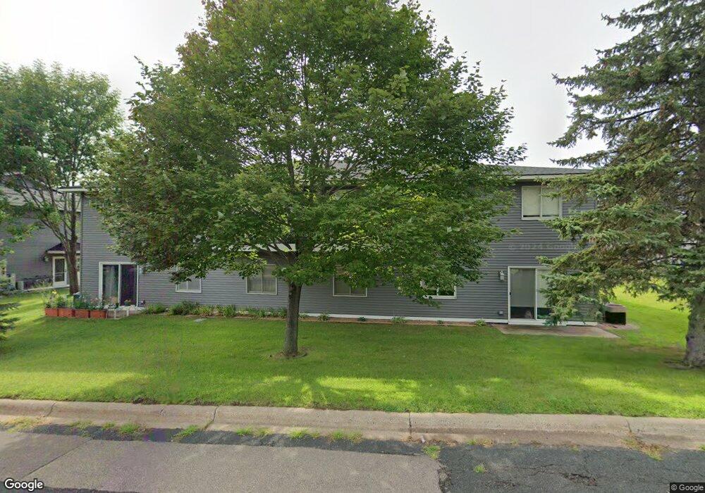
2077 N Park Dr Unit 6 Saint Paul, MN 55119
Battle Creek NeighborhoodEstimated Value: $177,000 - $196,000
2
Beds
1
Bath
960
Sq Ft
$193/Sq Ft
Est. Value
About This Home
This home is located at 2077 N Park Dr Unit 6, Saint Paul, MN 55119 and is currently estimated at $185,156, approximately $192 per square foot. 2077 N Park Dr Unit 6 is a home located in Ramsey County with nearby schools including Battle Creek Elementary School, Battle Creek Middle School, and Harding Senior High School.
Ownership History
Date
Name
Owned For
Owner Type
Purchase Details
Closed on
May 27, 2022
Sold by
Grunow Harvey A
Bought by
Grunow Joyce M and Vavrosky Charles
Current Estimated Value
Home Financials for this Owner
Home Financials are based on the most recent Mortgage that was taken out on this home.
Original Mortgage
$78,750
Interest Rate
4.4%
Mortgage Type
New Conventional
Purchase Details
Closed on
Jul 31, 2020
Sold by
Walker Susan A
Bought by
Grunow Harvey A
Home Financials for this Owner
Home Financials are based on the most recent Mortgage that was taken out on this home.
Original Mortgage
$80,000
Interest Rate
3%
Mortgage Type
New Conventional
Purchase Details
Closed on
Nov 16, 2001
Sold by
Depalma Victoria A
Bought by
Walker Susan A
Create a Home Valuation Report for This Property
The Home Valuation Report is an in-depth analysis detailing your home's value as well as a comparison with similar homes in the area
Home Values in the Area
Average Home Value in this Area
Purchase History
| Date | Buyer | Sale Price | Title Company |
|---|---|---|---|
| Grunow Joyce M | $105,000 | None Listed On Document | |
| Grunow Harvey A | $128,000 | Results Title | |
| Walker Susan A | $104,900 | -- |
Source: Public Records
Mortgage History
| Date | Status | Borrower | Loan Amount |
|---|---|---|---|
| Previous Owner | Grunow Joyce M | $78,750 | |
| Previous Owner | Grunow Harvey A | $80,000 |
Source: Public Records
Tax History Compared to Growth
Tax History
| Year | Tax Paid | Tax Assessment Tax Assessment Total Assessment is a certain percentage of the fair market value that is determined by local assessors to be the total taxable value of land and additions on the property. | Land | Improvement |
|---|---|---|---|---|
| 2025 | $2,604 | $172,800 | $1,000 | $171,800 |
| 2023 | $2,604 | $164,100 | $1,000 | $163,100 |
| 2022 | $1,980 | $147,600 | $1,000 | $146,600 |
| 2021 | $1,886 | $137,600 | $1,000 | $136,600 |
| 2020 | $1,780 | $139,600 | $1,000 | $138,600 |
| 2019 | $1,638 | $122,200 | $1,000 | $121,200 |
| 2018 | $1,220 | $112,900 | $1,000 | $111,900 |
| 2017 | $1,094 | $91,700 | $1,000 | $90,700 |
| 2016 | $1,040 | $0 | $0 | $0 |
| 2015 | $1,014 | $78,600 | $7,900 | $70,700 |
| 2014 | $934 | $0 | $0 | $0 |
Source: Public Records
Map
Nearby Homes
- 2069 Parkside Dr Unit G2
- 2059 Parkside Dr Unit 29
- 2063 N Park Dr Unit 6
- 138 Ruth St N Unit 9
- 1989 N Park Dr
- 1935 Warbler Ln
- 125 Mcknight Rd N Unit K
- 125 Battle Creek Place
- 136 White Bear Ave N
- 49 Battle Creek Place
- 2243 Edgebrook Ave
- 2169 Glenridge Ave
- 2250 Edgebrook Ave
- 465 Ruth St N
- 2138 3rd St E
- 1821 Wilson Ave
- 2243 3rd St E
- 1935 Fremont Ave E
- 1964 4th St E
- 2233 Fremont Ave E
- 2077 N Park Dr Unit 4
- 2077 N Park Dr Unit 3
- 2077 N Park Dr Unit 1
- 2077 N Park Dr Unit 5
- 2077 N Park Dr Unit 2
- 2077 2077 N Park Dr
- 2041 N Park Dr Unit 20416
- 2041 N Park Dr Unit 20412
- 2041 N Park Dr Unit 20413
- 2041 N Park Dr Unit 5
- 2041 N Park Dr Unit 20411
- 2041 N Park Dr
- 2033 N Park Dr
- 2047 N Park Dr
- 2033 N Park Dr
- 2041 N Park Dr Unit 4
- 2041 N Park Dr
- 2041 N Park Dr Unit 2
- 2041 N Park Dr Unit 1
- 2077 2077 N Park-Drive-