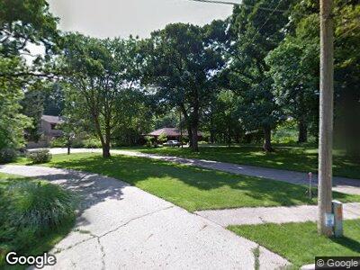
208 53rd St Des Moines, IA 50312
Westwood NeighborhoodEstimated Value: $517,000 - $562,000
2
Beds
3
Baths
1,688
Sq Ft
$319/Sq Ft
Est. Value
About This Home
This home is located at 208 53rd St, Des Moines, IA 50312 and is currently estimated at $538,309, approximately $318 per square foot. 208 53rd St is a home located in Polk County with nearby schools including Hanawalt Elementary School, Merrill Middle School, and Roosevelt High School.
Ownership History
Date
Name
Owned For
Owner Type
Purchase Details
Closed on
Nov 15, 2003
Sold by
Libbey Scott S and Libbey Jean L
Bought by
Patch Allen Len and Patch Nadine Theresa
Current Estimated Value
Home Financials for this Owner
Home Financials are based on the most recent Mortgage that was taken out on this home.
Original Mortgage
$215,500
Interest Rate
6.01%
Create a Home Valuation Report for This Property
The Home Valuation Report is an in-depth analysis detailing your home's value as well as a comparison with similar homes in the area
Home Values in the Area
Average Home Value in this Area
Purchase History
| Date | Buyer | Sale Price | Title Company |
|---|---|---|---|
| Patch Allen Len | $275,000 | -- |
Source: Public Records
Mortgage History
| Date | Status | Borrower | Loan Amount |
|---|---|---|---|
| Closed | Patch Allen Len | $174,000 | |
| Closed | Patch Allen Len | $65,700 | |
| Closed | Patch Allen Len | $187,250 | |
| Closed | Patch Allen Len | $82,500 | |
| Closed | Patch Allen Len | $80,000 | |
| Closed | Patch Allen Len | $182,400 | |
| Closed | Patch Allen Len | $215,500 |
Source: Public Records
Tax History Compared to Growth
Tax History
| Year | Tax Paid | Tax Assessment Tax Assessment Total Assessment is a certain percentage of the fair market value that is determined by local assessors to be the total taxable value of land and additions on the property. | Land | Improvement |
|---|---|---|---|---|
| 2024 | $10,066 | $529,200 | $121,200 | $408,000 |
| 2023 | $10,484 | $529,200 | $121,200 | $408,000 |
| 2022 | $10,402 | $453,700 | $107,500 | $346,200 |
| 2021 | $10,196 | $453,700 | $107,500 | $346,200 |
| 2020 | $10,588 | $417,200 | $98,800 | $318,400 |
| 2019 | $9,814 | $417,200 | $98,800 | $318,400 |
| 2018 | $9,710 | $373,700 | $86,800 | $286,900 |
| 2017 | $8,974 | $373,700 | $86,800 | $286,900 |
| 2016 | $8,738 | $340,300 | $78,900 | $261,400 |
| 2015 | $8,738 | $340,300 | $78,900 | $261,400 |
| 2014 | $7,930 | $318,600 | $72,800 | $245,800 |
Source: Public Records
Map
Nearby Homes
- 253 51st St
- 303 51st St
- 322 49th St
- 5105 Welker Ave
- 5124 Welker Ave
- 245 58th St
- 348 49th St
- 308 58th St
- 509 56th St
- 316 58th Place
- 543 53rd St
- 4820 Grand Ave
- 5740 Walnut Hill Ave
- 5322 Ingersoll Ave Unit B5
- 5420 Ingersoll Ave
- 5502 Ingersoll Ave
- 601 53rd St
- 4848 Ingersoll Ave
- 4844 Ingersoll Ave
- 500 N Valley Dr Unit 402
- 208 53rd St
- 204 53rd St
- 5320 Robertson Dr
- 5322 Robertson Dr
- 222 53rd St
- 124 53rd St
- 31 52nd St
- 5144 Robertson Dr
- 5324 Robertson Dr
- 211 53rd St
- 5151 Robertson Dr
- 5215 Robertson Dr
- 215 53rd St
- 5138 Robertson Dr
- 30 52nd St
- 25 52nd St
- 5311 Robertson Dr
- 5145 Robertson Dr
- 5132 Robertson Dr
- 5141 Robertson Dr
