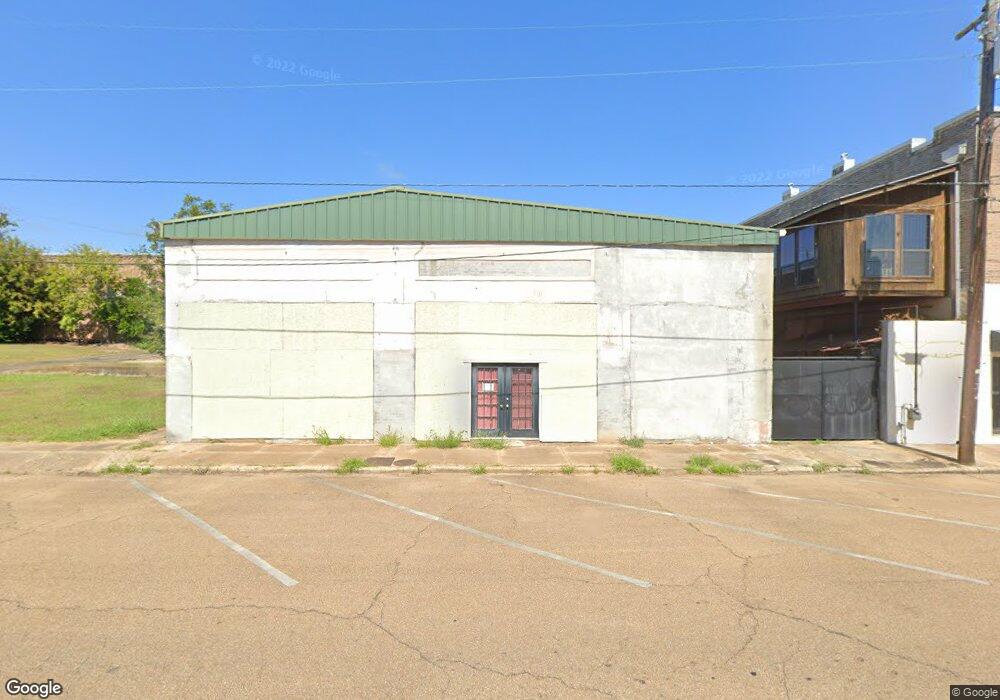
208 Canal St McComb, MS 39648
Estimated Value: $146,000
--
Bed
1
Bath
2,600
Sq Ft
$56/Sq Ft
Est. Value
About This Home
This home is located at 208 Canal St, McComb, MS 39648 and is currently priced at $146,000, approximately $56 per square foot. 208 Canal St is a home located in Pike County with nearby schools including Higgins Middle School, Otken Elementary School, and Denman Junior High School.
Ownership History
Date
Name
Owned For
Owner Type
Purchase Details
Closed on
Jul 1, 2011
Sold by
Brebreton Lula J and Mcghee Roy H
Bought by
Brebreton Lula J
Current Estimated Value
Purchase Details
Closed on
Apr 8, 2009
Sold by
Gibson E Benton
Bought by
Declouet Lula Jackson
Home Financials for this Owner
Home Financials are based on the most recent Mortgage that was taken out on this home.
Original Mortgage
$52,223
Interest Rate
5.14%
Mortgage Type
Commercial
Create a Home Valuation Report for This Property
The Home Valuation Report is an in-depth analysis detailing your home's value as well as a comparison with similar homes in the area
Home Values in the Area
Average Home Value in this Area
Purchase History
| Date | Buyer | Sale Price | Title Company |
|---|---|---|---|
| Brebreton Lula J | -- | None Available | |
| Declouet Lula Jackson | -- | None Available |
Source: Public Records
Mortgage History
| Date | Status | Borrower | Loan Amount |
|---|---|---|---|
| Previous Owner | Declouet Lula Jackson | $52,223 |
Source: Public Records
Tax History Compared to Growth
Tax History
| Year | Tax Paid | Tax Assessment Tax Assessment Total Assessment is a certain percentage of the fair market value that is determined by local assessors to be the total taxable value of land and additions on the property. | Land | Improvement |
|---|---|---|---|---|
| 2025 | $802 | $5,054 | $0 | $0 |
| 2024 | $802 | $4,490 | $0 | $0 |
| 2023 | $793 | $4,490 | $0 | $0 |
| 2022 | $782 | $4,490 | $0 | $0 |
| 2021 | $756 | $4,358 | $0 | $0 |
| 2020 | $729 | $4,200 | $0 | $0 |
| 2019 | $697 | $4,200 | $0 | $0 |
| 2018 | $677 | $4,200 | $0 | $0 |
| 2017 | $681 | $4,200 | $0 | $0 |
| 2016 | $676 | $4,200 | $0 | $0 |
| 2015 | -- | $3,968 | $0 | $0 |
| 2014 | -- | $3,968 | $0 | $0 |
| 2013 | -- | $3,998 | $0 | $0 |
Source: Public Records
Map
Nearby Homes
- 200-208 5th Ave
- 313 Louisiana Ave
- 425 S Broadway St
- 214 Thompson St
- 505 S Magnolia St
- 412 S 4th St
- 605 Virginia Ave
- 823 Edgar St
- 617 Edgar St
- 517 S 5th St
- 635 Delaware Ave
- 513 S 5th St
- 703 Pennsylvania Ave
- 507 W Georgia Ave
- 143 N Myrtle St
- 215 Peach Ave
- 133 N Live Oak St
- 415 N Magnolia St
- 133 N Chestnut St
- 126 Aston Ave