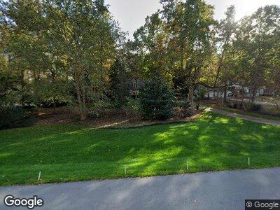
208 Dunstable Ct Raleigh, NC 27614
Falls Lake NeighborhoodEstimated Value: $567,832 - $649,000
--
Bed
3
Baths
2,095
Sq Ft
$294/Sq Ft
Est. Value
About This Home
This home is located at 208 Dunstable Ct, Raleigh, NC 27614 and is currently estimated at $615,708, approximately $293 per square foot. 208 Dunstable Ct is a home located in Wake County with nearby schools including Brassfield Elementary School, West Millbrook Middle School, and Millbrook High School.
Ownership History
Date
Name
Owned For
Owner Type
Purchase Details
Closed on
Mar 14, 1986
Bought by
Finger David T and Finger Cynthia H
Current Estimated Value
Create a Home Valuation Report for This Property
The Home Valuation Report is an in-depth analysis detailing your home's value as well as a comparison with similar homes in the area
Home Values in the Area
Average Home Value in this Area
Purchase History
| Date | Buyer | Sale Price | Title Company |
|---|---|---|---|
| Finger David T | $147,000 | -- |
Source: Public Records
Mortgage History
| Date | Status | Borrower | Loan Amount |
|---|---|---|---|
| Open | Finger David T | $15,000 | |
| Closed | Finger David T | $225,575 | |
| Closed | Finger David T | $256,000 | |
| Closed | Finger David T | $42,600 | |
| Closed | Finger David T | $100,122 | |
| Closed | Finger David T | $87,400 | |
| Closed | Finger David T | $54,100 | |
| Closed | Finger David T | $167,000 |
Source: Public Records
Tax History Compared to Growth
Tax History
| Year | Tax Paid | Tax Assessment Tax Assessment Total Assessment is a certain percentage of the fair market value that is determined by local assessors to be the total taxable value of land and additions on the property. | Land | Improvement |
|---|---|---|---|---|
| 2024 | $3,633 | $581,804 | $200,000 | $381,804 |
| 2023 | $3,139 | $399,982 | $110,000 | $289,982 |
| 2022 | $2,909 | $399,982 | $110,000 | $289,982 |
| 2021 | $2,831 | $399,982 | $110,000 | $289,982 |
| 2020 | $2,784 | $399,982 | $110,000 | $289,982 |
| 2019 | $2,845 | $345,892 | $114,000 | $231,892 |
| 2018 | $2,616 | $345,892 | $114,000 | $231,892 |
| 2017 | $2,479 | $345,892 | $114,000 | $231,892 |
| 2016 | $2,429 | $345,892 | $114,000 | $231,892 |
| 2015 | $2,256 | $321,941 | $114,000 | $207,941 |
| 2014 | -- | $321,941 | $114,000 | $207,941 |
Source: Public Records
Map
Nearby Homes
- 112 Hartland Ct
- 1006 Henny Place
- 10817 Brass Kettle Rd
- 11813 Edgewater Ct
- 10825 Rondeau Woods Ct
- 10805 the Olde Place
- 520 Brittany Bay W
- 10909 Raven Rock Dr
- 11817 Coachmans Way
- 401 Brinkman Ct
- 201 Wortham Dr
- 5828 Norwood Ridge Dr
- 14020 Durant Rd
- 5808 Norwood Ridge Dr
- 401 Canyon Crest Ct
- 417 Swans Mill Crossing
- 14115 Allison Dr
- 10609 Lowery Dr
- 12012 Six Forks Rd
- 10405 Veasey Mill Rd
- 208 Dunstable Ct
- 212 Dunstable Ct
- 204 Dunstable Ct
- 11316 Rumshill Rd
- 11317 Coachmans Way
- 11313 Coachmans Way
- 11312 Rumshill Rd
- 209 Dunstable Ct
- 205 Dunstable Ct
- 11309 Coachmans Way
- 201 Dunstable Ct
- 11308 Rumshill Rd
- 300 Dunstable Ct
- 213 Dunstable Ct
- 11305 Coachmans Way
- 113 Old Lowery Ct
- 11304 Rumshill Rd
- 11304 Coachmans Way
- 120 Cromwell Ct
- 109 Dunstable Ct
