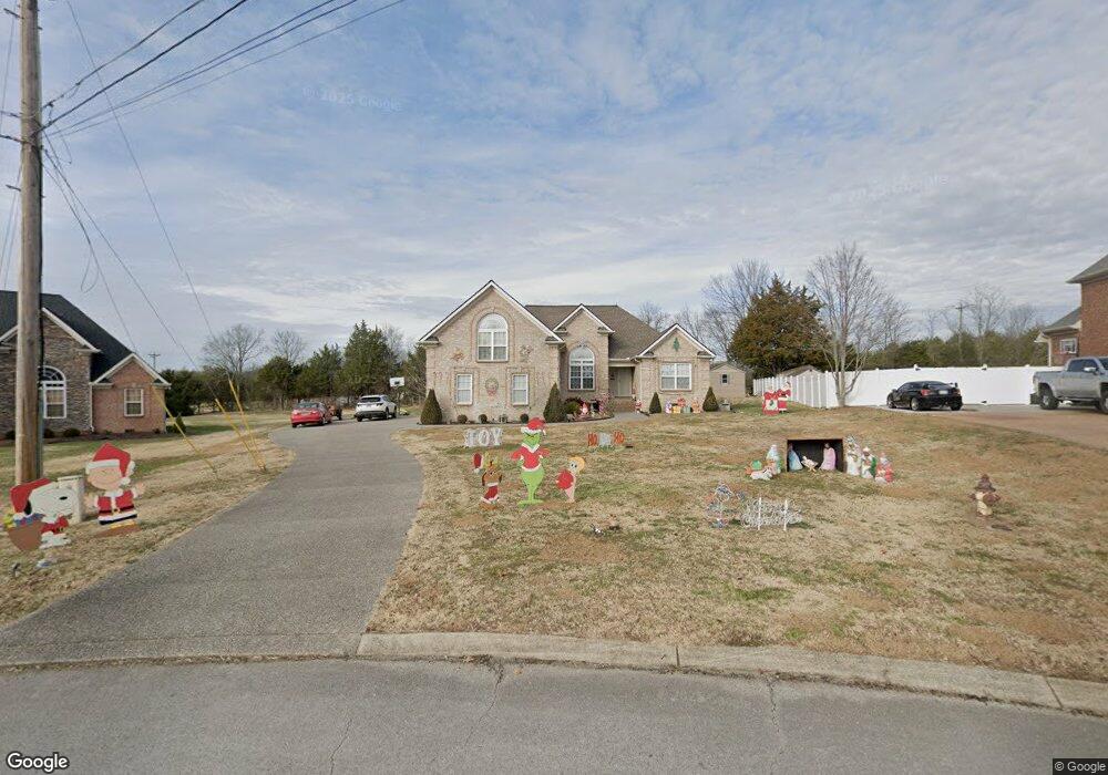
208 Fieldcrest Dr Mount Juliet, TN 37122
Estimated Value: $503,370 - $571,000
--
Bed
3
Baths
2,291
Sq Ft
$237/Sq Ft
Est. Value
About This Home
This home is located at 208 Fieldcrest Dr, Mount Juliet, TN 37122 and is currently estimated at $542,593, approximately $236 per square foot. 208 Fieldcrest Dr is a home located in Wilson County with nearby schools including Gladeville Elementary School, Gladeville Middle School, and Wilson Central High School.
Ownership History
Date
Name
Owned For
Owner Type
Purchase Details
Closed on
Jan 19, 2007
Sold by
Tacopa Land Llc
Bought by
Phillip Dennison
Current Estimated Value
Home Financials for this Owner
Home Financials are based on the most recent Mortgage that was taken out on this home.
Original Mortgage
$115,000
Outstanding Balance
$68,187
Interest Rate
6.07%
Estimated Equity
$474,406
Create a Home Valuation Report for This Property
The Home Valuation Report is an in-depth analysis detailing your home's value as well as a comparison with similar homes in the area
Home Values in the Area
Average Home Value in this Area
Purchase History
| Date | Buyer | Sale Price | Title Company |
|---|---|---|---|
| Phillip Dennison | $242,800 | -- | |
| Tacopa Land Llc | -- | -- |
Source: Public Records
Mortgage History
| Date | Status | Borrower | Loan Amount |
|---|---|---|---|
| Open | Tacopa Land Llc | $115,000 | |
| Closed | Tacopa Land Llc | $115,000 |
Source: Public Records
Tax History Compared to Growth
Tax History
| Year | Tax Paid | Tax Assessment Tax Assessment Total Assessment is a certain percentage of the fair market value that is determined by local assessors to be the total taxable value of land and additions on the property. | Land | Improvement |
|---|---|---|---|---|
| 2024 | $1,591 | $83,325 | $22,500 | $60,825 |
| 2022 | $1,591 | $83,325 | $22,500 | $60,825 |
| 2021 | $1,591 | $83,325 | $22,500 | $60,825 |
| 2020 | $1,642 | $83,325 | $22,500 | $60,825 |
| 2019 | $1,640 | $65,125 | $15,500 | $49,625 |
| 2018 | $1,640 | $65,125 | $15,500 | $49,625 |
| 2017 | $1,640 | $65,125 | $15,500 | $49,625 |
| 2016 | $1,640 | $65,125 | $15,500 | $49,625 |
| 2015 | $1,674 | $65,125 | $15,500 | $49,625 |
| 2014 | $1,446 | $56,271 | $0 | $0 |
Source: Public Records
Map
Nearby Homes
- 102 Stonefield Dr
- 555 Mccrary Rd
- 7736 Stewarts Ferry Pike
- Reedy Plan at The Oaks
- Harding Plan at The Oaks
- Sinclair Plan at The Oaks
- 703 Wiskey Trail
- 803 Molly Ln
- 705 Wiskey Trail
- 805 Molly Ln
- 707 Wiskey Trail
- 702 Wiskey Trail
- 800 Molly Ln
- 807 Molly Ln
- 704 Wiskey Trail
- 802 Molly Ln
- 708 Wiskey Trail
- 706 Wiskey Trail
- 447 Sanders Ln
- 809 Molly Ln
- 210 Fieldcrest Dr
- 206 Fieldcrest Dr
- 212 Fieldcrest Dr
- 204 Fieldcrest Dr
- 209 Fieldcrest Dr
- 205 Fieldcrest Dr
- 214 Fieldcrest Dr
- 8470 Stewarts Ferry Pike
- 202 Fieldcrest Dr
- 203 Fieldcrest Dr
- 406 Cobblestone Way
- 410 Cobblestone Way
- 404 Cobblestone Way
- 502 Stonehurst Ct
- 106 Stonefield Dr
- 402 Cobblestone Way
- 504 Stonehurst Ct
- 1 Fieldcrest Dr #1
- 502 Stonehurst Ct
- 108 Stonefield Dr